Observation Date
12/19/2024
Observer Name
Gagne/Costa
Region
Salt Lake » Mill Creek Canyon » Porter Fork » Main Porter
Location Name or Route
Main Porter Fork
Comments
My goals today were to (1) check out the overall snowpack in Millcreek Canyon and, (2) compare stability on northerly slopes that were not wind-loaded with slopes that have been wind-loaded.
I was pleasantly surprised with the depth of the snowpack in Millcreek, with 45-90 cms (1.5 - 3 feet) above 7,500'.
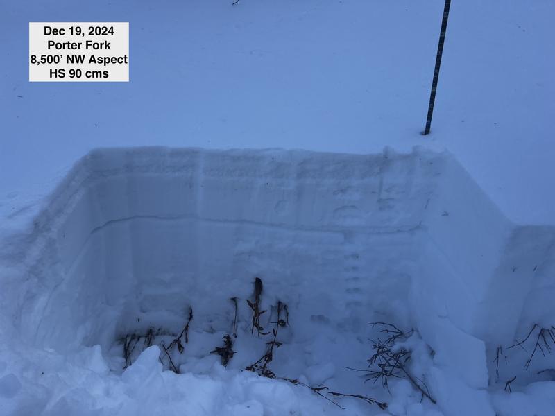
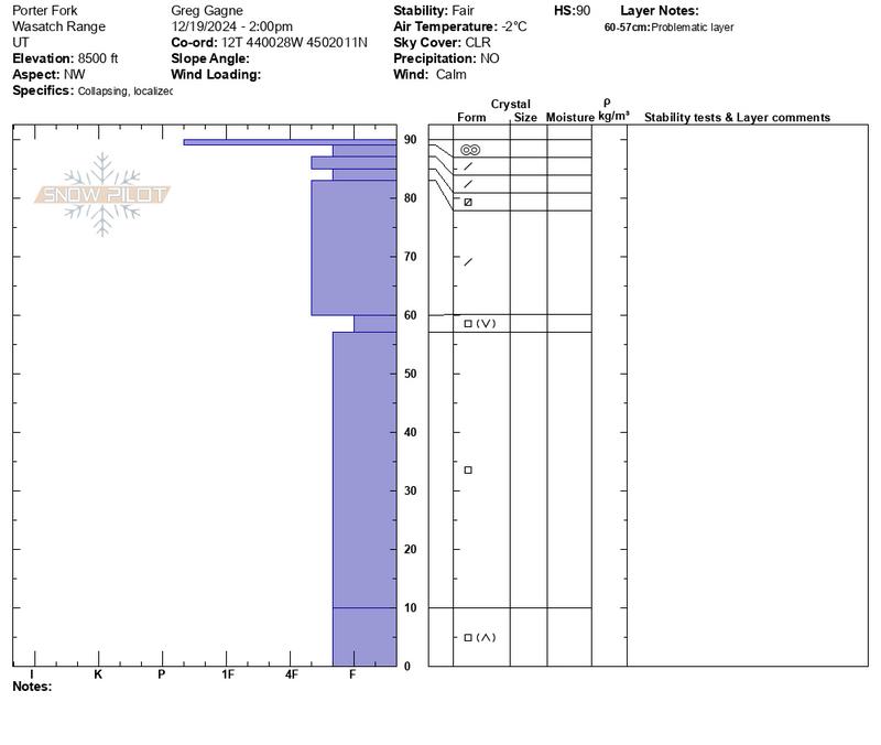
On slopes that had no wind-loading, extended column tests would just collapse the entire weak snowpack. The photo below shows a NW aspect at 8,500' where the thin stripe highlights the weakest snow - this was a layer of surface hoar and near-surface facets that was preserved and buried in the Dec 12/13 storm. The slab on top of the weak layer is barely 4F hard and not strong enough for a fracture to propagate. The video below shows the extended column test from this pit where the entire snowpack just collapses underneath the taps from the shovel. You may see many videos of extended column tests with a propagation, but this one demonstrates where you get a collapse of the weak layer, but no propagation. With our current snowpack consisting mostly of faceted snow with no strong slab on top, these types of test results are common where the entire snowpack just crumbles.


Video
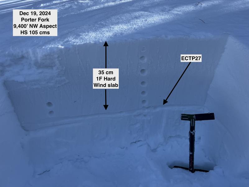
On one isolated slope, we were able to find a strong slab on top of the faceted layer shown in the photo below. This was a 1F hard wind slab and a test score of ECTP27. So a full propagation, but the high score demonstrates it would be difficult to trigger an avalanche.
How I interpret what I saw today: You need a strong slab on top of the facets for a slope to avalanche, and it is getting increasingly difficult to trigger avalanches. But, I don't trust facets and I will continue to avoid steep north-facing slopes that have been wind-drifted as they will have a stronger slab on top of the facets. Mark White provided an excellent observation from No Name Bowl where he describes how he evaluates a slope for possible wind-loading.

Today's Observed Danger Rating
Moderate
Tomorrows Estimated Danger Rating
Moderate
Coordinates


