

Observation Date
12/13/2024
Observer Name
Kelly, Kelly
Region
Salt Lake » Little Cottonwood Canyon » Grizzly Gulch
Location Name or Route
Bakers Dozen
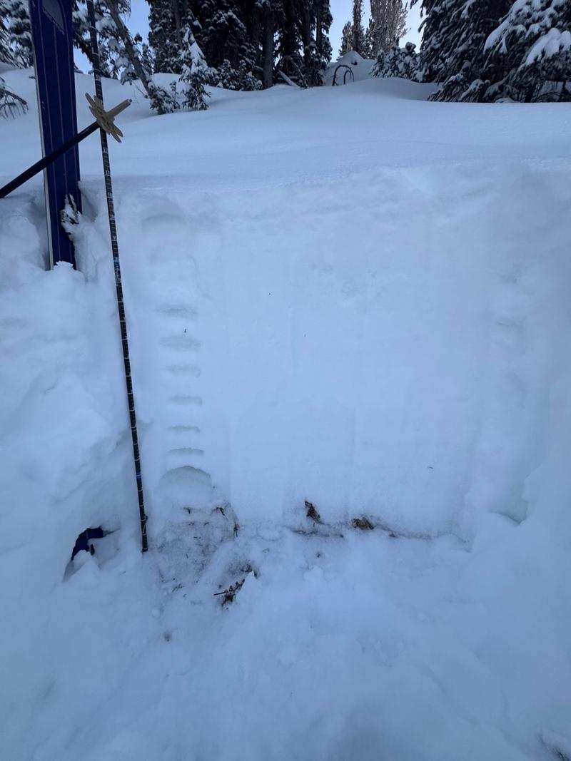
Comments
In this area the new snow was still not enough to create a stiff slab over the buried persistent weak layer. The failures we saw were 8" (20cm) from the ground on weak dry faceted grains. The new snow in this location appeared to have bonded well to the old snow surface (but this won't be the case everywhere). If the new snow were to be wind drifted and create a stiffer slab then there will be more of an avalanche problem. I am still wary of any slope with buried facets and any area that is wind loaded will get lots of my attention. In this snowpit we had compression test results with failure on this weak faceted snow near the ground. I'll be looking for and avoiding slopes over 30° in steepness if I see signs of collapsing, cracking, and whumpfing.
We were able to initiate dry loose new snow sloughing in steeper terrain, but did not trigger any slides failing into the persistent weak layer in our travels.
Today's Observed Danger Rating
Moderate
Tomorrows Estimated Danger Rating
Moderate
Coordinates