Observation Date
11/29/2024
Observer Name
Hardesty and Wilson
Region
Salt Lake » Big Cottonwood Canyon » Willows » West Willow
Location Name or Route
West Wilow
Comments
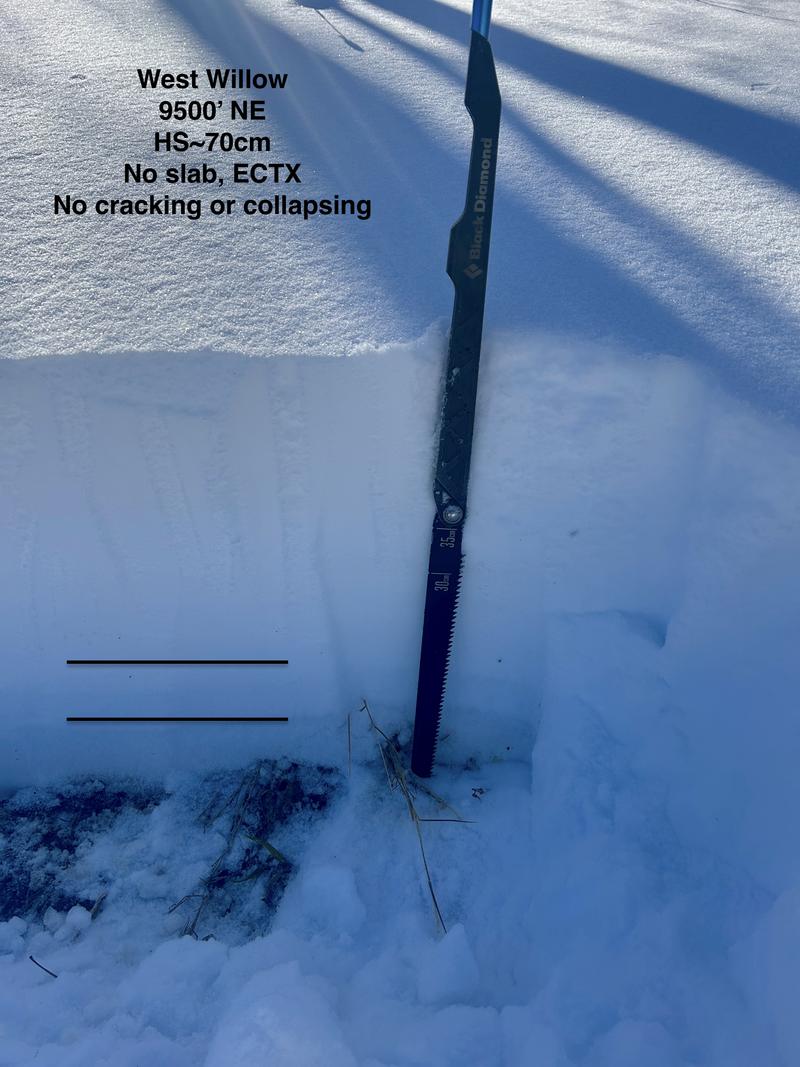
Travel was BCC, up the Willows, west across West Willow and down into Beartrap. Coverage is 12-28" and while thin, travel was fine. No avalanches, cracking or collapsing noted; although the structure remains poor. The lower 8-10" of the snowpack consists of weak faceted snow.
Seems as if there is a lack of a slab or load where we toured. Multiple tests in the mid and upper elevations yielded no results. Still, the PCMR avalanche teams that investigated this avalanche - at Scotts noted, "I was surprised by how soft the snow was in our crown/flank profile and lack of propagating pit results. Not really an "in your face" avalanche problem". Caution still recommended.
Photo of structure below with two layers of facets near the bottom of the snowpack.

Today's Observed Danger Rating
Moderate
Tomorrows Estimated Danger Rating
Moderate
Coordinates


