Observation: Cutler Ridge

Observation Date
4/8/2025
Observer Name
Derek DeBruin, Evan Wallace
Region
Ogden » Ben Lomond » Cutler Ridge
Location Name or Route
Ben Lomond, Cutler Ridge
Weather
Weather Comments
Variably sunny and cloudy skies, calm wind down low, light winds at middle elevations, more higher. A few random sprinkles and a bit of graupel. Warm temps in the 40s F at the trailhead this morning.
Snow Characteristics
Snow Characteristics Comments
Damp from the get go before 0800 at low elevations. Some mid elevations zones had a very weak freeze with a thin unsupportive surface crust. Otherwise, pretty standard creamy, to squishy, to sloppy surface along the descent. Need to walk a few hundred yards on pavement to get to connected, skinnable snow all the way up. Given temps this week, I anticipate some bare gaps in the uptrack by the weekend, likely a few in the refrigerator canyon luge as well as the traverse above the hairpin.
Red Flags
Red Flags Comments
Plenty of wet avalanches from a few days ago, with the activity on solar aspects on Willard Peak matching that of Mount Ogden. Lots has already fallen down, and I suspect the "spring shed" on solars is coming to a close. More noteworthy to me were the numerous natural wet avalanches on high and mid elevation northerly terrain. We saw various D1-D2 slides across the Cutler Headwall from recent days. Timing is everything, of course, but I'm anticipating rising wet avalanche hazard throughout the daily warm-up on polars aspects in coming days. Also kicked off a chunky wet slide on a 40 degree N slope at 7600ft, running up to 6 inches deep on a supportive subsurface crust. Worth keeping that on the bingo card, too. Finally, can't forget about cornices. Many have fallen, but several large cornices remain on the highest ridgelines.
Comments
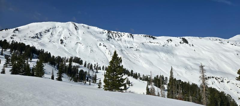
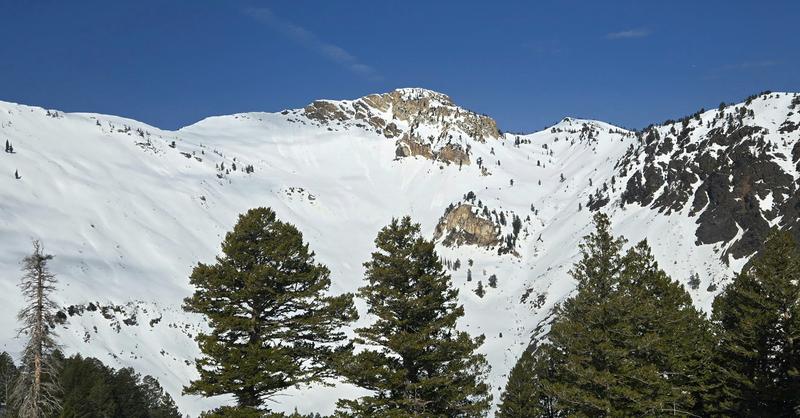
NE facing wet slides on Ben Lomond and Cutler Headwall.
Old activity on Willard Peak solar aspects.
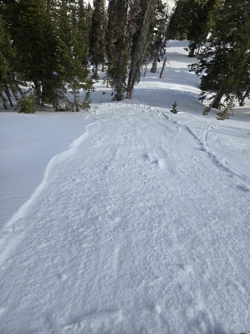
Kicked off this avalanche about 6" deep on supportive subsurface crust, N facing 7600ft, approx 40 degrees.
Today's Observed Danger Rating
None
Tomorrows Estimated Danger Rating
None
Coordinates