Forecast for the Uintas Area Mountains

Andrew Nassetta
Issued by Andrew Nassetta on
Monday morning, March 31, 2025
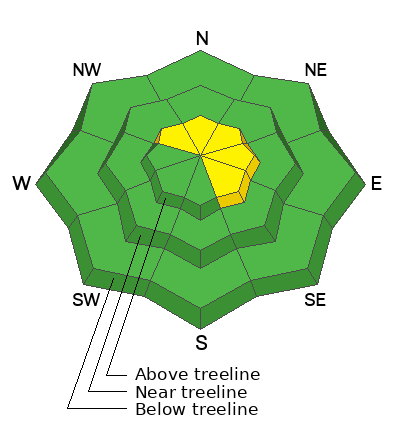
Today's avalanche danger is MODERATE above treeline where it's POSSIBLE for us to trigger wind-drifted snow 6-12" deep on slopes facing northwest through southeast. All other terrain offers LOW avalanche danger where, although UNLIKELY, a slide could be triggered into old snow and quickly become unmanageable.
With a large winter storm on the door step, expect avalanche danger to rise this evening into tomorrow depending upon its arrival. And remember, as we step into bigger terrain and think about tackling our spring objectives we need to shift our mindset and be prepared with the right equipment, partners and plan.
Low
Moderate
Considerable
High
Extreme
Learn how to read the forecast here
Special Announcements
The final report for the Hoyt Peak avalanche accident on March 7th has been published and is available, here.
Weather and Snow
Nowcast Yesterday we scooped up a trace of snow at higher elevations and things felt very wintery. Currently, as of 0500 AM cloudy skies are met with mild temperatures ahead of the incoming storm. Trailheads are reading 30℉ up high and ridgelines are showing 20℉ with windchill the single digits. Winds blow steady from the southwest averaging 25 MPH with gusts into the 40's and 50's.
Forecast For today, expect covered skies and steady temperatures in the 20's. Later this afternoon, increasing clouds accompanied by continued southwest winds averaging 20 MPH gusting into the 40's and 50's throughout the day along the high peaks and ridges.
Futurecast A large storm impacts the range tonight through Wednesday evening. Around 10-12" of new snow with potentially 1" of SWE are on tap for our mid and upper-elevations.
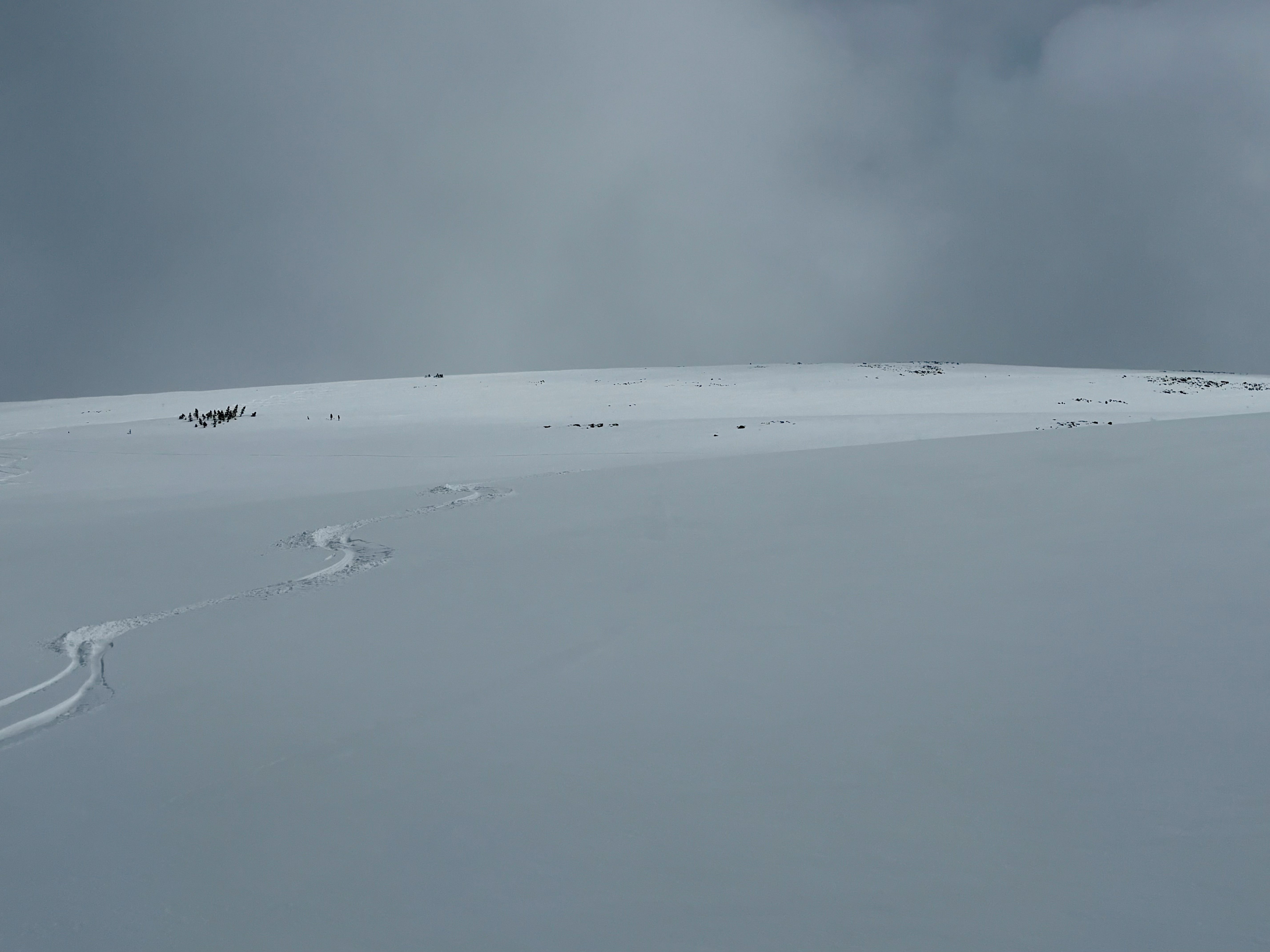
Travel & Riding Conditions Many trailhead elevations are melted out and mountain pass pavement is starting to become visible again, something to keep in mind when planning your travels. With Saturday nights shot of snow travel improved and added a nice creamy topper to a nearly go-anywhere supportable base. Slope-angle was the ticket yesterday and mellow terrain allowed smooth turning conditions while not feeling old tracks or anything beneath your rides. Expect more of the same today, with a little settlement yesterday and wind overnight, I would go as far as to say riding conditions will be imporoved!
A west facing slope at 11k' near the Mirror Lake Corridor where soft slope angles produced creamy turning conditions accompanied by spring-squalls and broken skies.
Recent Avalanches
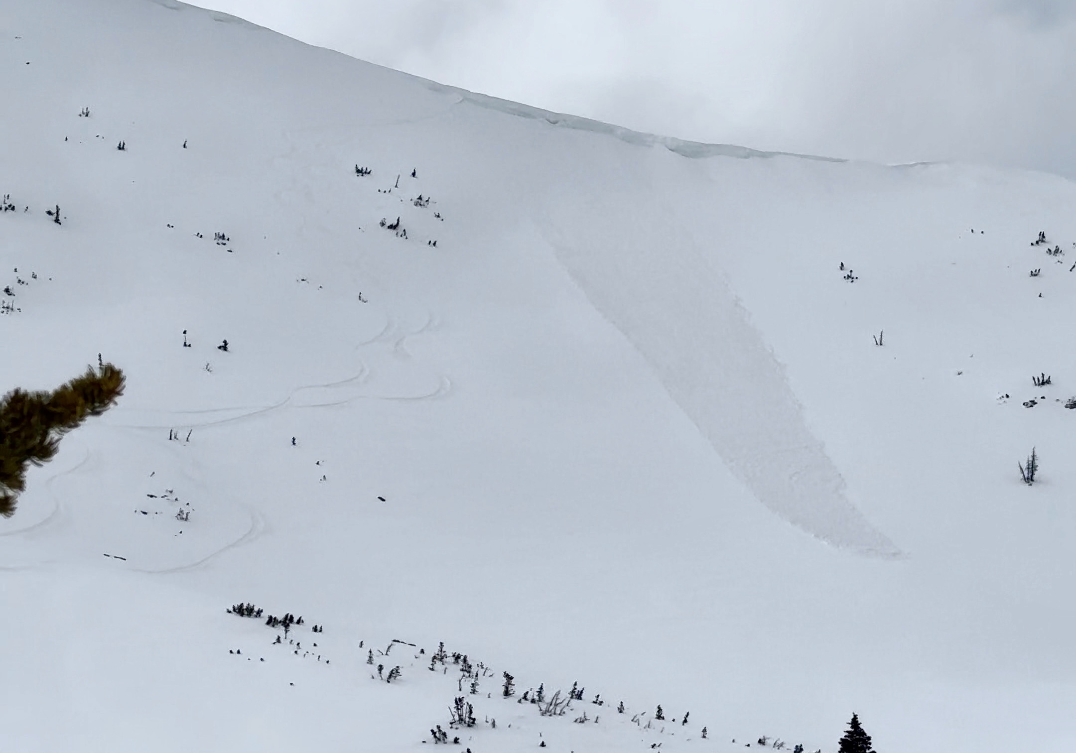
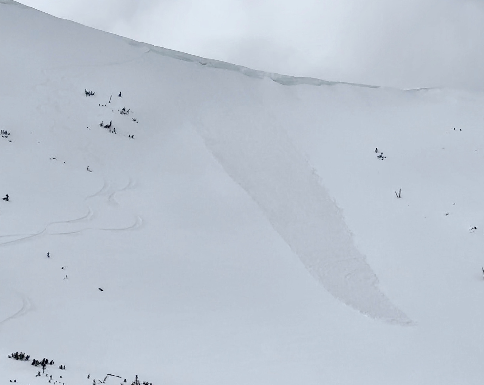
Yesterday, a skier triggered a small windslab about 100' wide and 6-12" deep on east slope or Mt.Watson at 11,500' off the Mirror Lake Corridoror. You can check out all the action, info and intel for the Uinta range and beyond, here.
Wind-drifted snow triggered by a skier on an upper-elevation slope in the high-country -- More info found, here. Not super consequential terrain, but imagine that same avalanche running above some cliffs, rocks, trees and taking that ride vs. a "casual" slide down an apron, like the one above.
Ad
Avalanche Problem #1
Wind Drifted Snow
Type
Location
Likelihood
Size
Description
Steady southwest winds have formed wind-drifted snow that will be reactive to our additional weight as a rider today. Today's drifts are specific to slopes facing northwest through southeast above treeline and relatively small in size, around 6-12" deep. Sitting atop a supportable base, once initiated today's drifts will pick up steam and run fast and far down avalanche paths and aprons. As the day grows older, winds will contribute to the potential size and sensitivity of today's windslabs. These slides are manageable by looking near ridges for fat, rounded pillows of snow that look textured and sound hollow like a drum, and either dealing with the problem or avoiding it all together.
Remember, you don't always need the tree-snapping, sled busting avalanche to ruin your day -- Even a small slide on a consequential slope can put you into a terrain trap or smash you up against trees or rocks.
An east facing slope on Mt.Watson, where a skier-triggered wind-drift ran a couple hundred feet down the apron. A slide like this could seriously ruin your day in consequential terrain full of rocks, trees and other hazards where the snow might not kill you, but anything you hit will.
Avalanche Problem #2
Persistent Weak Layer
Type
Location
Likelihood
Size
Description
Our PWL's are acting dormant and we are not seeing avalanches or signs of instability, but as Craig says, the snowpack is always guilty until proven innocent. We are building confidence in these weak layers that are at the end of their lifespan but shallow snowpack areas in the alpine or repeater slopes that have avalanched this season, are suspect. No shot were here to tell ya to run and hide under the covers, but we're here to shoot it to you straight and here are some considerations in dealing with this problem:
  • Steep, rocky slopes with a shallow snowpack are prime suspects.
  • This problem exists in a small and isolated, or pockety, portion of our terrain and is easily avoidable.
  • Big triggers can produce big avalanches -- Watch out for cornice failure or rapid change... anything that could help pry out one of these nasty slides.
  • If entering this suspect terrain be prepared with the right partners, plan, and think about the consequences of the slope you are riding if you were to get caught in a slide.
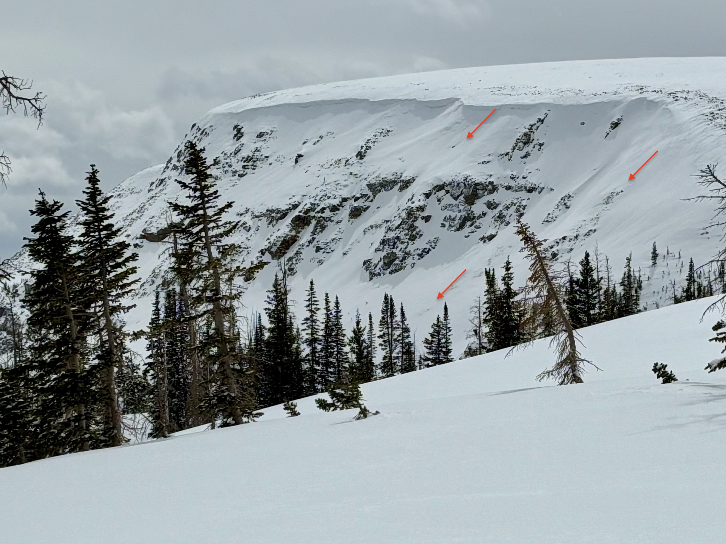
Arrows highlighting what a shallow, steep, and rocky slope look like Mt.Murdock off of Bald Mountain Pass is a great example. It's avalanched multiple times, has rocks peppered about, and is obviously steep -- These are the places I am avoiding in my travels especially as I venture into bigger terrain.
Additional Information
General Announcements
We are always looking for snow and avalanche observations or just general riding conditions. In the meantime reach out to us with questions, concerns, or if you see anything in your travels! Contact us directly through the info below:
This forecast is from the U.S.D.A. Forest Service, which is solely responsible for its content. This forecast describes general avalanche conditions and local variations always occur. This forecast was issued on Monday, March 31th at 06:00 AM and expires 24 hours after it was issued.