Observation: Currant Creek

Observation Date
2/18/2025
Observer Name
Brackelsberg/Davis
Region
Uintas » Currant Creek
Location Name or Route
Currant Creek
Weather
Sky
Obscured
Precipitation
Light Snowfall
Wind Direction
Northwest
Wind Speed
Strong
Weather Comments
The day started out with decent weather. Cloudy and light wind, but as the day progressed, the clouds thickened and the wind picked up dramatically. We had light snow with periods of graupel. Photo 1 shows the thick clouds that developed in the afternoon.
Snow Characteristics
New Snow Depth
8"
New Snow Density
Low
Snow Surface Conditions
Powder
Snow Characteristics Comments
The overnight snow appeared to over delivery in the Currant Creek and Mill Hollow areas. We found around 8" of new snow on top of the storm snow that has falled over the past 4 days. Riding conditions were 5-star+ as long as you avoided the high wind swept ridges.
Red Flags
Red Flags
Wind Loading
Poor Snowpack Structure
Red Flags Comments
We witnessed significant snow transport today with the tracks and trail being blow in quickly. The bottom portion of the snowpack is still weak facets. When the sled dropped through the dense layers, it would sink to the ground in the facets.
Avalanche Problem #1
Problem
Wind Drifted Snow
Trend
Same
Problem #1 Comments
With all the new snow available to transport, wind slabs are the main concern we had.
Avalanche Problem #2
Problem
Persistent Weak Layer
Trend
Same
Problem #2 Comments
The weak-faceted snow is still untrustworthy. While our ECT did not produce results, we did get results from our ECT in Mill Hollow. I feel it would just take a shallow spot to be able to trigger an avalanche on these facets.
Snow Profile
Aspect
Northeast
Elevation
9,900'
Slope Angle
21°
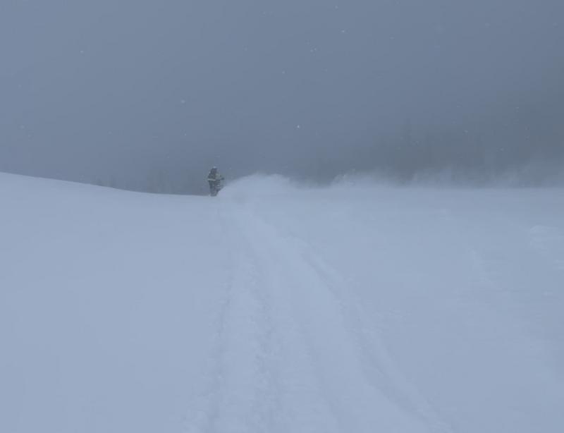
Our travels too us along the ridges above Mill Hollow and on to Currant Creek and back. Protected terrain had excellent, deep snow conditions. In open areas, we found soft snow, but significant wind and wind transported snow.
Visibility degraded rapidly after 3pm.
With all the new snow and wind over the past 4 days, we had expected to find avalanches, but only found old remnants of small slides, which appeared to be caused by the large cornices breaking off.
Lots of tracks in steep terrain which had not produced avalanches. We experienced no cracking or collapsing which I had experienced in this region on Sunday.
Our snow pit and ECT still indicate that the PWL is still a concern, but it seems to be getting more stubborn.
Today's Observed Danger Rating
Considerable
Tomorrows Estimated Danger Rating
Considerable
Coordinates