Forecast for the Ogden Area Mountains

Paige Pagnucco
Issued by Paige Pagnucco on
Tuesday morning, February 18, 2025
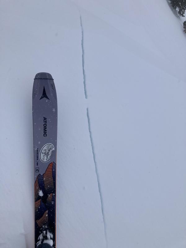
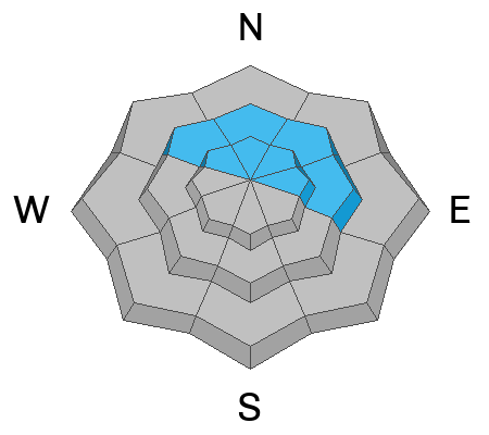
The avalanche danger is CONSIDERABLE on upper and mid-elevation slopes. Human-triggered avalanches are likely on most slopes, especially on those with buried weak layers. MODERATE danger exists in low-elevation terrain and human-triggered avalanches are possible.
My travel advice today is to avoid avalanche terrain. If you do travel in avalanche terrain, take all necessary precautions - cross or ride one at a time, watch from a safe spot, and have and know how to use avalanche rescue gear.
Low
Moderate
Considerable
High
Extreme
Learn how to read the forecast here
Weather and Snow
We've had reports of very good powder riding in the Ogden area backcountry as over 2" of SWE has fallen in the past 3 days. The Ben Lomond Peak weather station has received .5" of SWE since yesterday morning and could receive another inch or two of snow before the end of the day. Winds have been blowing from the northwest overnight around 10-15 MPH with gusts in the 20s MPH. The NWS Winter Weather Advisory continues through noon today. Expect mostly cloudy skies with an 8500' high of 26°F. Winds will blow from the west at 9 to 14 MPH with ridgetops gusting into the 20s and 30s MPH. There's a lull in the action tonight through Wednesday evening when our next storm arrives.
Recent Avalanches
One avalanche was reported Sunday from Rodeo Ridge (pic below). This avalanche was 14 inches deep, and because of the light, Bill Brandt couldn't see how wide it was. It sounds like this was a slab of wind-drifted snow. Greg Gagne was also on Rodeo Ridge, and you can find all the Ogden-specific observations HERE. Ski areas also reported sensitive slabs of wind-blown snow.
Ad
Avalanche Problem #1
Wind Drifted Snow
Type
Location
Likelihood
Size
Description
Elevated winds have continued to create sensitive wind drifts on all aspects at mid and upper-elevations. Cornices have grown large and may break further from ridgelines than expected. Any avalanche involving wind-drifted snow may step down to a buried persistent weak layer.
Avalanche Problem #2
Persistent Weak Layer
Type
Location
Likelihood
Size
Description
This is not our typical February Wasatch setup as we have four weak layers buried in the snowpack:
1. November / December faceted snow near the ground.
2. Slopes that previously avalanched (repeaters).
3. Late January faceted snow.
Avalanches can fail on any of these weak layers, and it's hard to determine which one. It’s not the time to thread the needle trying to find the one steep slope that won’t slide because there is too much spatial variability. Until the snowpack becomes less complex, we recommend staying out of avalanche terrain.
General Announcements
This information does not apply to developed ski areas or highways where avalanche control is normally done. This forecast is from the U.S.D.A. Forest Service, which is solely responsible for its content. This forecast describes general avalanche conditions and local variations always occur.