


Observer Name
Leydet and Zacharias
Observation Date
Monday, February 17, 2025
Avalanche Date
Monday, February 17, 2025
Region
Salt Lake » Mill Creek Canyon » Sheep Shit Ridge
Location Name or Route
Sheep Shit Ridge
Elevation
9,300'
Aspect
Northeast
Slope Angle
37°
Trigger
Natural
Avalanche Type
Soft Slab
Avalanche Problem
New Snow
Weak Layer
New Snow/Old Snow Interface
Depth
12"
Width
300'
Comments
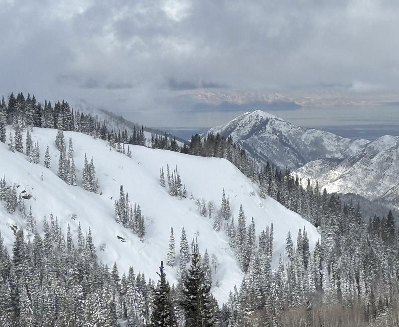
We observed a fresh avalanche on a northeast facing aspect along Sheep Shit Ridge in BCC. It appears to be a natural avalanche as we were unable to see any ski tracks in or out of this zone. Caltopo shading puts this slope in the 35-45° range. We estimate that the avalanche failed at the new/old interface approximately 12" (30 cm) down from the surface based on other pit profiles we conducted in this zone. It is likely that this slope was heavily wind loaded as we experienced mostly westerly winds along the exposed ridgelines in this zone.
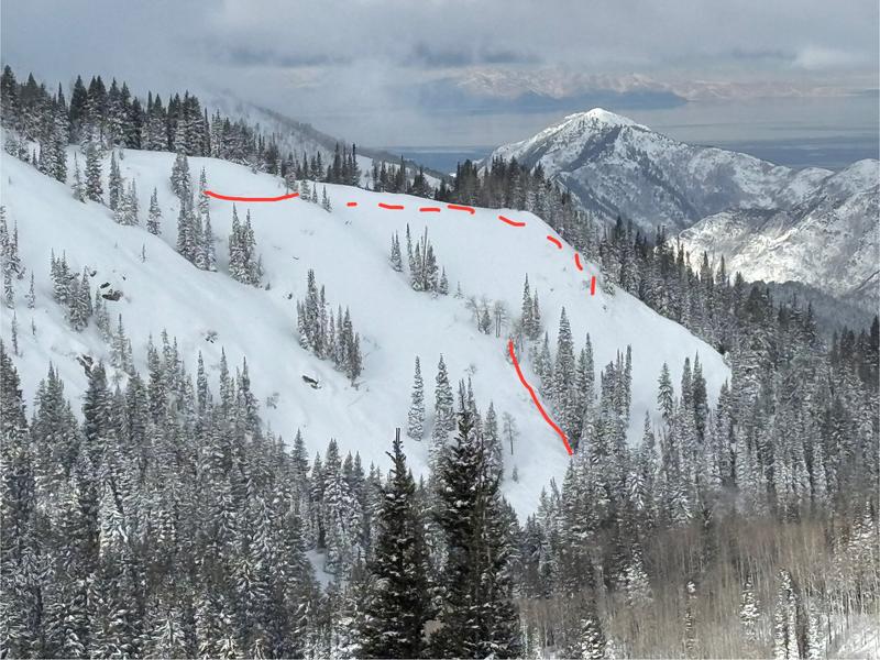
The two photos below show the crown and flank of the avalanche (red line). It also appears that the avalanche connected to an adjacent slope, although there was no crown visible from our vantage point (dashed red line).
We classify this avalanche as a soft slab, natural trigger, big enough to bury/kill a skier, and failure likely occuring in the old/new interface (SS-N-D2/R3-I).
Note: All measurements in this report are estimates or based on measurements on Caltopo.
Coordinates