Observation: Rodeo Ridge

Observation Date
2/16/2025
Observer Name
Gagne & friends
Region
Ogden » Ben Lomond » Rodeo Ridge
Location Name or Route
Ben Lomond - Rodeo Ridge
Weather
Sky
Obscured
Precipitation
Moderate Snowfall
Wind Direction
Southwest
Wind Speed
Strong
Weather Comments
Strong southwest winds with drifting along 7,800' ridgeline. Drifting was on leeward (north through east) aspects. Poor visibility with drifting snow and flat lighting.
Snow Characteristics
New Snow Depth
3"
New Snow Density
High
Snow Surface Conditions
Powder
Wind Crust
Snow Characteristics Comments
~5 cms of new snow consisting of dense, rimed stellars. Looking at Ben Lomond wx station with snow/water numbers, density was 20% which made for dense snow at the surface.
Red Flags
Red Flags
Recent Avalanches
Heavy Snowfall
Wind Loading
Cracking
Collapsing
Red Flags Comments
Widespread cracking and collapsing above 7,200' on wind-drifted slopes. Very poor lighting, so it was difficult to determine if a northeast-facing slope at 7,800'had avalanched or if it was from a natural cornice fall, but there were large chunks of debris up to 50 meters (200') down the slope. (I talked to pro observer Bill Brandt who was also up on Rodeo today and he indicated it was an avalanche.)
Avalanche Problem #1
Problem
Wind Drifted Snow
Trend
Same
Problem #1 Comments
Widespread collapsing and cracking, with cracks on wind-drifted slopes propagating over 100' wide and up to 2.5' deep.
Comments
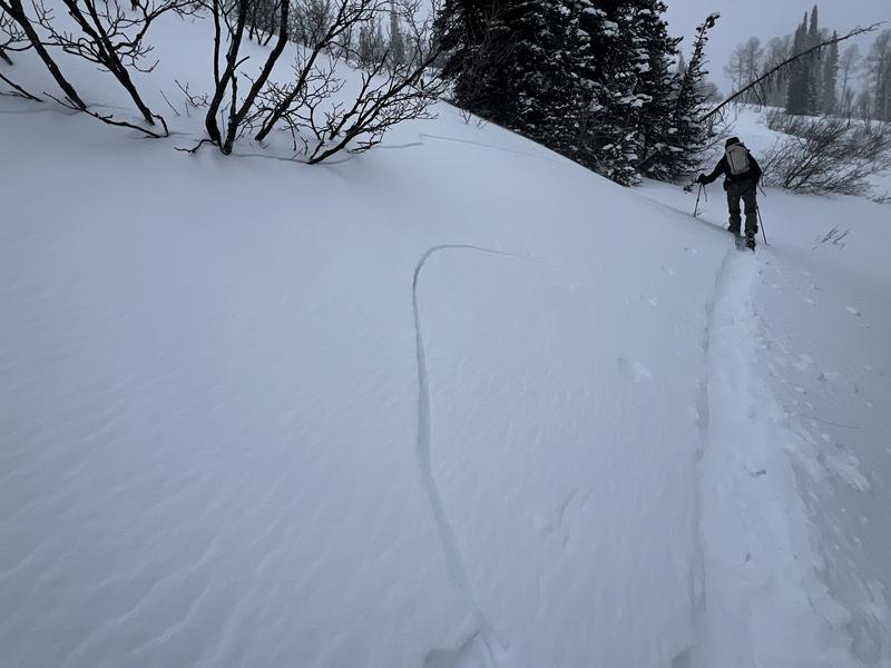
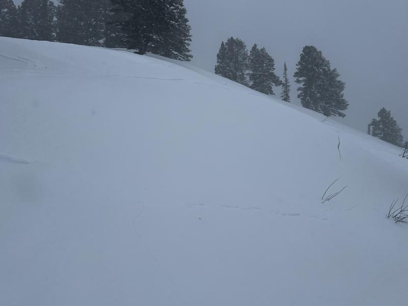
Photos of cracking and a slope that *may* have avalanched or was just from a fresh cornice fall.
Today's Observed Danger Rating
High
Tomorrows Estimated Danger Rating
None
Coordinates