AVALANCHE WARNING!! Tap for info
UDOT PLANNED AVALANCHE CLOSURES!!

Observation: Providence Canyon

Observation Date
1/16/2025
Observer Name
Richie Schumacher
Region
Logan » Providence Canyon
Location Name or Route
Providence Canyon
Weather
Sky
Clear
Wind Direction
Southwest
Wind Speed
Light
Weather Comments
Cold (teens), calm, and clear at the TH this morning. It was much warmer at higher elevations in the morning and throughout the day. Generally as the day progressed, things warmed up, winds increased into the light/moderate range on ridge lines (with some snow being transported), and skies stayed clear with valley air quality appearing to worsen throughout the day.
Snow Characteristics
New Snow Density
Low
Snow Surface Conditions
Powder
Faceted Loose
Wind Crust
Snow Characteristics Comments
Surface snow is made up of a nice and fairly consistent right side up setup of surface hoar (& RR?) and faceting snow on top of a increasingly dense and supportable base that was thick enough to prevent us from reaching the old PWL layer on the slopes we travelled and poked around on. As expected, the snow near ridgelines was variable with some areas of thin and hollow sounding hard wind slab deposits and small cornice we avoided. By early afternoon, solar aspects were becoming more damp and forming a breaking snowball, but were still skiing well. Polar aspects were settling a bit, but staying dry. Some roller balls were noted off steep cliffs ands on solar terrain from yesterday.
Red Flags
Red Flags Comments
No red flags noted today. We experienced stable conditions.
Comments
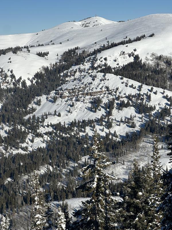
Photo 1: cornice and hard wind deposits
photo 2: roller balls off cliffs
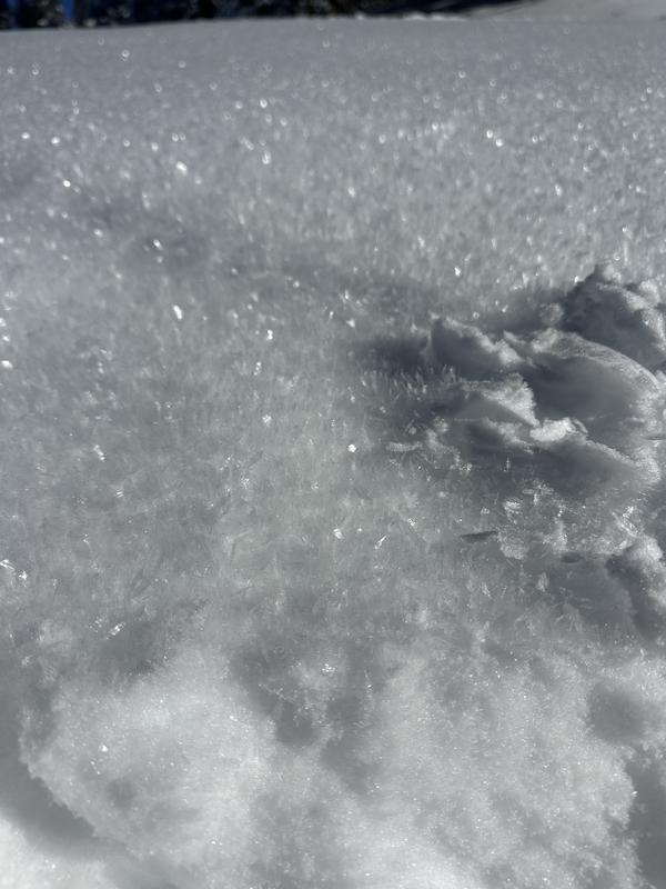
photo 3: surface conditions on NW @ 8300'- SH and snowball
photo 4: Surface hoar from slope above (1mm grid)
Today's Observed Danger Rating
Low
Tomorrows Estimated Danger Rating
Low