Join us at our 2nd Annual Blizzard Ball

Forecast for the Uintas Area Mountains

Andrew Nassetta
Issued by Andrew Nassetta on
Monday morning, January 13, 2025
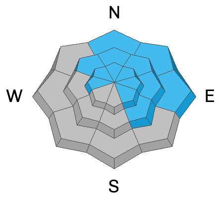
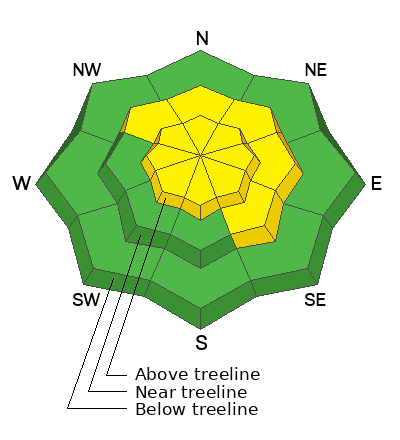
MODERATE danger exists on upper-elevation slopes facing northwest through north through southeast for triggering a persistent slab avalanche breaking up to 4’ deep and hundreds of feet wide. Although less consequential, human-triggered avalanches are POSSIBLE at mid-elevations around the compass for new and recently wind-drifted snow.
I am still avoiding the persistent slab problem and avalanche terrain on the north half of the compass where I could trigger a large avalanche remotely. I am gunning for south-facing sunny slopes out of the wind zone where the riding is best and there is less danger of triggering an avalanche. .
Low
Moderate
Considerable
High
Extreme
Learn how to read the forecast here
Special Announcements
Receive forecast region-specific text message alerts to receive messages about changing avalanche conditions, watches, and warnings. Sign up and update your preferences HERE.
Weather and Snow
Nowcast
A beautiful Wolf Moon sits in a clear sky this morning, with temps in the single digits across most of the range. Winds are light from the north, and other than a few bumps late yesterday afternoon, have remained calm.
Forecast
It will be cold with single digit temperatures and an expected high of 10℉. A potential snow shower or two will be met with increasing clouds through the later part of the day. Light winds from the north continue and shift northwest by day's end, keeping things feeling bitter.
Futurecast
More sunshine and powder riding on tap for this week as we enter a period of calmer weather. Things look to get active again as we head into the weekend.
Recent Avalanches
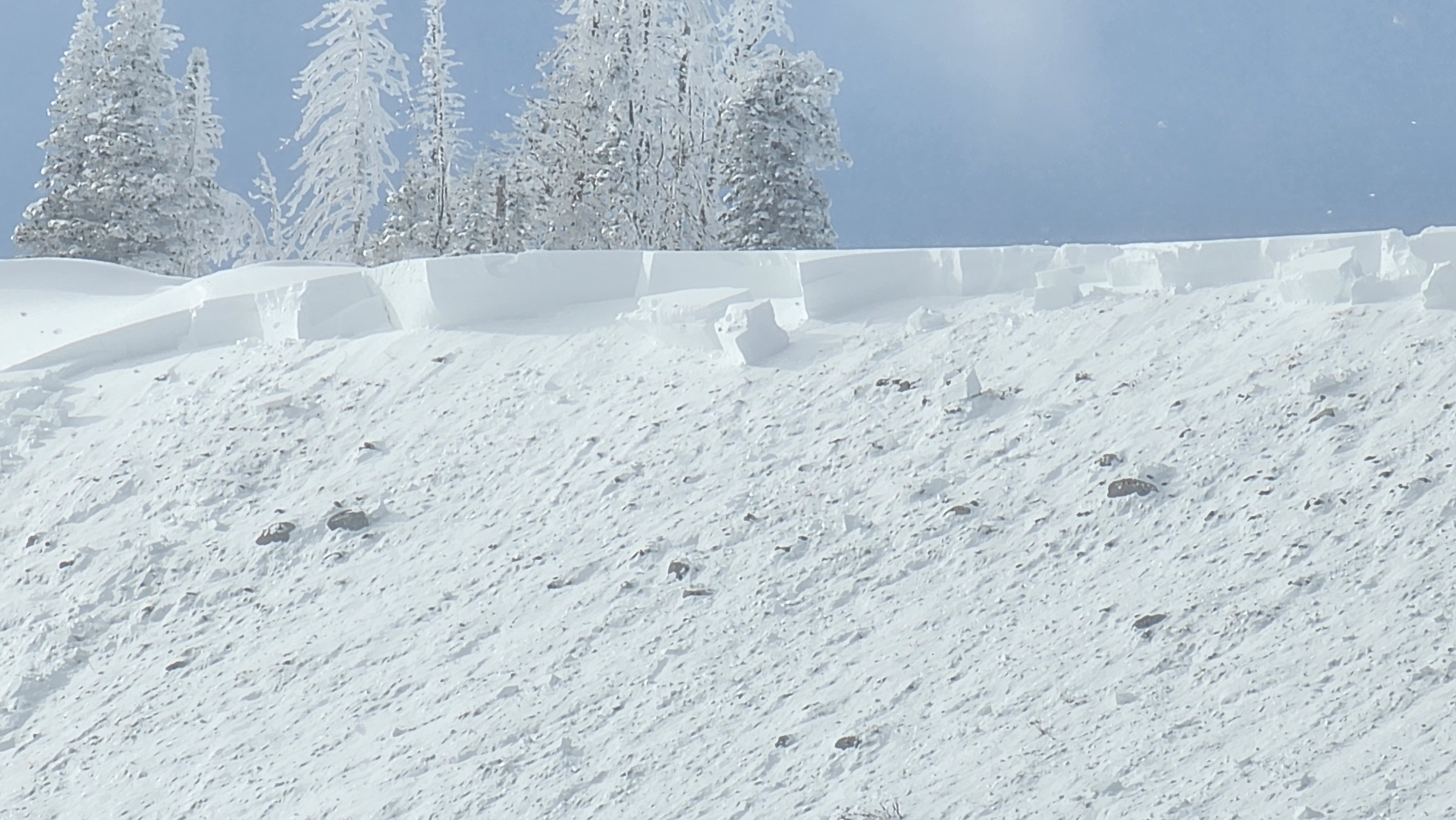
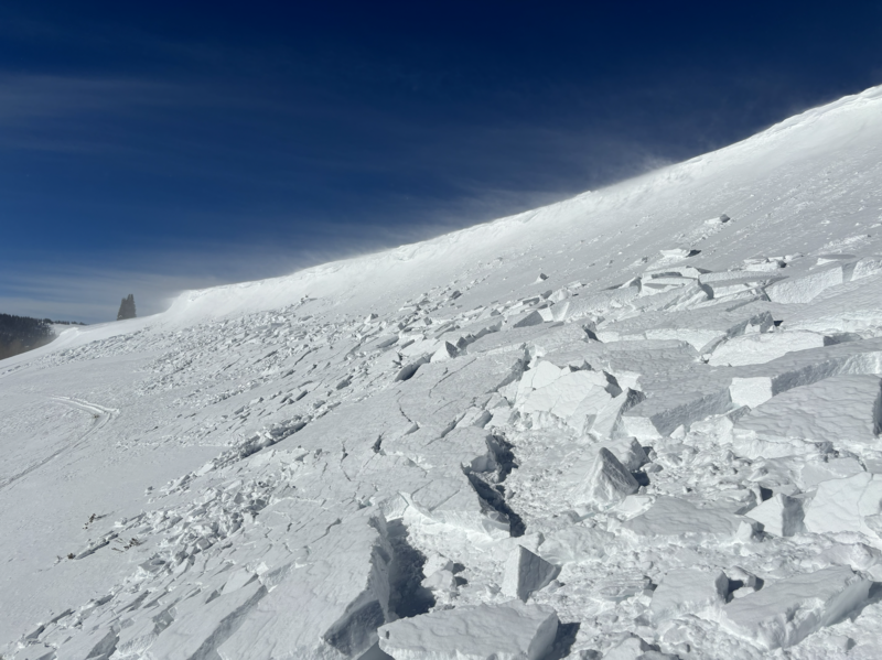
Yesterday, a slide was triggered near Duchesne Ridge on a north-facing, heavily wind- loaded slope. This avalanche was 2-4’ deep and a couple hundred feet wide failing on our persistent weak layer.
You can find all travel observations and recent slides from across the range and beyond, here.
Ad
Avalanche Problem #1
Persistent Weak Layer
Type
Location
Likelihood
Size
Description
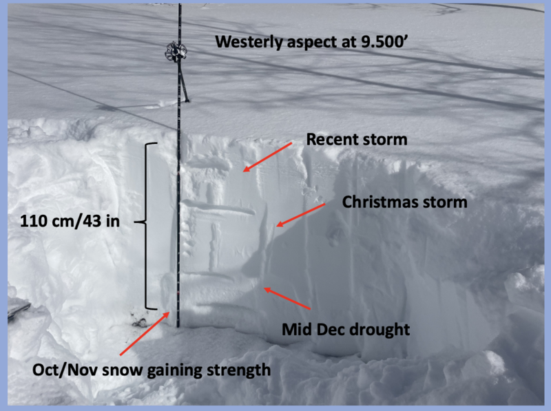
We have entered a tricky period of avalanche hazard. The likelihood of triggering a persistent slab avalanche has gone down slightly, but the consequences, if triggered, remain the same. We have seen fewer signs of instability, like cracking and collapsing, but yesterday's human-triggered avalanche and poor snowpack structure at higher elevations on north-facing slopes suggest we keep a close eye on the problem.
What am I doing to reduce my risk? I'm steering clear of it by avoiding avalanche terrain where this structure exists. Persistent slab avalanche problems require persistent patience, which I am continuing to practice.
Above, Craig provided a nice breakdown of the poor structure and the weak, December drought layer. He also adds, "I'm ever so slightly and very cautiously, slowly nibbling on the edges of bigger terrain." A sure sign that the pack is getting comfortable, but we have not fully turned the corner.
Avalanche Problem #2
Wind Drifted Snow
Type
Location
Likelihood
Size
Description
Periods of gusting winds and plenty of light snow to move around have created sensitive drifts at mid and upper elevations. When triggered, they may have the potential to break out wider and deeper than we might expect. You can identify this problem by investigating steep starting zones and cross-loaded features of terrain like gullies and convex rolls. They will sound hollow like a drum or feel stiff underneath our sleds or skis and allow us to get on the slope before breaking above or below us.
General Announcements
The Uinta weather station network was upgraded this summer and all that real-time info is found here. Simply click on the "Western Uinta" tab and then the "Weather Stations" tab to find all your weather needs.
We are always looking for snow and avalanche observations or just general riding conditions. So... if you see something, say something. You can reach our team directly by contacting: Craig at craig@utahavalanchecenter.org, 801-231-2170, or Andrew at andy@utahavalanchecenter.org, or 860-460-8142.
General Information
This forecast is from the U.S.D.A. Forest Service, which is solely responsible for its content. This forecast describes general avalanche conditions and local variations always occur. This forecast was issued on Monday, January 13th at 05:00AM and expires 24 hours after it was issued. We will update the forecast by 0700 AM tomorrow. But, in the meantime reach out to us with questions, or if you see anything in your travels.