Forecast for the Uintas Area Mountains

Issued by Andrew Nassetta on
Sunday morning, January 5, 2025
Sunday morning, January 5, 2025
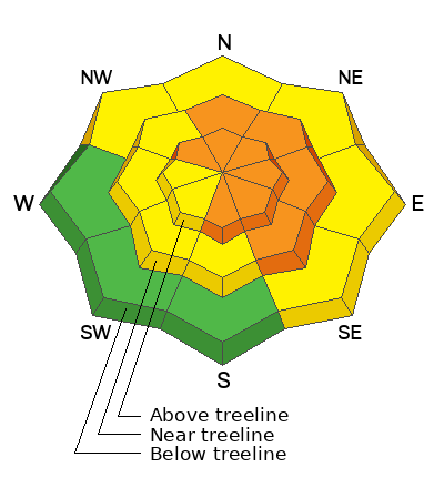
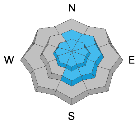
Avalanche danger is CONSIDERABLE at upper elevations, and human-triggered avalanches are LIKELY on slopes facing northwest through southeast. We can trigger today’s avalanches remotely, or from a distance, up to 6’ deep and hundreds of feet wide. What’s tricky is that we are seeing fewer red flags like recent avalanches, collapsing, and cracking, but a quick dig reveals a stout slab over a weak layer that is waiting for a trigger like us to come along.
For today, there is plenty of good riding to be had while avoiding the avalanche hazard. I'm heading to lower angle slopes on the south half of the compass where there is reduced hazard and less concern of remote triggers.
Low
Moderate
Considerable
High
Extreme
Learn how to read the forecast here
 Special Announcements
We are deeply saddened to confirm two avalanche fatalities. The first involved a 38 year old man in Main Porter Fork of Mill Creek Canyon who went missing on Saturday. The second avalanche fatality occurred Tuesday and involved a 54 year old man off Davenport Hill into Silver Fork of BCC. Both individuals were traveling alone in the backcountry. Please know, our hearts are heavy for the family and friends of these gentlemen.
Many thanks to those who responded to these accidents: search and rescue teams from AirMed, LifeFlight, Utah Dept Public Safety, Utah Department of Transportation, Salt Lake County Search and Rescue, Wasatch Backcountry Rescue, Alta Ski Area, and members of the Utah Avalanche Center.
 Weather and Snow
Nowcast
Since 0500 AM yesterday we have added an additional 3-5” of snow to the stakes with around .4” of water. Currently, temperatures hover in the teens at the trailheads and single digits on the high peaks while winds wisp from the west and northwest and continue throughout the morning with speeds between 10 and 20 MPH.
Forecast
Partly cloudy skies pair with a few lingering snow showers throughout the late morning and into the afternoon while winds continue to blow lightly. Temperatures stay consistently chilli throughout the day in the teens and proceed to stay put.
FuturecastA slight break in the action today will be followed up with more weather to come early this work week.
 Recent Avalanches
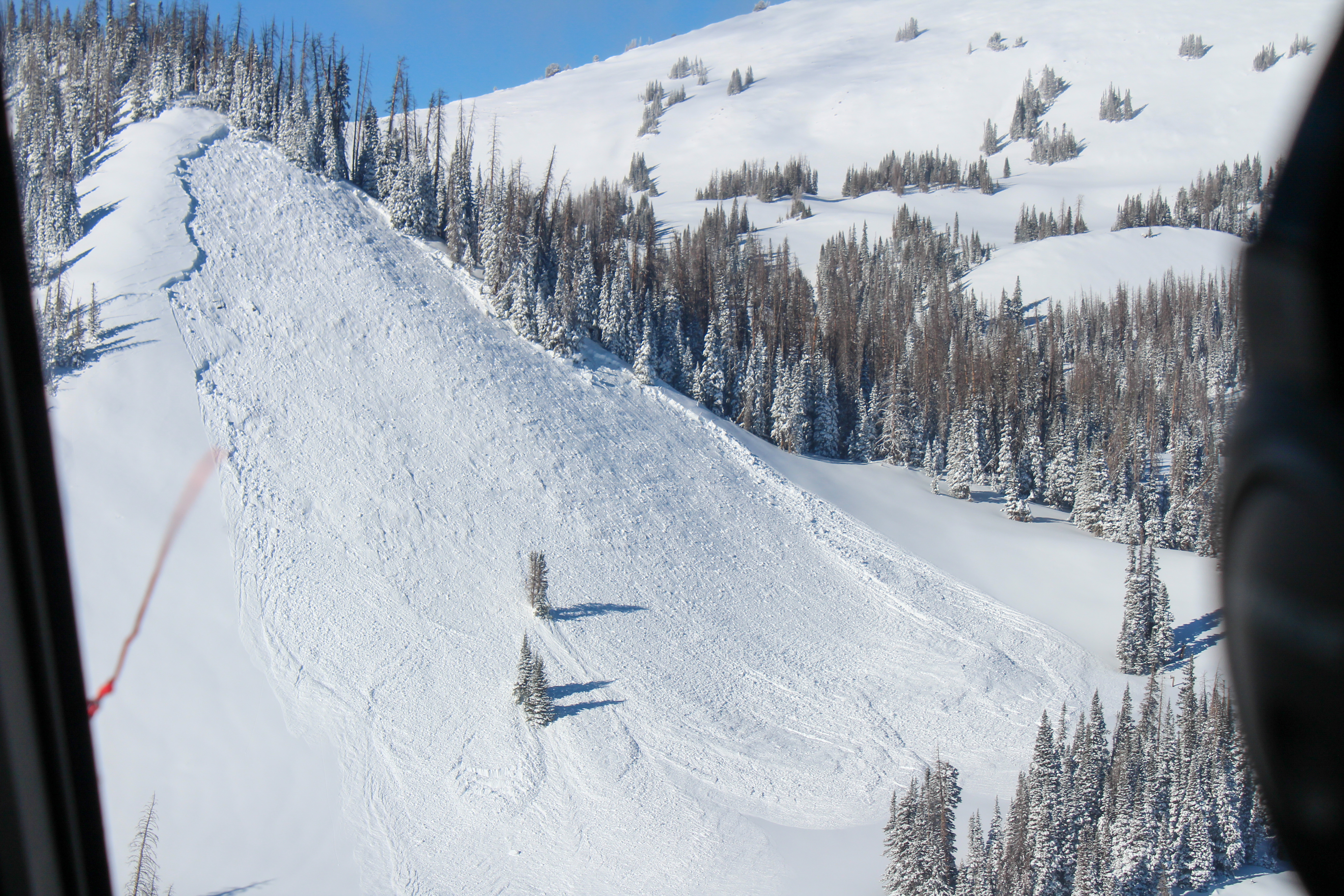
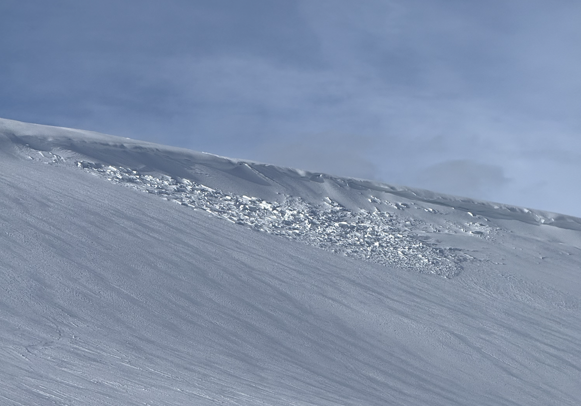
No significant avalanche activity to report from yesterday, but the image above speaks to the problem we are focused on... A well-connected avalanche on the north side of the range near Whitney Basin that slid during last weeks natural cycle. All Uinta obs and trip reports can be found here.
Avalanche Problem #1
Persistent Weak Layer
Type
Location
Likelihood
Size
Description
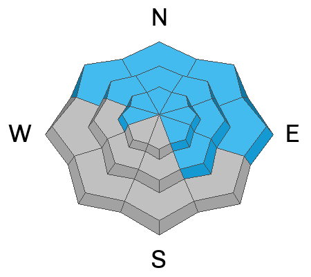
Things are getting tricky with our PWL as red flags decrease, and we are seeing less obvious signs of avalanche hazard. In many places on the north half of the compass, sugary, weak, faceted snow is preserved beneath a 2-4’ slab of cohesive snow. As time has worn on, the likelihood of triggering these avalanches has gone down but the consequences, if triggered, remain the same.
While stability tests and the lack of avalanche activity suggest strengthening of this weak layer, there is still a likely chance of triggering a large avalanche remotely, or from a distance that could keep you from coming home at the end of the day.
Avalanche Problem #2
Wind Drifted Snow
Type
Location
Likelihood
Size
Description
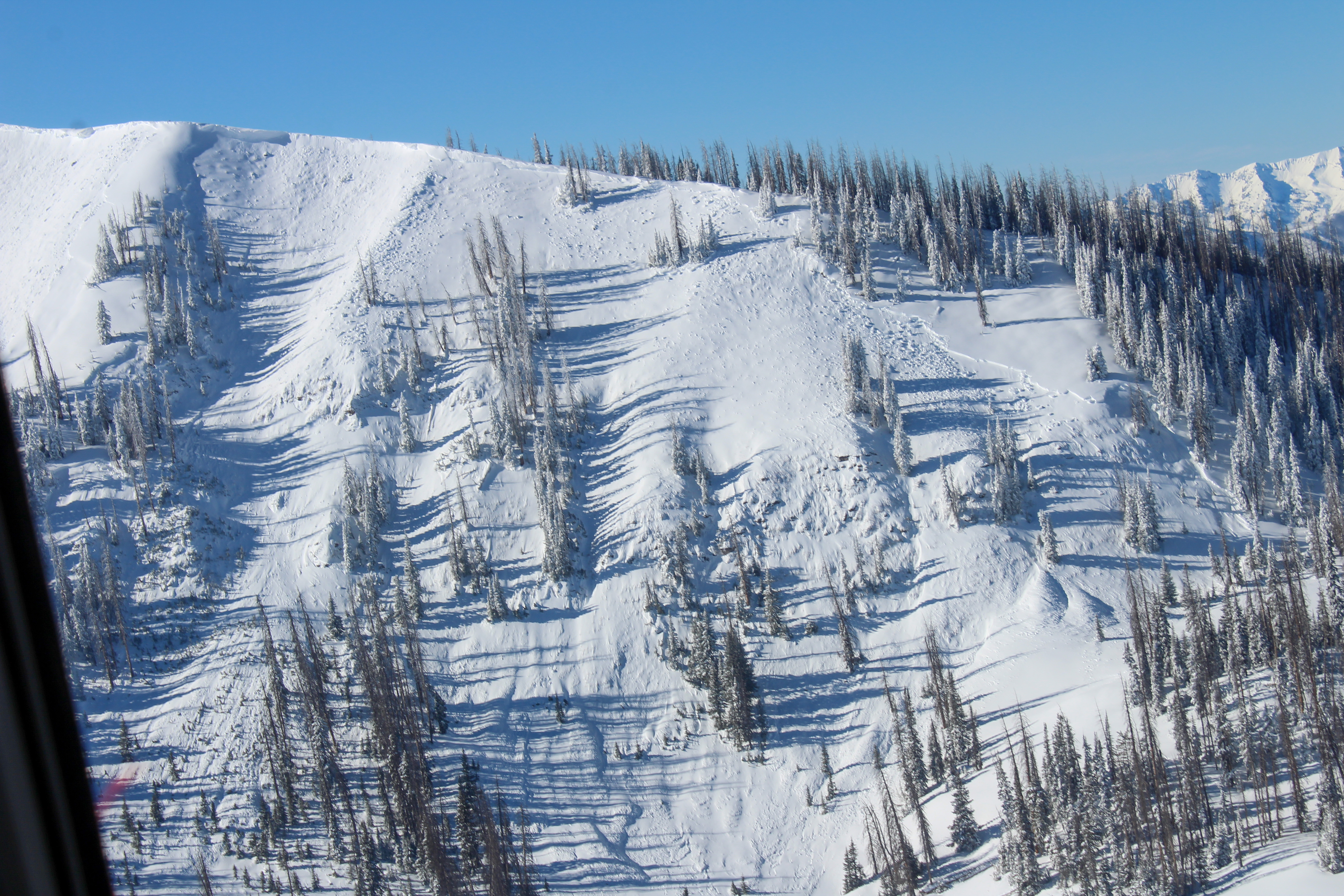
For today, expect stiff wind drifts in steep, mid and upper-elevation terrain where consistent westerly winds have packed in a slab. In many places, these drifts will look like rounded pillows and may sound hollow like a drum underneath our ride. Once triggered, today's drifts can get out of hand quickly if they break into faceted weak layers that are now buried several feet deep in the snowpack.
Don’t get fooled into thinking fresh wind drifts are always a manageable avalanche problem. Once triggered, wind-drifted snow has the potential to get out of hand and break into deeper, faceted layers in the snowpack.
General Announcements
The Uinta weather station network was upgraded this summer and all that real-time info is found here. Simply click on the "Western Uinta" tab and then the "Weather Stations" tab to find all your weather needs.
We are always looking for snow and avalanche observations or just general riding conditions. So... if you see something, say something. You can reach our team directly by contacting: Craig at craig@utahavalanchecenter.org, 801-231-2170, or Andrew at andy@utahavalanchecenter.org, or 860-460-8142.
General Information
This forecast is from the U.S.D.A. Forest Service, which is solely responsible for its content. This forecast describes general avalanche conditions and local variations always occur. This forecast was issued on Sunday, January 5th at 06:00AM and expires 24 hours after it was issued. We will update the forecast by 0700 AM tomorrow. But, in the meantime reach out to us with questions, or if you see anything in your travels.


