UDOT PLANNED AVALANCHE CLOSURES!!

Forecast for the Uintas Area Mountains

Craig Gordon
Issued by Craig Gordon on
Thursday morning, December 26, 2024
Heads up... a series of storms is slated to slide into the Uinta zone the next couple days and avy danger is gonna get real-
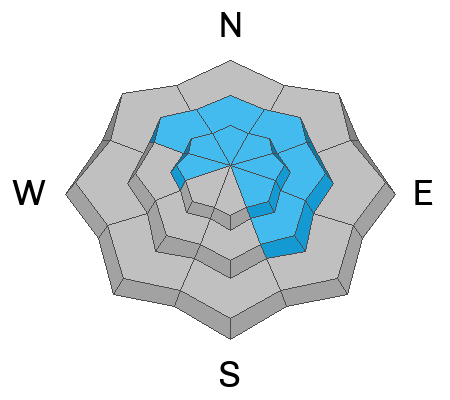
For this morning, you'll find MODERATE avalanche danger at and above treeline. Human triggered avalanches are POSSIBLE especially on steep, rocky, leeward slopes, and particularly in terrain facing the north half of the compass. The walls aren't caving in just yet but with additional snow and wind, it's gonna get tricky and the danger may bump up a notch and rise to CONSIDERABLE by days end. Think about it for a sec... once triggered, today's avalanches may break deeper and wider than you might expect, revealing a host of season ending obstacles like stumps, rocks, or deadfall.
Lose some elevation, lose the wind and you lose the problem... lower elevation terrain offers generally LOW avalanche danger around the dial and human triggered avalanches are UNLIKELY.
Remember... it's still low tide and there's a whole 'lotta reef out there. Rock and stump tagging conditions are a significant hazard so you'll wanna throttle it down a titch 'til the snowpack matures a bit more.
Low
Moderate
Considerable
High
Extreme
Learn how to read the forecast here
Avalanche Watch
What:
This Avalanche Watch is for rising avalanche danger, with very dangerous conditions continuing through the weekend and into next week.
Heavy snowfall and drifting by strong winds will elevate backcountry avalanche danger over the next several days. Very dangerous conditions and HIGH avalanche danger are expected to develop in many areas.
Where:
The Avalanche Watch is for the mountains of Northern and Central Utah as well as Southeastern Idaho, including the Wasatch Range, Bear River Range, and the western Uinta Mountains.
Impacts:
Very dangerous avalanche conditions are expected to develop on many slopes.
Avalanches can be triggered on slopes steeper than 30 degrees. They may also be triggered remotely (from a distance) or from below.
What to do:
Avoid traveling on or underneath steep terrain at mid and upper elevations in the backcountry.
Carry and know how to use avalanche rescue equipment.
Find safer riding conditions on slopes less than 30 degrees with no overhead hazard.
Weather and Snow
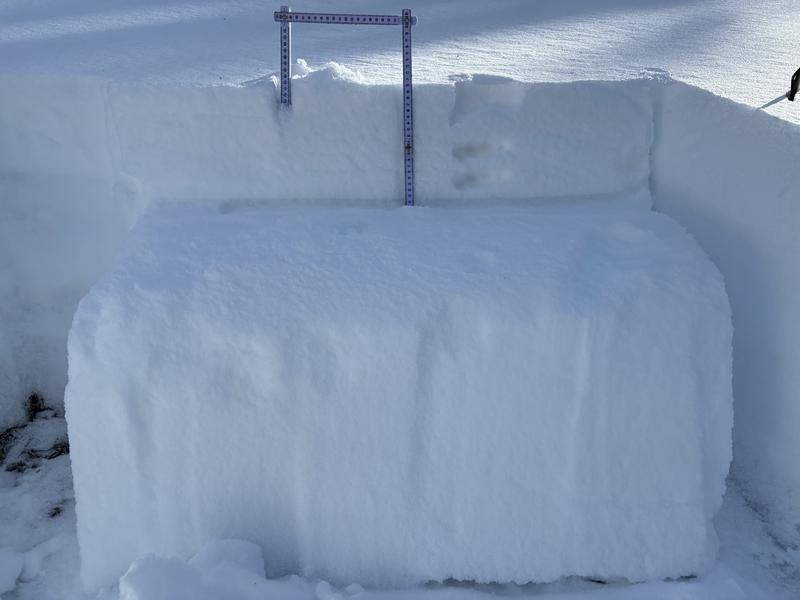
Nowcast- The Christmas storm dribbled in all day, turning into the little gift that kept giving, stacking up an evenly distributed 4" of snow with about .32" H2O. In other words, right in line with our typical storm snow density. A brief clearing early this morning allowed temperatures to dive into the mid teens, but clouds are already on the doorstep and should thicken right around sunrise. After a lull in the action yesterday afternoon, southerly winds began an uptick at the turn of the new day and currently blow 10-20 mph near the high peaks.
Forecast- Westerly winds ramp into the 30's along the high ridges, opening the door to the first in a series of storms rolling into the Uinta's early this morning. It's a quick hitter, but should deliver about 3"-5" of snow in short order. Expect mild temperatures climbing into the upper 20's. Overnight lows dip into the teens.
Futurecast- An active pattern is still on track with multiple waves of storminess to wrap up the work week. Look for a break in the action this afternoon with another shot of snow slated for tonight into early Friday. Strong winds and heavy snow develop late Friday into Saturday, a break for early Saturday, with yet another wave of moisture on tap for Saturday night into Sunday. We've got a good pattern developing and these storms should stack up solid snow and water totals... not Herculean, but respectable none-the-less. Fingers, toes, and eyes crossed :)
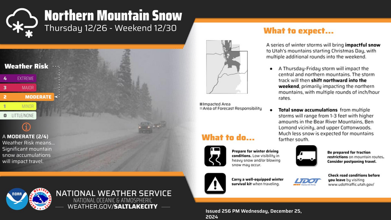
Our good friends and longtime partners at Slat Lake's National Weather Servive issued a Winter Storm Warning for a good portion of Northern Utah which of course, includes the western Uinta's.
Travel & Riding Conditions-
A little snow goes a long way. Riding and turning conditions vastly improved with yesterdays shallow coat of fresh paint.
Recent Avalanches
An avalanche accident in the Logan area mountains Tuesday, resulted in a complete burial, but fortunately, a quick thinking companion used his avalanche transceiver for the rescue, resulting in only minor injuries to the buried rider. The avalanche was 2 feet deep and 500 feet wide.
Closer to home, it's been nearly a week since we've seen or heard of any avalanche activity in the Uinta zone. But avalanches like in the Logan Zone, give us a peak under the hood into our snowpack's personality and what's to come once our weak layering is overloaded with dense, heavy snow or wind.
If you're looking for info, travel obs, and avalanches from the western Uinta range and from around the state, well then, you came to the right place... simply click here!
Ad
Avalanche Problem #1
Wind Drifted Snow
Type
Location
Likelihood
Size
Description
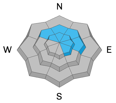
Recent storm snow coupled with increasing winds, team up to create fresh drifts reactive to our additional weight. Found mostly on the leeward side of upper elevation ridges, I wouldn't be too surprised to find a shallow drift or two lurking on mid elevation slopes or cross-loaded in a terrain feature like a chute or gully wally. In either case, I'm gonna look for and avoid any fat looking piece of snow, especially if it sounds hollow like a drum.
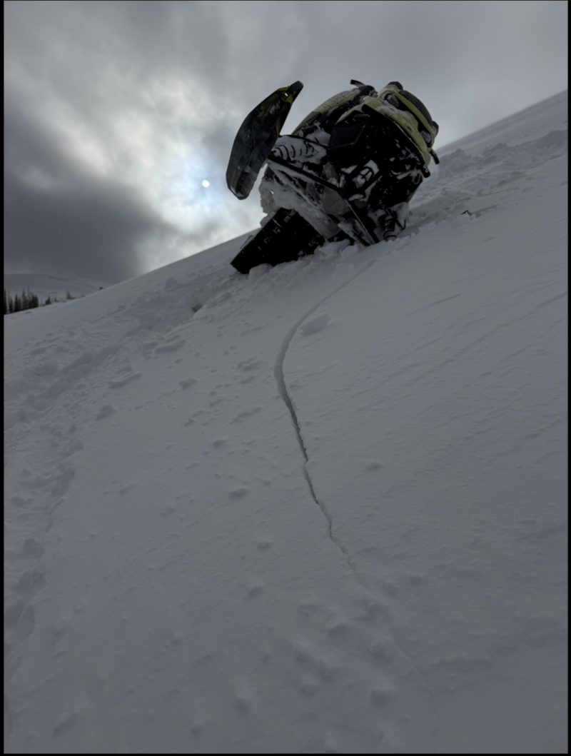
Clues like whoomphing sounds or shooting cracks out in front of our skis, board, or sled are a huge red flag to unstable snow.
Avalanche Problem #2
Persistent Weak Layer
Type
Location
Likelihood
Size
Description
I don't think there's enough water in yesterday's storm snow to activate dormant weak layers, but let's face it, our snowpack structure is a mess and we're teetering on the edge. There's some unknowns right now, so let's not pull on the dogs tail to test our theories or take our eyes off the prize... with more storms in the queue, I expect buried weak layers are gonna come back to life, creating deceptively dangerous avalanche conditions by late in the work week.
More snow and water is on the way and our focus should begin to shift accordingly to a tricky avalanche dragon, weak near surface facets now buried about 12" below the snow surface.
General Announcements
The Uinta weather station network was upgraded this summer and all that real-time info is found here. Simply click on the "Western Uinta" tab and then the "Weather Stations" tab to find all your weather needs.
We are always looking for snow and avalanche observations or just general riding conditions. So... if you see something, say something. You can reach our team directly by contacting: Craig at craig@utahavalanchecenter.org, 801-231-2170, or Andrew at andy@utahavalanchecenter.org, or 860-460-8142.
General Information
This forecast is from the U.S.D.A. Forest Service, which is solely responsible for its content. This forecast describes general avalanche conditions and local variations always occur. This forecast was issued on Thursday, December 26th at 03:30 AM and expires 24 hours after it was issued. We will update the forecast by 0700 AM tomorrow. But, in the meantime reach out to us with questions, or if you see anything in your travels.