Observer Name
Fullmer
Observation Date
Sunday, December 15, 2024
Avalanche Date
Sunday, December 15, 2024
Region
Salt Lake » Little Cottonwood Canyon » Grizzly Gulch
Location Name or Route
Grizzly Gulch
Elevation
9,400'
Aspect
Southwest
Slope Angle
41°
Trigger
Skier
Trigger: additional info
Intentionally Triggered
Avalanche Type
Soft Slab
Avalanche Problem
Wind Drifted Snow
Weak Layer
Facets
Depth
16"
Width
100'
Comments
HS-AS-D1.5-I
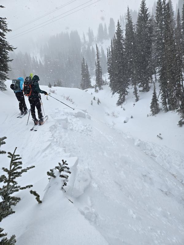
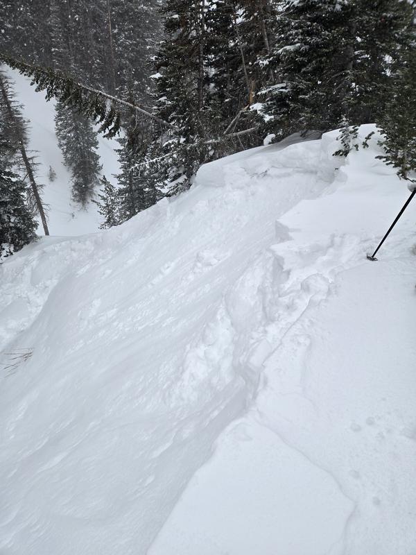
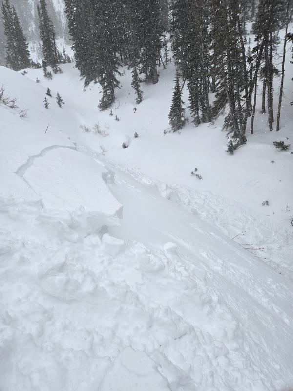
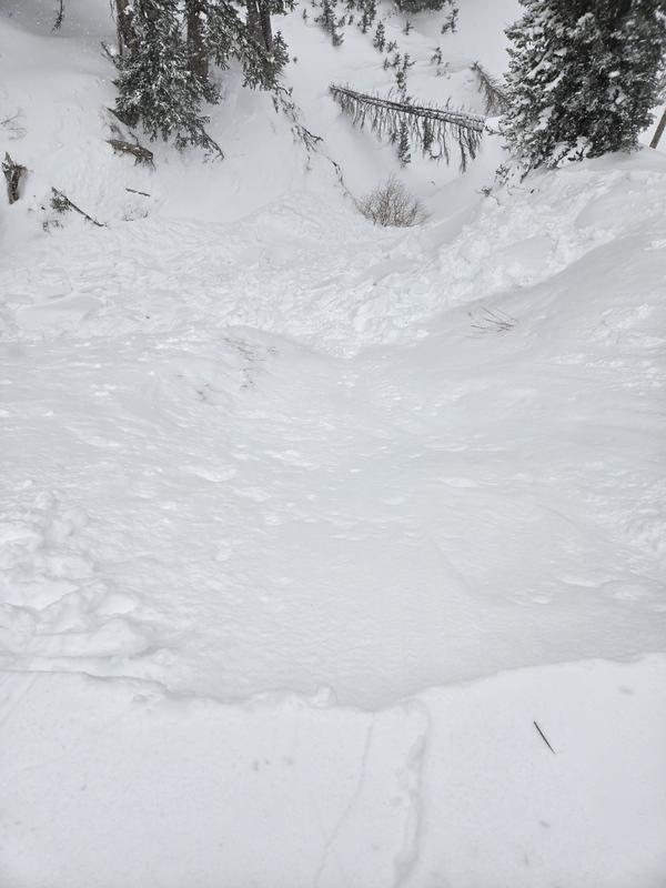
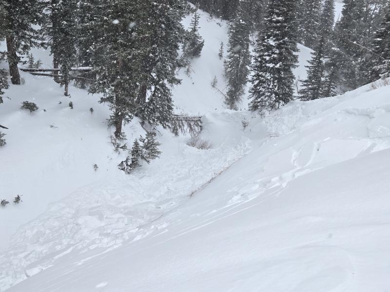
The ridge of this gully was clearly wind effected and loaded. I stepped onto the wind loaded snow to demonstrate wind loaded instabilities to an Avalanche Level 1 course, hoping to get some results. The collapse remotely triggered the avalanche which moved very rapidly into the gully. Impressive energy to the avalanche.
The crown averaged 1-1.5’ in depth (30-45cm). The width was approx. 100’.
We also experienced an audible collapse at 10,100’ on a SW aspect near East Pass. This also was a heavily wind loaded zone in rocky terrain. We were in flat terrain, no apparent cracks with the collapse.
To investigate SW aspects further, we dug a pit at 9600’:
- CT5 SC down 15cm within new snow (density inversion from storms Dec. 13-14)
- CT10 SC down 25cm at new/old interface (December near surface facet layer)
- CT27 RP down 55cm within old snow (at the early season facet layer)
- ECTN4 down 15cm
- ECTN7 down 25cm.
TLDR: it’s what we know, all that we need is more snow and a slab and we’ll see plenty of avalanche activity. If the tipping point isn’t here, it’s near.
[Forecaster Comment: UAC staff visited this site on 12/17, given that it was reported on a southwest aspect and apparently failed on facets, a persistent weak layer (PWL). The PWL is found on northerly aspects (northwest through east, with some isolated slopes facing west and southeast at the upper elevations. South and southwest aspects held very little snow prior to this recent series of storms and therefore did not have a PWL. Although this avalanche did occur on a southwest aspect, the steep-sided gully and the steep slopes to the south and west shaded this location, so it had a similar snowpack to what would be found on northerly-facing slopes: weak, faceted grains throughout the snowpack, capped with a dense 1F-hard wind drift. Extended column tests on Tuesday still produced full-propagation on the slope above the crown: ECTP13 and ECTP17, failing down 45 cms at the interface of the old snow surface prior to the Dec 12/13 storm, indicating that avalanches remain a concern on wind-loaded slopes where there is a PWL.]

Coordinates


