Check out our Holiday Auction

Forecast for the Uintas Area Mountains

Craig Gordon
Issued by Craig Gordon on
Wednesday morning, December 11, 2024
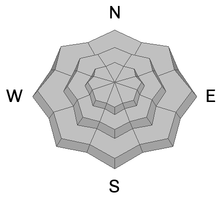
The avalanche danger is LOW today and human-triggered avalanches are UNLIKELY. Barely clocking in as a hazard, recent winds did whip up a few drifts in the windzone above treeline. And though very manageable, you'll still want to look for and avoid steep terrain that appears fat and rounded.
Note to self... it's lean out there with settled snow depths registering just 1'-2' in most areas. Right now the biggest threat is slamming into a season ending buried treasure like a stump, log, or rock. But don't let your heart be troubled, meadow skipping is the ticket and good riding is found on low-angle slopes facing the north half of the compass.
Low
Moderate
Considerable
High
Extreme
Learn how to read the forecast here
Weather and Snow
Nowcast-
With clear skies overhead, a waxing moon casts a curious light on our mountains, as brief high pressure settles into the Beehive State. Temperatures have been steadily climbing out of the icebox for the past 24 hours and register in the teens while west and northwest winds blow in the low 20's near the high peaks.
Forecast-
It'll be a brilliant day in the mountains with mostly sunny skies and high temperatures reaching into the upper 20's and low 30's. West and northwest winds should remain relatively well behaved throughout the day, blowing 10-20 mph along the high ridges. Overnight lows dip into the teens.
Futurecast-
Expect partly cloudy skies for early Thursday, though clouds and wind increase late in the day, ushering in a quick hitting storm and a fresh, albeit shallow coat of white paint. A break for Saturday with another fast moving system slated for late in the weekend. Not a bottomless cup by any means, but the couple of refills on tap will go a long way to improve spirits and cushion old snow surfaces.
Current Conditions-
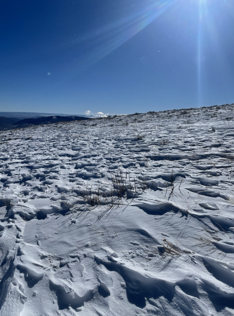
Snowpro and all around amazing person, the ever intrepid Trevor Katz was out and about in the Currant Creek zone yesterday and found Monday nights storm helped reset wind sheltered slopes, but up high snow surfaces remain variable and wind sculpted.
Recent Avalanches
Pretty quiet on the eastern front and it's been two weeks since we've heard of or seen any avalanche activity. The last reported slide occurred on Wednesday, November 27th, near Wolf Creek Pass, failing on our persistent weak layer.
More information on avalanches and current conditions from the range can be found, HERE.
Ad
Avalanche Problem #1
Normal Caution
Type
Location
Likelihood
Size
Description
Early season snow near the ground has grown weak and sugary, but fortunately, this persistent weak layer (PWL) is largely dormant. In fact, we haven’t seen an avalanche break to the PWL for several weeks, since right around Thanksgiving... good news.
The bad news... the recent drought is turning our snowpack into a weak, sugary mess and it’s rotten to the ground, becoming unsupportable on many polar aspects, especially where the pack is thin.
Triggering an avalanche today is unlikely. That said, I’m still avoiding steep, thin, rocky slopes in upper elevation terrain where a pocket of wind-drift snow sitting on top of facets could react to my additional weight, knock me off my feet and take me for an unexpected ride.
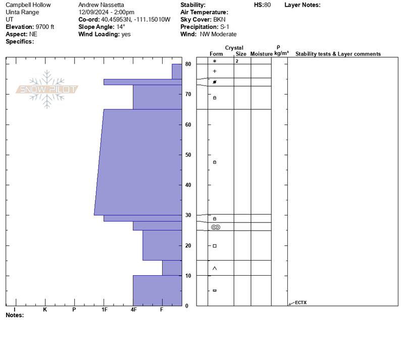
Andy's pit profile above from Campbell Hollow yesterday suggests a little structure to the snowpack, but not exactly the kind of foundation we wanna build our condo complex or our winter snowpack on.
General Announcements
Additional Information
The Uinta weather station network was upgraded this summer and all that real-time info is found here. Simply click on the "Western Uinta" tab and then the "Weather Stations" tab to find all your weather needs.
We are always looking for snow and avalanche observations or just general riding conditions. So... if you see something, say something. You can reach our team directly by contacting: Craig at craig@utahavalanchecenter.org, 801-231-2170, or Andrew at andy@utahavalanchecenter.org, or 860-460-8142.
General Information
This forecast is from the U.S.D.A. Forest Service, which is solely responsible for its content. This forecast describes general avalanche conditions and local variations always occur. This forecast was issued on Wednesday, December 11th at 0330 AM and expires 24 hours after it was issued. We will update the forecast by 0700 AM tomorrow. But, in the meantime reach out to us with questions, or if you see anything in your travels.