Check out our Holiday Auction

Forecast for the Ogden Area Mountains

Drew Hardesty
Issued by Drew Hardesty on
Tuesday morning, November 26, 2024
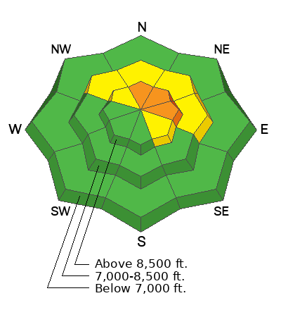
The avalanche danger may reach CONSIDERABLE today in the upper elevations, particularly on steep north to easterly facing aspects. Human triggered avalanches are likely, particularly in areas that see the most snow and wind. Avalanches may fail within the new storm snow and they may also fail in the old faceted snow. A MODERATE danger exists on other northwest to easterly facing aspects on slopes that had pre-existing snow.
Remember that cracking and collapsing are not to be ignored: they are key clues to instability. Remember also that some avalanches can be triggered at a distance, even from below.
Extra Caution should be advised with today's changing conditions.
Low
Moderate
Considerable
High
Extreme
Learn how to read the forecast here
Special Announcements
The 17th Annual Utah Snow and Avalanche Workshop (USAW) is scheduled for Saturday December 7th - Information and tickets available here.
Weather and Snow
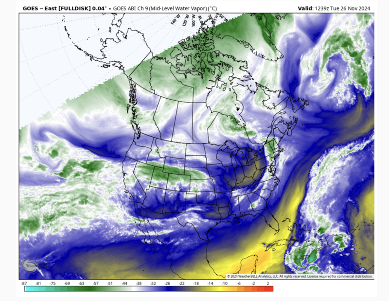
Let's start with capital 'U' Uncertainty with how this whole decaying atmospheric river will play out. We used to call these storms The Pineapple Express because of their subtropical origins and they often led to wet warm and windy storms. But as always, the devil is in the details: Where will the firehose point?
As of 6am, the the northern part of the Ogden mountains have picked up 3-6" of snow with upwards of 1" of snow water equivalent. This is heavy dense snow. Temperatures have warmed radically over the past 24 hours, and are now in the upper 20s. Winds are 15-20mph with gusts to 30 from the west.
Here's my best guess at today's weather: We'll see continued heavy dense snowfall adding up to 6-12" (by early dinnertime). Winds will blow 20mph from the west. A cold front pushes through around rush hour and snowfall rates will increase at this time with light snowfall continuing overnight. Snow totals may reach 8-14" with 1.5" of snow water equivalent. Maybe more.
By tomorrow, snowfall should start to peter out by mid-morning. Temps will be in the upper teens to low 20s. Winds will be light from the northwest.
The weather outlook does not look good. You may need binoculars to see the next storm. And even that may not help.
Recent Avalanches
None.
Ad
Avalanche Problem #1
Persistent Weak Layer
Type
Location
Likelihood
Size
Description
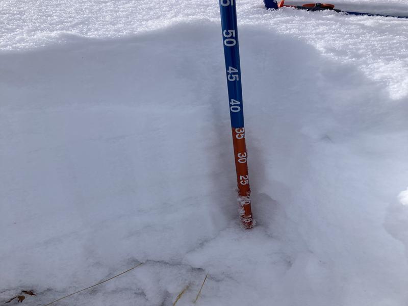
The Ogden area mountains have just 10-18" of snow on the ground and what does exist is composed of crusts, weak sugary facets and lingering storm snow. Early season weak snowpacks can easily be overwhelmed by storms bringing heavy snow and wind and I suspect that avalanches may be triggered today, particularly on steep wind drifted shady slopes. Long time backcountry skier and observer Bill Brandt's photo of the current structure is below. His excellent report is HERE>. Based on overall coverage, the danger will be confined to generally the upper elevations...bleeding down to localized areas of the mid elevations.
If I were out today (particularly in the afternoon after we've had more snow and wind), I would proceed very cautiously and listen for audible whumphs or collapses. I would jump on test slopes to see how they react. I'd watch for shooting cracks. I'd do a few Extended Column Tests and see how the snow reacts to these tests.
Avalanche Problem #2
Wind Drifted Snow
Type
Location
Likelihood
Size
Description
New and developing soft slabs should be on your radar today. In some areas they will be sitting on yesterday's new drifts of wind blown snow. Any of today's developing wind drifts will be primarily confined to the lee of ridgelines at the mid and upper elevations and primarily on north to east facing slopes.
*These and other new snow avalanches may be particularly sensitive as the new snow will be coming in on a warming trend and "feel" dense and upside down.
*I don't think there is enough pre-existing snow on many aspects to be a problem and so snow will generally be falling on mostly bare ground.
General Announcements
This information does not apply to developed ski areas or highways where avalanche control is normally done. This forecast is from the U.S.D.A. Forest Service, which is solely responsible for its content. This forecast describes general avalanche conditions and local variations always occur.