Observation Date
11/3/2024
Observer Name
Meisenheimer / Morgan / Pat
Region
Salt Lake » Little Cottonwood Canyon » Alta Ski Area » Upper Collins area
Location Name or Route
Alta - Collins Gulch to Herold's Cabin
Comments
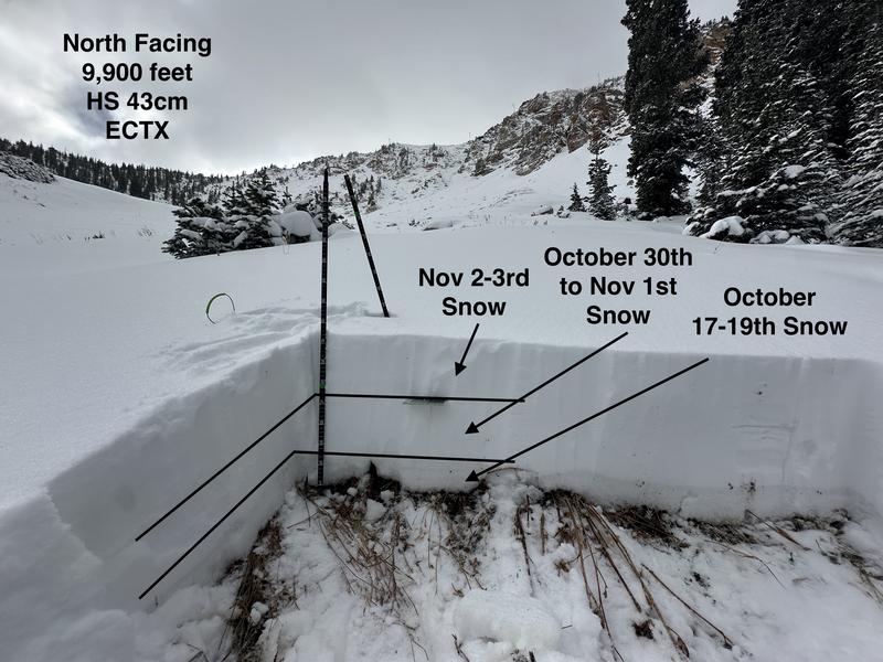
The snowpack consists of three layers (storms). The bottom layer in the photo is snow that fell from October 17th through the 19th. We thought that this layer only exists around 9,000' on shady aspects. Below that, it's pretty spotty and melted out. Where we dug at 9,900 feet, this layer is crusted and not faceted.
On top of that layer is our October 30th through November 1st storm, and then over that layer is the most recent overnight snowfall (6.5" with 0.62 H20). The total height of the snowpack here was roughly 43 cm.
We did two extended column tests that were negative (no propagation).

Today's Observed Danger Rating
Low
Tomorrows Estimated Danger Rating
Low
Coordinates


