Join us at our 2nd Annual Blizzard Ball

Forecast for the Skyline Area Mountains

Brett Kobernik
Issued by Brett Kobernik on
Friday morning, April 5, 2024
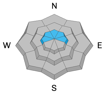
The overall avalanche danger remains generally LOW on the Skyline today.
There may be some scattered fresh drifts that could be sensitive to people today. These won't pose much threat.
With slightly cooler temperatures today and clouds moving in, wet avalanche activity isn't much concern.
Low
Moderate
Considerable
High
Extreme
Learn how to read the forecast here
Weather and Snow
Current Conditions: Highs on Thursday were in the mid 40s and overnight lows were around freezing. The wind got pretty strong from the south.
Mountain Weather: Strong wind will continue from the south today. We'll see high temperatures in the mid to upper 30s today. Clouds move in and we could see some snow late in the day. I'm not expecting much out of this little impulse. Another round of snow should move through on Saturday. Overall, these little storm systems are looking weaker and I'm only expecting a few inches by Sunday.
Ad
Avalanche Problem #1
Wind Drifted Snow
Type
Location
Likelihood
Size
Description
Fresh wind drifts is your only concern today. The wind has been strong and will continue to blow from the south today. This may create some fresh drifts that could be sensitive to people. I don't think this is a huge threat but if for some reason you're up battling the wind in the higher terrain, watch for fresh drifts and slabs just below ridgelines.
General Announcements
This forecast is from the U.S.D.A. Forest Service, which is solely responsible for its content. This forecast describes general avalanche conditions and local variations always occur.