Check out our Holiday Auction

Forecast for the Uintas Area Mountains

Craig Gordon
Issued by Craig Gordon on
Wednesday morning, December 6, 2023
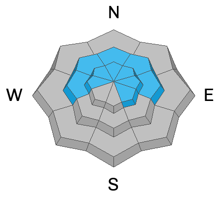
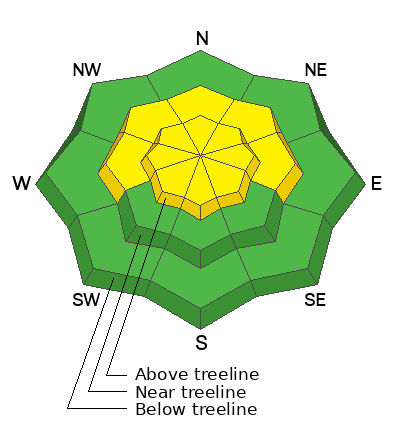
In the windzone at and above treeline look for MODERATE avalanche danger today. While becoming harder to trigger and not nearly as reactive as a few days ago, human triggered slab avalanches are still POSSIBLE, especially on steep, upper elevation, wind drifted slopes facing the north half of the compass. Any slide triggered can fail on the persistent weak layer (PWL) formed in November, producing an avalanche that breaks deeper and wider than you might expect. Yeah... it'll instantly ruin your day.

Switch aspect, lose elevation, and you'll find generally LOW avalanche danger on all other slopes.
Low
Moderate
Considerable
High
Extreme
Learn how to read the forecast here
Special Announcements
The 5th Annual Avalanche Awareness Week is December 3-10. The week's goal is to save lives through activities that promote avalanche awareness, education, and safety. We have a variety of events around the state. Find an event near you.
Weather and Snow
In the wake of the big weekend storm, skies remained clear overnight and temperatures start their day in the upper 20's and low 30's. Along the high ridges, southerly winds bumped into the mid 20's right around supper-time Tuesday and continue in that spirit this morning. It'll be a beautiful day in the mountains, but look for increasing clouds and southwest winds bumping into the 40's late in the day as a weak storm slides into the Uinta zone overnight, delivering a couple traces of snow and cooling temperatures. A break in the action Thursday with a more robust system slated for late in the week.
The December 1st-3rd storm recap-
14"-24" of snow with nearly 2" of water (SWE) stacked up late Thursday through early Monday. The storm started cold and finished very warm with a slight rime crust on the snow surface yesterday. Our snowpack is in its infancy and it's quite dense (bueno), but upside down (no es bueno).
Total settled snow depths are:

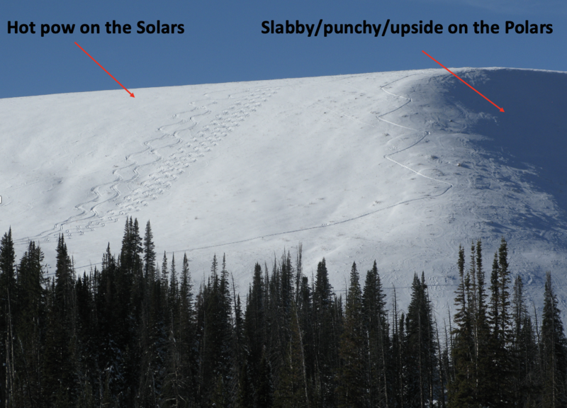
I was near Wolf Creek Pass yesterday and found the early season, snow-goer conundrum everyone is facing... shady, upper elevation, polar slopes with the deepest snow is exactly where we wanna ride to avoid slamming obstacles, but they're also the sketchiest in terms of avy danger. Southerly facing, solar slopes offer better stability and hot pow... but less coverage.
Recent Avalanches
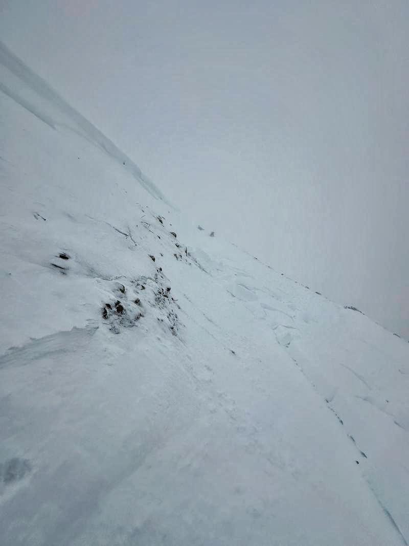
No new avalanches reported yesterday, but on Monday Nikki and Mark triggered this pocket while riding under a small, steep slope. It was a major warning sign not to tickle any bigger terrain.

Read the latest observations HERE
Ad
Avalanche Problem #1
Persistent Weak Layer
Type
Location
Likelihood
Size
Description
Here's the setup-
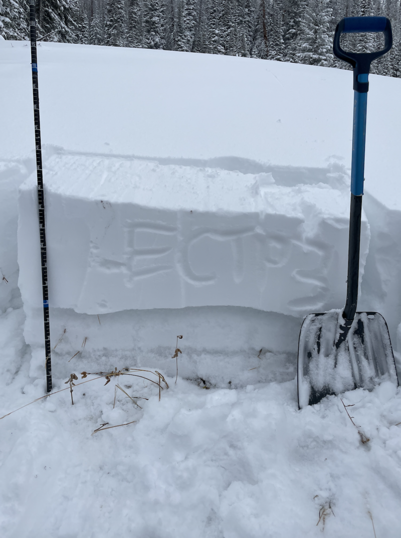
During the late autumn dry spell, old snow from November grew weak and faceted (sugary) on shady slopes near and above treeline. And while not nearly as widespread or uniform, it may also exist below treeline, but it's definitely more pockety. Bust your shovel out and dig down... it's easy to see in any snowpit, just like in the image below. And while the big weekend storm delivered a much needed dose of dense heavy, base building snow, it also created a layer of cohesive snow (slab) on top of this PWL (persistent weak layer).
While not nearly as reactive as earlier in the week, I think the jury is still out and we need to visit more terrain, gather more intel, and tread lightly until we can see a more clear pattern in our collective snow scope.
What a difference a day makes. Yesterday the snowpack was generally well-behaved and I didn't experience any cracking, collapsing, or whumphing. However on Monday, Trevor and Andy found very reactive weak snow under the dense storm. In fact, this extended column test came to life after only three light taps from the wrist in Mill Hollow. (Photo - Katz/Nassetta)
General Announcements
Issued at 04:15 on Wednesday, December 6th this forecast will be updated by 0700 Thursday, December 7th, 2023.
This forecast is from the U.S.D.A. Forest Service, which is solely responsible for its content. This forecast describes general avalanche conditions and local variations always occur.
We are always looking for snow and avalanche observations. So... if you see something, say something. You can reach me directly at craig@utahavalanchecenter.org or 801-231-2170