
Forecast for the Logan Area Mountains

Issued by Toby Weed on
Wednesday morning, March 22, 2023
Wednesday morning, March 22, 2023
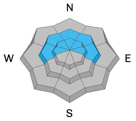
There is CONSIDERABLE danger at mid and upper elevations in the backcountry. People are likely to large cornice falls, soft slab or loose avalanches of storm snow, and/or 1' to 2' thick slab avalanches of wind drifted snow on slopes steeper than 30°. Periods of heavy snowfall and drifting will elevate the danger during the day, natural avalanches will be increasingly possible, and HIGH danger is likely to develop in some upper elevation terrain by evening. Long running natural avalanches are likely tonight.
- Conditions are dangerous so make conservative decisions, evaluate snow and terrain carefully, and stay well away from and out from under those big cornices.
- This evening and tonight people should avoid being in avalanche terrain and stay well clear of avalanche runouts.

Low
Moderate
Considerable
High
Extreme
Learn how to read the forecast here

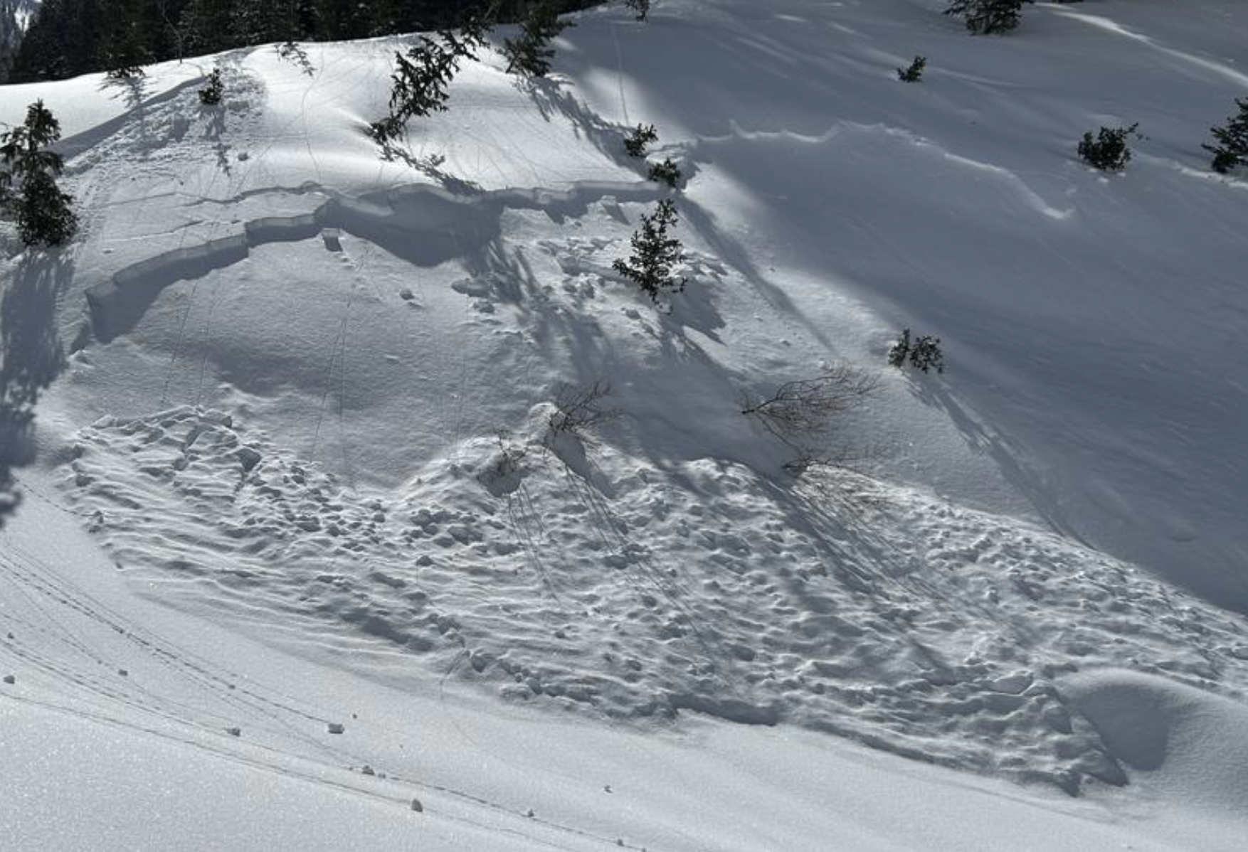 Small natural soft slab avalanches were widespread across the Logan Zone and in the Mount Naomi Wilderness yesterday, 3-21-23...(R.Choi)
 Natural avalanches of wind drifted storm snow in the Wellsville Mountain Wilderness as seen from the valley on 3-21-23


