Join us at our 2nd Annual Blizzard Ball

Forecast for the Logan Area Mountains

Toby Weed
Issued by Toby Weed on
Wednesday morning, February 22, 2023
There is CONSIDERABLE avalanche danger at all elevations in the backcountry. People are likely to trigger 1 to 2 foot thick slab avalanches of storm snow on slopes steeper than 30°. There are also areas where the danger is HIGH on drifted slopes at upper elevations. Natural avalanches are possible, and some could be long running and destructive.
  • Avoid travel in drifted upper elevation terrain and stay clear of avalanche runouts.
  • Make conservative decisions and evaluate snow and terrain carefully.
Low
Moderate
Considerable
High
Extreme
Learn how to read the forecast here
Weather and Snow
The 8400' Tony Grove Snotel reports 14 inches of new snow with 1.7" SWE. It's 17° F this morning, and there is 108 inches of total snow. This morning, winds at the CSI weather station at 9700' on Logan Peak are from the east-northeast, blowing 15 to 20 mph.

Here is the NWS point forecast for high elevations in the Central Bear River Range:
Today: Snow. Steady temperature around 10. Wind chill values as low as -11. North northeast wind 13 to 18 mph becoming west in the afternoon. Chance of precipitation is 90%. Total daytime snow accumulation of 3 to 5 inches possible.
Tonight: Snow, mainly before midnight. Low around 3. Wind chill values as low as -16. Southwest wind 15 to 18 mph. Chance of precipitation is 80%. New snow accumulation of 2 to 4 inches possible.
Thursday: Snow, mainly after noon. High near 17. Wind chill values as low as -10. Breezy, with a south southwest wind 16 to 22 mph. Chance of precipitation is 80%. New snow accumulation of 1 to 3 inches possible.
Wintery weather will continue into the weekend...
Recent Avalanches
Natural wet loose avalanches occurred at lower elevations yesterday as rain saturated the snow. Observers also reported obvious signs of instability involving wind drifted storm snow.

For a list of avalanches in the Logan Zone go HERE
Find a list of all recent observations & avalanches from across Utah HERE.
Ad
Avalanche Problem #1
Wind Drifted Snow
Type
Location
Likelihood
Size
Description
After blowing hard from the southwest for much of the day yesterday, the winds moderated and blew out of the northwest and north overnight. This morning, still plenty strong enough to drift the light powder, they are blowing from the east. Avalanches of wind drifted storm snow, 1 to 2 feet thick, are quite possible on drifted slopes at all elevations, but will be larger and more likely at upper elevations. Areas with a HIGH danger probably exist at upper elevations, where natural and human triggered avalanches are likely.
  • Avoid corniced slopes and stiffer drifts on steep slopes near ridges and in and around terrain features like cliff bands, sub-ridges, mid-slope break-overs, and gully walls.
  • Before yesterday's storm shallow wind slabs formed on weak surface snow. These are now buried by storm snow but could still be sensitive to triggering by people.
  • Wind slabs consist of stiffer drifted snow. Today, soft slab avalanches of drifted storm snow are most likely, but some avalanches could pull out harder slabs that were formed before the new snow fell.
Avalanche Problem #2
New Snow
Type
Location
Likelihood
Size
Description
  • Soft slab and loose avalanches of storm snow are likely in steep terrain, even in sheltered areas. Natural avalanches of storm snow are possible at all elevations, most likely during periods of heavy snowfall and/or drifting.
  • Even small avalanches of wind drifted or loose snow can be a problem, especially if you get carried into trees, gullies, benches, or rocks.
Additional Information
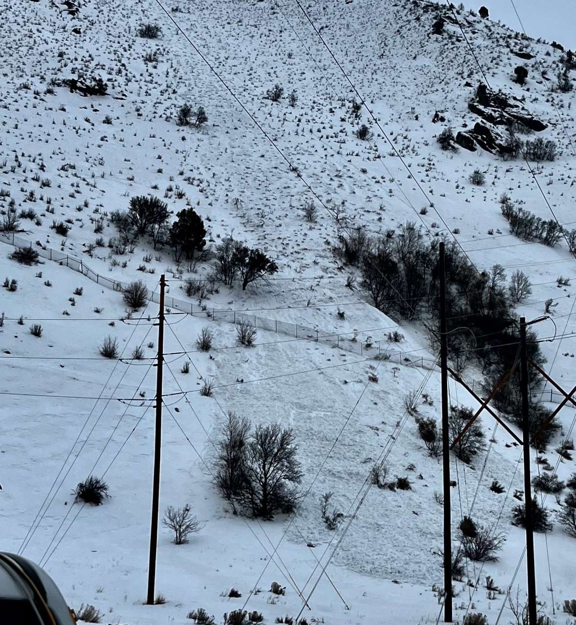
A natural avalanche of rain saturated snow occurred sometime Tuesday at low elevations at the mouth of Logan Canyon.
General Announcements
  • Please submit your observations from the backcountry HERE.
  • For a list of avalanche classes from the Utah Avalanche Center go HERE
  • For information on where you can ride your sled or snowbike, check out this map of the winter travel plan for the Logan and Ogden Ranger Districts HERE, and a close up of the Tony Grove and Franklin Basin Areas HERE.
This forecast is from the U.S.D.A. Forest Service, which is solely responsible for its content. This forecast describes general avalanche conditions and local variations always occur.