Join us at our 2nd Annual Blizzard Ball

Forecast for the Provo Area Mountains

Dave Kelly
Issued by Dave Kelly on
Tuesday morning, January 10, 2023
The avalanche danger is HIGH at upper elevations where natural avalanches are occurring. The avalanche danger is HIGH in mid elevation terrain because of overhead hazard and at lower elevations because of heavy rain and reported wet loose avalanches already hitting the highway.

Travel in or below avalanche terrain is not recommended.

Avoid travel below steep terrain as avalanches have the potential to run into lower elevation flat areas near trailheads or overrun ice climbing routes.
Low
Moderate
Considerable
High
Extreme
Learn how to read the forecast here
Avalanche Watch
Updated 1230PM
What
The avalanche danger for the Provo area mountains is currently HIGH and will remain elevated at this level as more snow and wind are forecast to affect the area through 0600am on January 11, 2023
When
Where
For the Provo area mountains.
Impacts
Recent heavy snow combined with wind is creating widespread areas of unstable snow. Both human triggered and natural avalanches are likely. Stay off of and out from under slopes steeper than 30 degrees.
Weather and Snow
Overnight mountain locations reported 14" of new snow and 2-2.7" of water. Storm totals are 18-20" snow and 2.8-3.2" of water. It is currently snowing, and the last few hours have been steady inch an hour snowfall rates.
Temperatures are in the low 30's F. Winds are blowing southwest 30 gusting to 45 MPH at the 8000' ridgelines.
Today will bring continued clouds and 5-9" of snow. Temperatures will be 35-39 F. Winds will blow from the southwest 30 gusting to 45 MPH at the 9000' ridgelines and west-southwest 40 gusting to 80 MPH at the 11,000' ridgelines. The freezing level will hover between 6,000' and 7,000' throughout the day.

The National Weather Service has issued a winter storm warning effective until 5:00pm on Wednesday. This morning's southerly flow storm will bring higher density snow before winds shift to the northwest bringing lower density snow Tuesday afternoon through Wednesday.
Recent Avalanches
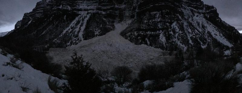
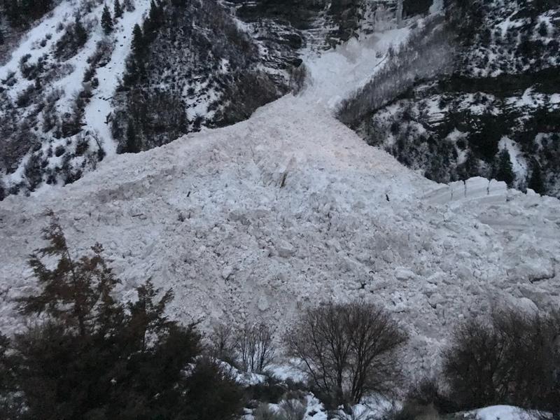
This morning ski area and highway operations reported natural avalanche activity running from the highest elevation terrain down to the flats. There were also reports of wet loose avalanches hitting the road.
Photo: UDOT Provo Bridal Veil Falls Avalanche from early this morning.
Ad
Avalanche Problem #1
New Snow
Type
Location
Likelihood
Size
Description
Natural avalanches have been reported this morning and will continue as long as it is snowing hard. Wet loose avalanche activity will continue as heavy rains fall on the snowpack at lower elevations.
Avalanche Problem #2
Wind Drifted Snow
Type
Location
Likelihood
Size
Description
New and developed pillows of wind drifted snow can be found in upper and mid elevation terrain. These areas of wind-drifted snow have now been buried under new snow and will be harder to see.

Watch for sensitive cornices primarily on north-east facing ridgelines where snow has been transported over the last twenty-four hours.

Any wind drifted avalanche may step down into a deeper buried weak layer resulting in a larger avalanche.
Avalanche Problem #3
Persistent Weak Layer
Type
Location
Likelihood
Size
Description
The deeply-buried persistent weak layer (PWL) from November continues to gain strength and it has become harder to initiate an avalanche on this layer. It may take a significant trigger - a large cornice fall, multiple riders on a slope, or another avalanche adding more weight to the snowpack to trigger this layer. Any avalanche triggered on this weak faceted snow would 2-7' deep.
Areas where you are more likely to trigger this PWL are shallow thinner spots and rocky ridges.
General Announcements
This information does not apply to developed ski areas or highways where avalanche control is normally done. This forecast is from the U.S.D.A. Forest Service, which is solely responsible for its content. This forecast describes general avalanche conditions and local variations always occur.