Check out our Holiday Auction

Forecast for the Logan Area Mountains

Toby Weed
Issued by Toby Weed on
Sunday morning, December 25, 2022
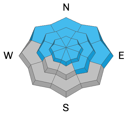
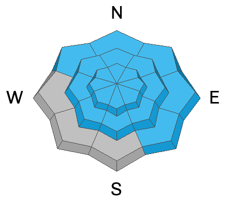
Merry Christmas. Areas with CONSIDERABLE danger remain on steep drifted slopes at all elevations. Wednesday's winds and snowfall created widespread slabs of wind drifted snow that overloaded a buried persistent weak layer buried 1 to 4 feet deep. Dangerous avalanches could be triggered remotely, from a distance or below.
The danger is MODERATE on southerly facing slopes at low and mid elevations, and in sheltered terrain.
People can safely venture into the backcountry by staying off of and out from under slopes steeper than 30°. Continue to evaluate snow and terrain carefully.
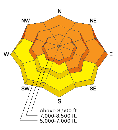
Low
Moderate
Considerable
High
Extreme
Learn how to read the forecast here
Weather and Snow
Last week's crazy winds and a bit of freezing rain in the past couple days have done a number on snow surface conditions, and there's not really much in the way of nice powder to be found these days. The good news is that a prolonged winter storm is headed our way this week, and we could get lots of snow in the mountains.
It's snowing lightly this morning, with an inch of accumulation overnight. It's 29° F at the 8400' Tony Grove Snotel where there is 50 inches of total snow. On Logan Peak winds are blowing from the west 25 to 28 mph with gusts of around 40 mph.
There's a chance of freezing rain and maybe a bit of snow in the mountains today. It'll be cloudy with 8500' high temperatures around 29° F and 15 mph west winds.
Expect mostly cloudy skies tomorrow with high temperatures around 34° F and 7 to 10 mph winds from the southwest.
Snowfall will commence on Tuesday, with 11 to 19 inches of accumulation forecast on upper elevation slopes by Wednesday morning. Snow will continue to fall and accumulate in the mountains through the week and perhaps on into the new year...
Recent Avalanches
Avalanche activity spiked following Wednesday's snow and wind. There have been no avalanches reported since then. See our updated list of observed avalanches from the Logan Zone HERE and from across Utah HERE
Ad
Avalanche Problem #1
Persistent Weak Layer
Type
Location
Likelihood
Size
Description
There's a good chance a person can trigger a slab avalanche on a buried persistent weak layer of facets 1-4 feet deep. Where the snow is deepest, this layer may be starting to gain some strength, but in areas with shallower snow, like low elevations or places scoured by winds, this widespread layer of loose sugary snow remains weak.
Mark rode throughout Copenhagen Basin Friday and found an unstable layer of surface hoar on top of these facets (video below). He thought he would have easily triggered a slide if he had tried to ride on a steep slope. The party experienced plenty of collapsing.
***Since we don't trust slopes with this kind of buried persistent weak layer, we'll continue to avoid avalanche terrain where it exists by staying off and out from under slopes steeper than 30°.
Avalanche Problem #2
Wind Drifted Snow
Type
Location
Likelihood
Size
Description
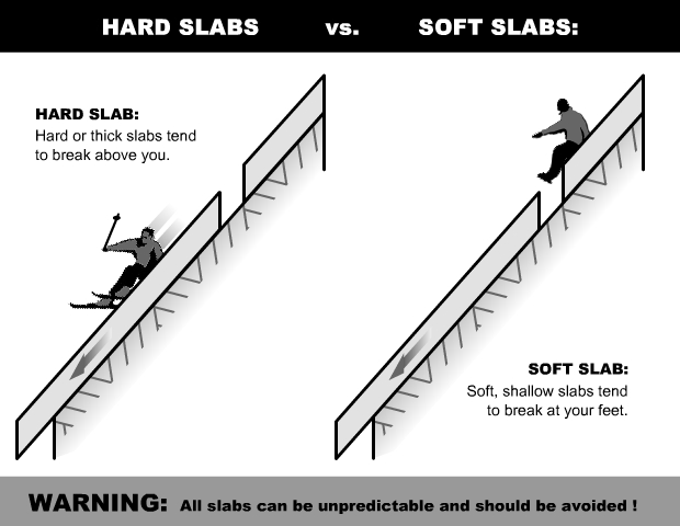
Hard slabs of wind drifted snow are widespread, but the likelihood of a person triggering one is diminishing with time. The main danger with these hard wind slabs from Wednesday's winds is triggering a deeper avalanche that fractures on the persistent weak layer discussed above. What makes these hard slabs so tricky is that they can be more stubborn, and they can let a person get further onto them before they avalanche. Or they may let several people ride on top of them before sliding.
Additional Information

Take the all-new online avalanche courses the UAC built for Know Before You Go or take other online courses listed on the KBYG website (Develop skills -> Online Learning).
Remember, when you leave the ski area boundary, Beaver Mt or Cherry Peak, you are entering the backcountry, and you could trigger dangerous avalanches....
  • Put fresh batteries in your transceiver and inspect your shovel and probe.
  • Practice Companion Rescue with your backcountry partners.
General Announcements
As the end of the year approaches, please consider a donation to the UAC to support avalanche forecasting.
Please submit your observations from the backcountry HERE.
For a list of avalanche classes from the Utah Avalanche Center go HERE
For information on where you can ride your sled or snowbike, check out this map of the winter travel plan for the Tony Grove and Franklin Basin Areas HERE.
This forecast is from the U.S.D.A. Forest Service, which is solely responsible for its content. This forecast describes general avalanche conditions and local variations always occur.