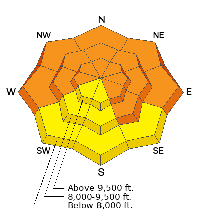
Current Conditions: We've had periods of light snowfall over the last 24 hours adding a few more inches. Storm totals since Sunday are in the 15 to 18 inch range. The wind was slightly breezier on Wednesday than I thought it would be. It definitely was drifting snow in the more exposed terrain. It looks like there are still moderate speeds along the ridges from the west. Temperatures have remained cold with highs on Wednesday in the mid teens. It's around 10˚F in the high country this morning.
Mountain Weather: It'll be yet another day of cloudy skies, potential light snowfall and cold temperatures. Temperatures won't warm much more than where they are right now. Wind will be from the northwest in the moderate speed category along the ridges. We could see an inch or two of snow accumulation. Skies start to clear on Friday with continued cold temperatures. The weekend looks really clear with temperatures rebounding.
No new avalanches have been reported on the Skyline but visibility has been really bad and not many people have been venturing out all that much. There was another skier caught, carried and injured in an avalanche again in the Salt Lake mountains on Wednesday. They sustained serious injuries and had to be rescued. The reason I mention this is that the snowpack at the accident site is very similar to many locations on the Skyline right now.
There have actually been three accidents that have many similarities to terrain and snowpack here on the Skyline:


