Current Conditions
Saturday was a spectacular day in the mountains with clear skies, slightly warmer temperatures than what we've seen recently and light northwest wind. Riding conditions remain excellent. Aside from dangerous avalanche conditions, this has been a great week for deep powder enthusiasts. Overnight ridgetop temperatures were in the low 20s. Drainage and canyon bottoms were still fairly cold with readings around 10˚F.
Mountain Weather
Today will be another nice day although we'll see some high clouds move through. Temperatures will get into the low 30s. Southwest wind will increase in speed a bit this afternoon but generally looks like it'll remain in the light to moderate speed categories.
There were at least two more snowmobile triggered avalanches on Saturday. That makes three days in a row of large human triggered avalanches. Any money on today being the fourth?
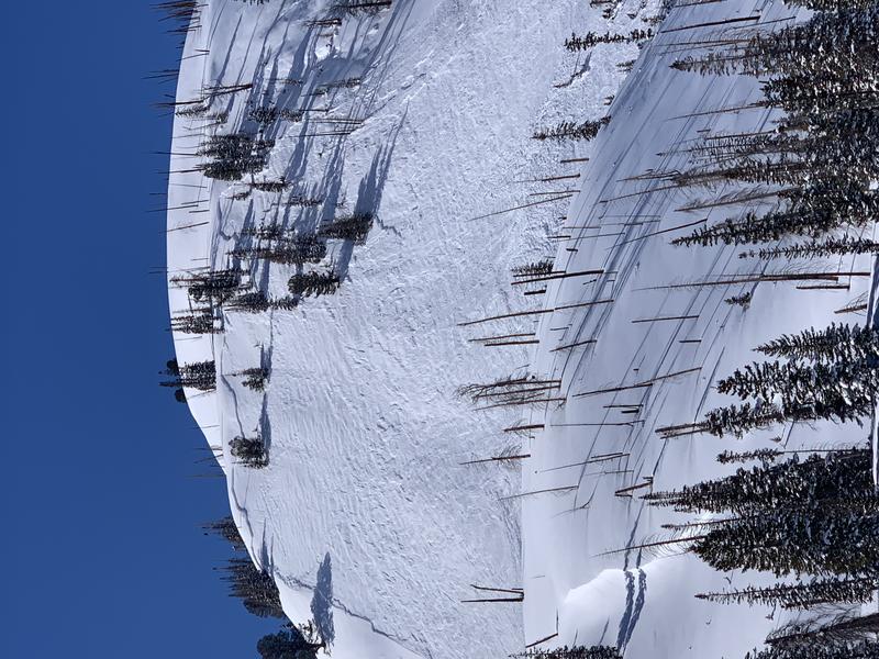
This one was triggered by sledders that were in flat safe terrain about 1/4 mile away from the avalanche path. Black Mountain, 6 Mile Canyon. Photo - Calvin Hawley:
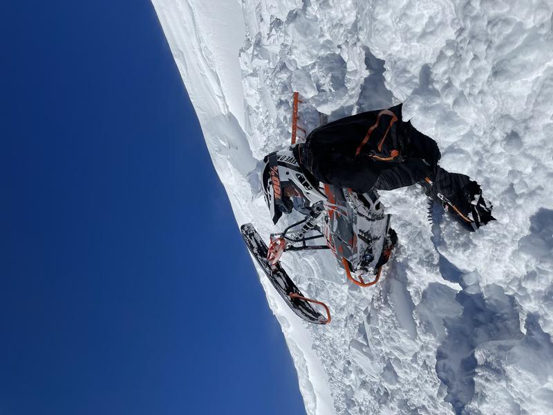
A snowmobiler triggered a pretty wide cornice fall and got bossed around a bit and partially buried on the not so steep slope below the cornice. This avalanche is not really directly related to the current buried faceted Persistent Weak Layer but it's a good reminder to watch out for cornices especially right after a storm. Photo - Calan Cook:
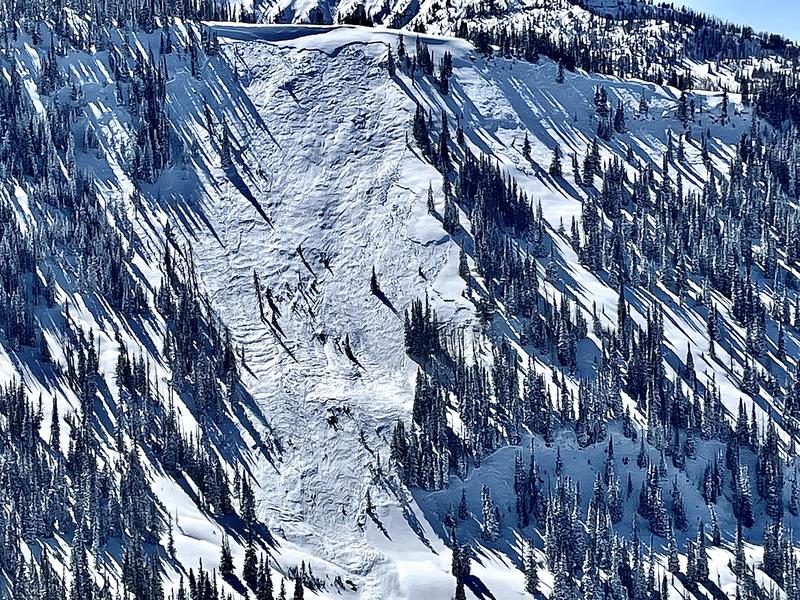
I continue to find many more large avalanches that released naturally during last Wednesday's storm. Below is an example from Canal Canyon: