Thanks to the generous support of our local resorts and Ski Utah, discount lift tickets are now available. Support the UAC while you ski at the resorts this season. Tickets are available
HERE
Special Thanks to Polaris and Northstar (in Preston and Logan).
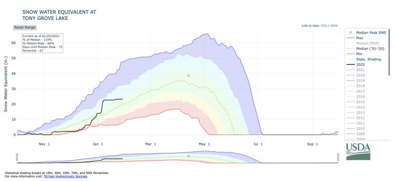
The 8400' Tony Grove Snotel reports 26°F, and there is 67 inches
of total snow containing 114% of normal SWE for the date. Winds out of the southwest are blowing around 30 mph this morning at the 9700' CSI Logan Peak weather station with gusts in the 50's.
The storm that was to be is no longer but still expect a cold, blustery day in the mountains today, with 8500' high temperatures holding steady until 10 am, then falling to around 14F during the remainder of the day. Wind chill values will be as low as -5F with west winds blowing 21 to 25 mph and gusting as high as 40 mph. There's more bark than bite with this system as forecasted total accumulation is less than an inch. Let's hope it overproduces. Get the puffy back out as mountain temperatures will be significantly colder this week with daytime highs in the teens and overnight lows near zero. Another weak system will bring the threat of light snow to mainly the higher terrain Tuesday into Wednesday.
Under weeks of high pressure with cold overnight temperatures and clear skies, the snow has continued to facet and weaken. We expect this trend to continue until the next storm moves through potentially up to a few weeks away. Current surface conditions range from bulletproof crusts to shallow, soft, faceted snow.
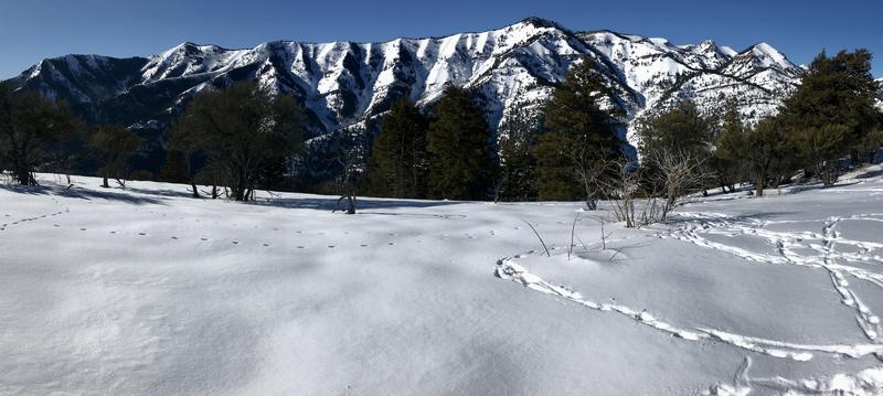
 A few inches of fresh snow last week really helped conditions in the backcountry. Call it dust-on-crust or shallow powder, but you can still find freshened and softened surface conditions on a solid supportable base and generally stable snow across the Logan Zone these days. We did find some nice springlike "corn snow" conditions Saturday in sunny terrain, but recently we've been finding the best riding conditions on lower-angled slopes in sheltered, shaded terrain.
 Water-wise we are still above average at this point of the year. Despite the lack of storms in January, the snowfall in late Dec and early Jan really gave our zone a solid base. Let's hope the trajectory continues upward.
No avalanches were reported recently in the Logan Zone.
Check
HERE for all the latest observations and avalanche activity.


 A few inches of fresh snow last week really helped conditions in the backcountry. Call it dust-on-crust or shallow powder, but you can still find freshened and softened surface conditions on a solid supportable base and generally stable snow across the Logan Zone these days. We did find some nice springlike "corn snow" conditions Saturday in sunny terrain, but recently we've been finding the best riding conditions on lower-angled slopes in sheltered, shaded terrain.

 Water-wise we are still above average at this point of the year. Despite the lack of storms in January, the snowfall in late Dec and early Jan really gave our zone a solid base. Let's hope the trajectory continues upward.
