Check out our Holiday Auction

Forecast for the Logan Area Mountains

Toby Weed
Issued by Toby Weed on
Thursday morning, December 30, 2021
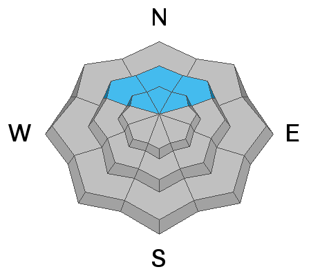
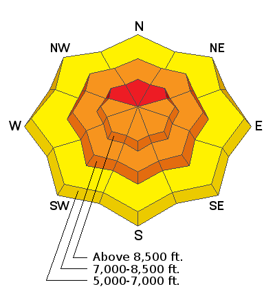
Dangerous avalanche conditions and CONSIDERABLE danger exist on many slopes in the backcountry steeper than about 30°. The danger is HIGH on upper elevation north facing slopes, with large natural and human triggered avalanches likely. People are likely to trigger dangerous deep slab avalanches failing 3 to 5 feet deep on a buried persistent weak layer near the ground. Recent drifting and plenty of new snow created heightened avalanche conditions on steep slopes at all elevations. People could trigger slab avalanches of wind drifted snow in exposed terrain, and loose avalanches and shallow soft slabs of storm snow are likely on any steep slope with significat deposits of new snow. Natural avalanches are most likely during periods of intense snowfall and drifting.
Conditions are much safer and quality powder riding can be found in low angled terrain off of and out from under slopes steeper than about 30 degrees.
Low
Moderate
Considerable
High
Extreme
Learn how to read the forecast here
Weather and Snow
Looks like about a foot of snow overnight and it's snowing this morning in the Bear River Range. The strong southwest winds from overnight moderated just a bit and veered more from the west this morning, with a 27 mph average wind speed and gusts in the mid 40s at the 9700' CSI Logan Peak weather station. The Christmas storms brought a few feet of snow to upper elevation slopes, and close to 5" of SWE was recorded at local Snotel sites. It warmed up with last night's storm and I'm reading 16°F at Tony Grove and 10°F at Logan Peak.
Expect more heavy snowfall today, with another foot of accumulation quite possible, and drifting from strong west-southwest winds in the mountains. Temperatures are expected to remain steady around 17°F at 8500', with wind chill values around -4°F.
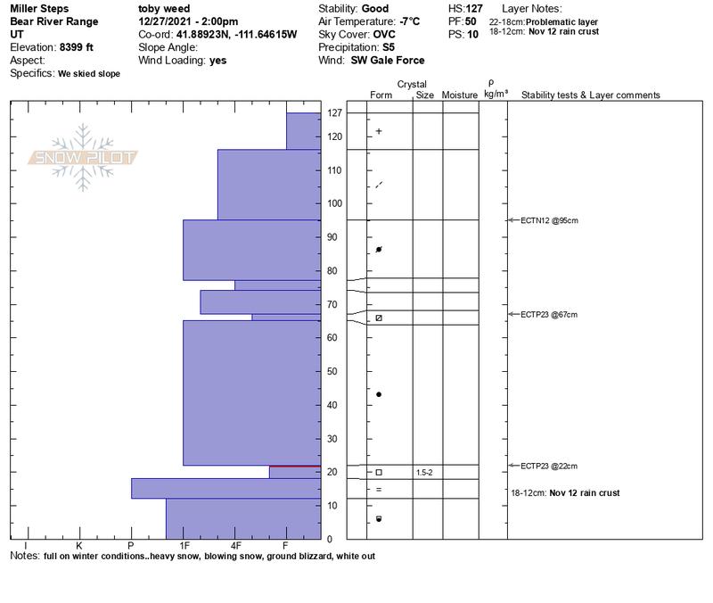
Mark and I went for a ride out of Beaver Creek TH on Tuesday. We traveled over Danish Pass and found pretty nice powder riding conditions in Egan Basin and upper Franklin Basin. We saw evidence of a couple recent natural avalanches, triggered a couple collapses or whumpfs in the flats, and found the buried persistent weak layer of concern in north facing terrain. We also found great powder conditions in low angled terrain and good stability on slopes not facing north.

Here is a look at what I found during Monday's stormy weather in the Central Bear River Range....
Recent Avalanches
No one reported any new avalanches in the past couple days, but there were a few large naturals that occurred early in the Christmas storm cycle. We think these failed on a buried persistent weak layer and occurred on upper elevation north facing slopes late on or around 12/24, (Christmas Eve), but the crowns and debris from these avalanches was all blown in and covered up by a couple feet of new snow when we looked at them on Tuesday.
  • Check HERE for all the latest observations and avalanche activity.
Ad
Avalanche Problem #1
Persistent Weak Layer
Type
Location
Likelihood
Size
Description
Dangerous deep slab avalanches breaking on a persistent weak layer near the ground are likely for people to trigger. This layer of weak, sugary facets can be found in north facing terrain 6-12 inches above the ground just above a hard ice crust that caps old snow from October and early November. Avalanches failing on this layer will likely be 3 to 5 feet deep and may break hundreds of feet across. Avalanches could still be triggered remotely from a distance, or worse, from below.
  • Audible collapses or "whumpfs" and shooting cracks are red flags indicating unstable snow and a lurking persistent weak layer.
Avalanche Problem #2
Wind Drifted Snow
Type
Location
Likelihood
Size
Description
Overnight, strong southwest and west winds were blowing as heavy snow fell, drifting tons of weight onto vast lee side slopes, some plagued by a buried persistent weak layer near the ground. Winds blowing from the south, southwest, and west have been transporting tremendous amounts of snow during the last several days. Monday the winds dropped down into the terrain, and this week we observed significant drifting at all elevations. The wind slabs appear to be well bonded the the fresh snow in most areas, but in some areas, especially around terrain features where drifts form, people could trigger avalanches.
  • Winds during the storm drifted snow directly onto slopes that have a persistent weak layer of sugary facets near the ground. Wind slabs will make avalanches breaking on the facets larger, deeper, and more deadly.
  • Avoid travel on and under steep drifted slopes.
  • Drifts and wind slabs form on the downwind side of major ridges and in and around terrain features like sub-ridges, gullies, and cliff bands.
  • These appeared to be bonding pretty well yesterday, but avalanches of wind drifted snow are possible where there is no apparent faceted persistent weak layer. Avalanches at any elevation could fail on a density change within drifted new snow or on a thin, or a not-so-obvious weak layer.
Avalanche Problem #3
New Snow
Type
Location
Likelihood
Size
Description
About a foot of nice powder snow fell on many slopes in the Logan Zone overnight and another foot is quite possible today, with another also likely tonight. Soft slab and loose avalanches of fresh storm snow are likely in steep terrain and possible at all elevations. Natural avalanches are most likely during periods of particulary intense or heavy snowfall and drifting. Stay out from under steep slopes and be aware of potential terrain traps and trees below you if you venture onto steep slopes even in sheltered areas.
Additional Information
  • Always follow safe backcountry travel protocols. Go one person at a time in avalanche terrain, while the rest of your party watches from a safe area.
  • Check your avalanche rescue equipment, change your batteries, and practice often with your backcountry partners
General Announcements
Who's up for some free avalanche training? Get a refresher, become better prepared for an upcoming avalanche class, or just boost your skills. Go to https://learn.kbyg.org/ and scroll down to Step 2 for a series of interactive online avalanche courses produced by the UAC.
  • Check out all the upcoming education classes and clinics HERE.
  • Please submit your observations from the backcountry HERE.
This information does not apply to developed ski areas or highways where avalanche control is normally done. This forecast is from the U.S.D.A. Forest Service, which is solely responsible for its content. This forecast describes general avalanche conditions and local variations always occur.