Forecast for the Uintas Area Mountains

Craig Gordon
Issued by Craig Gordon on
Saturday morning, November 20, 2021
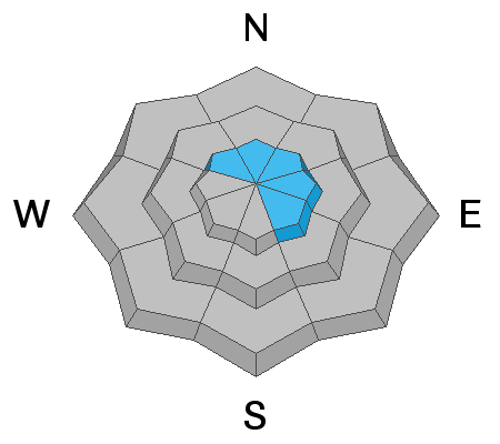
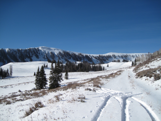
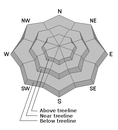
Fresh drifts along the highest ridges are about the only avalanche concern these days. The good news is... you'd really have to go out of your way to get into trouble because they're isolated to the highest terrain. But remember... even a small avalanche this time of year will reveal a myriad of season ending obstacles. So, if you're hiking, hunting, snowshoeing or out for a high elevation peak bagging circuit you'll want to look for and avoid any steep, wind drifted slope.
Low
Moderate
Considerable
High
Extreme
Learn how to read the forecast here
Weather and Snow
NOWCAST-
A few snow showers linger in the wake of last nights storm which delivered 3" of medium density snow throughout the range. Westerly winds blow at a reasonable clip, registering 20-30 mph along the high peaks. Temperatures hover in the mid 20's. With only 12"-16" of total snow depth, a road ride or a few turns on a low angle grassy meadow are the only games in town.
FORECAST-
Expect mostly cloudy skies with light snow showers tapering off as the day progresses. High temperatures climb into the upper 20's and lows dip into the teens. Winds switch to the northwest, but don't get out of hand and remain in the 20's and 30's along the high ridges.
FUTURECAST-
High pressure builds into the area tonight through the early part of next week leading to drier and stable conditions.
Looking for real-time temps, snow, or wind?
Click HERE and then on the "western Uinta" tab for western Uinta specific, weather station network.
As the seasons change, we're interested in what you're seeing. Go here to fill out an observation.
Recent Avalanches
No recent avalanche activity to report.
Observations, trip reports, and avalanches found here.
Ad
Avalanche Problem #1
Wind Drifted Snow
Type
Location
Likelihood
Size
Description
Ted was in upper Humpy Basin a week ago and snapped these images, illustrating the overall coverage and general snow structure in upper elevation terrain.
Yesterdays storm added a little fresh snow to the high country and combined with recent winds, whipped up a few fresh drifts along the leeward side of the highest ridges. And while today's drifts may react to our additional weight, it's easy not to get into trouble, because wind slabs are a cinch to detect by their fat, round, and often chalky looking appearance. The bad news is... even a small wind drift can easily knock you off your feet and take you for a nasty ride through rocks, deadfall, or stumps.
And remember- just 'cause you can see it from the road doesn't means it's good to go. Our high mountain passes dump us off in avalanche terrain. I think about early season roadside attractions like Murdock Bowl off the Mirror Lake Highway or Wolf Creek Bowl near highway 35 and Wolf Creek Pass. Easy grabs... right? Even though it might not seem like there's enough snow to avalanche, today you'll want to avoid any steep, wind drifted slope.
Additional Information
As the seasons shift we will see you back here more frequently
Your observations are important, so please let me know what you're seeing... click HERE and contribute to this amazing community based program
General Announcements
I will update this forecast as conditions change and then once winter kicks you can expect the usual daily forecasts issued by 07:00... or perhaps earlier :)
Before it gets too crazy, now is the time to book an avalanche awareness presentation for your group, club, or posse. You can reach me directly at 801-231-2170 or craig@utahavalanchecenter.org
This forecast is from the U.S.D.A. Forest Service, which is solely responsible for its content. This forecast describes general avalanche conditions and local variations always occur.