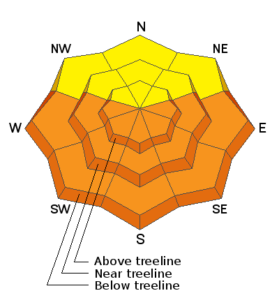
Forecast for the Abajos Area Mountains

Issued by Eric Trenbeath on
Saturday morning, April 3, 2021
Saturday morning, April 3, 2021
Soaring temperatures will cause the danger for loose wet, or even wet slab avalanches to quickly rise to MODERATE on all sun-exposed slopes. With record temps in the forecast, and with light to no overnight refreezes, the danger could reach CONSIDERABLE later in the day. Signs of instability include rollerballs, pinwheels, and punchy or sloppy unsupportable snow. Timing is everything, work slope aspects according to the sun and get off of and out from under steep slopes as they become wet and sloppy.

Low
Moderate
Considerable
High
Extreme
Learn how to read the forecast here


