Forecast for the Moab Area Mountains

Issued by Eric Trenbeath on
Monday morning, March 29, 2021
Monday morning, March 29, 2021
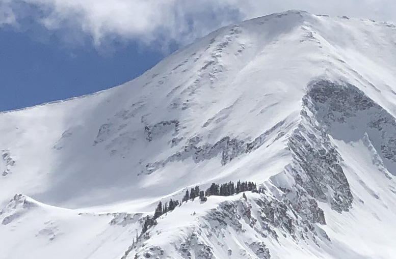
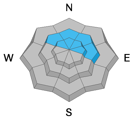
A MODERATE avalanche danger exists on steep, wind drifted slopes near and above treeline that face NW-N-E and human-triggered avalanches remain possible. Shallow snowpack areas with steep convexities and rocky, more radical terrain are where you are most likely to trigger an avalanche failing on weak, faceted snow.
And, with a strong sun and quickly rising temps today, be alert to an increasing MODERATE danger for loose wet avalanches on sun-exposed slopes. Signs of instability include rollerballs and pinwheels and sloppy wet snow. Stay off of and out from under steep slopes when these signs are present.

Low
Moderate
Considerable
High
Extreme
Learn how to read the forecast here