Forecast for the Skyline Area Mountains

Brett Kobernik
Issued by Brett Kobernik on
Monday morning, March 29, 2021
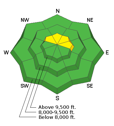
The avalanche danger is generally LOW today. People can travel around most places without being in danger of triggering an avalanche.
Although there isn't much loose snow available for the wind to transport, watch for freshly formed drifts along the north through east sides of the higher ridgelines. These are always most sensitive when they are forming.
Low
Moderate
Considerable
High
Extreme
Learn how to read the forecast here
Weather and Snow
Current Conditions: Warm temperatures on Sunday made the snow wet and sloppy in the lower and mid elevations. Riding conditions were still decent in the higher terrain. Overnight temperatures remained warm with most stations above freezing. West southwest wind has been increasing and is moderate to strong in speed.
Mountain Weather: We have a weather disturbance that's moving through that will bring windy conditions to our area today. Temperatures will cool off starting this afternoon. Highs on Tuesday will be in the low 20s along the upper ridges. Temperatures rebound rapidly on Wednesday with much much warmer weather coming for the later part of the week.
Ad