Forecast for the Skyline Area Mountains

Brett Kobernik
Issued by Brett Kobernik on
Thursday morning, March 25, 2021
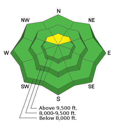
The avalanche danger is generally LOW today. You can travel around through most terrain without the worry of triggering an avalanche.
There is a "pockety" MODERATE danger in the highest northerly facing very steep slopes where the snowpack remains shallow. Places where the snowpack is less than 3 or 4 feet deep would be likely spots to still trigger an avalanche that breaks into weak snow near the ground. The chances for triggering an avalanche are fairly unlikely. The trend is for increasing stability.
Low
Moderate
Considerable
High
Extreme
Learn how to read the forecast here
Weather and Snow
Current Conditions: Overnight temperatures were around 20˚F. Westerly wind increased during the day on Wednesday but looks like it's slowed again.
Mountain Weather: A storm system will move through later this afternoon and tonight. It is not looking as good as it did a few days back and continues to look worse for any significant snowfall. We should see clouds today with snow starting mid afternoon. Southwest wind will be light to moderate in speed. Expect high temperatures in the mid 20s along the higher terrain. I'm now thinking 2 to 4 inches of snow is all we're going to get out of this storm by the time it ends on Friday. We'll see lingering periods of light snowfall on Friday. The weekend looks pretty nice with sun and a warming trend.
Ad