Observer Name
Kobernik
Observation Date
Monday, February 22, 2021
Avalanche Date
Sunday, February 21, 2021
Region
Skyline » Pleasant Creek » Coal Fork » South Fork Coal Fork
Location Name or Route
South Coal Fork of Pleasant Creek
Elevation
10,000'
Aspect
North
Trigger
Natural
Avalanche Type
Soft Slab
Avalanche Problem
Persistent Weak Layer
Weak Layer
Facets
Depth
3'
Width
200'
Vertical
350'
Comments
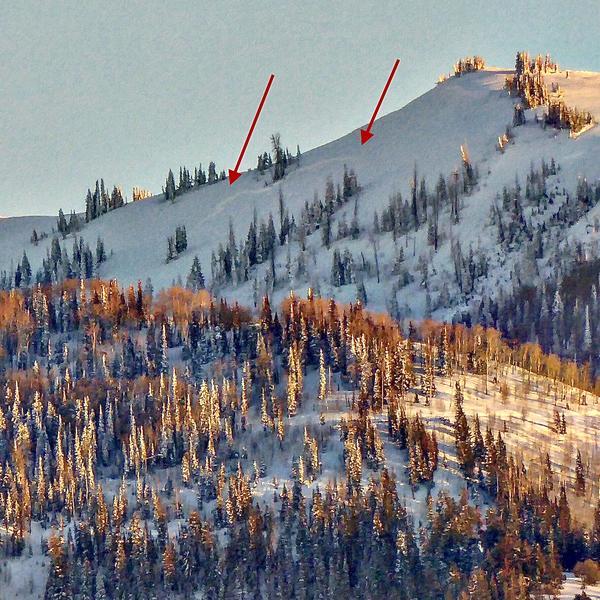
Viewed from Sanpete Valley. Dimensions are rough estimates. There is little doubt this broke into weak faceted snow near the ground.

Coordinates


