Forecast for the Skyline Area Mountains

Brett Kobernik
Issued by Brett Kobernik on
Sunday morning, December 27, 2020
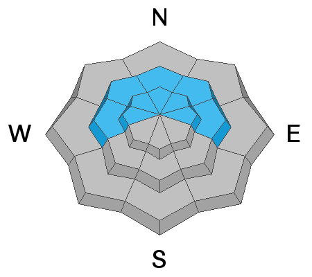
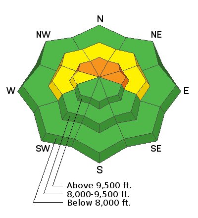
Human triggered avalanches are likely today in the high elevation northwest through east facing terrain. Avoid steep upper elevation northerly facing terrain. The danger will increase with the next storm.
Low
Moderate
Considerable
High
Extreme
Learn how to read the forecast here
Weather and Snow
Current Conditions: No big changes in conditions since Saturday. Wind was slightly gusty in the highest terrain on Saturday. Overnight temperatures are in the mid teens and wind is light to moderate in speed from the west.
Mountain Weather: Clouds continue to stream through today ahead of a storm that will mostly impact our area on Monday and Monday night. Highs today will be around 20˚F. Wind will remain light for the most part. The storm on Monday is still looking good for 4 to 8 inches of new snow.
Ad
Avalanche Problem #1
Persistent Weak Layer
Type
Location
Likelihood
Size
Description
The weak faceted sugary snow (a Persistent Weak Layer) near the ground is still lurking. Snow pit tests are poor meaning the snow fails easily with propagation through the weak layer. This old weak snow will plague us for some time to come so don't let your guard down and think it's a thing of the past.