Current Conditions: The snowpack remains very shallow in many locations across the Skyline. There is a poor snowpack structure that contains weak faceted sugar snow near the ground. This weak snow is showing its cards by continuing to collapse under a person's weight. Snowpack tests also show poor results. It's actually difficult for lots of people to get into steep avalanche terrain due to the shallow snow cover. This will change with more snow and people will be able to get into danger easier.
Mountain temperatures remain mild with many stations right around 30˚F. West wind bumped in speed slightly across the higher ridgelines but nothing too significant.
Mountain Weather: We'll see clouds today and possibly some light snow this afternoon with no real accumulation. Temperatures will remain mild and wind will increase in speed slightly from the southwest. It looks like a better looking storm will move through on Monday night bringing 4 to 8 inches of new snow. Looking out a bit farther, I see a couple more small storms lined up. Nothing too exciting but we'll take every inch of snow we can get at this point.
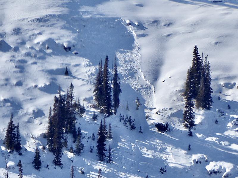
I spotted this small pocket that released naturally most likely on Tuesday during some stronger wind.
DETAILS HERE. While this is only a small pocket, it is just another "Red Flag" pointing to our weak and potentially dangerous snowpack. If natural avalanches are releasing after just a trace of new snow and a little wind, we're sure to see more with larger storms.