Forecast for the Skyline Area Mountains

Brett Kobernik
Issued by Brett Kobernik on
Sunday morning, March 15, 2020
The avalanche danger is generally LOW today. The danger may rise to MODERATE with daytime heating. Wet avalanches are possible on the steepest more sunny slopes.
Low
Moderate
Considerable
High
Extreme
Learn how to read the forecast here
Weather and Snow
Current Conditions: I traveled in the 12 Mile Canyon region on Saturday and was measuring 10 inches of new snow. Reports from the Fairview Canyon are 3 to 4 inches of new snow from the Friday storm. Despite the mostly cloudy skies, the new snow still became damp on many aspects and elevations. Ridgetop temperatures reached into the mid 30s during the day and dropped into the mid 20s overnight. South wind picked up along the most exposed locations a bit but otherwise stayed fairly light.
Mountain Weather: We may see a few lingering clouds over the mountains today but it looks like a nice day ahead so far. Temperatures will push into the mid to upper 30s in the higher terrain and southerly wind will be moderate in speed along the higher terrain. Monday and Tuesday look like nice days with the next storm moving in Wednesday and Thursday which currently looks fairly decent for our area.
Recent Avalanches
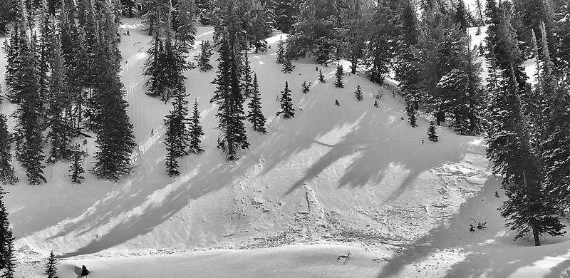
I noticed one shallow natural soft slab avalanche during my travels on Saturday. This occurred during the storm. This minor instability was already a thing of the past when I was there and I found the new snow to be mostly stable.
Ad
Avalanche Problem #1
Wet Snow
Type
Location
Likelihood
Size
Description
The new snow is always prone to avalanching as it gets heated for the first time during the spring. Warmer temperatures and clearer skies today will definitely warm the new snow. However, it already went through a minor heating and cooling cycle yesterday and last night so I'm actually not expecting all that much in the line of wet avalanches. That said, keep your eye on it today. Watch for "rollerballs" and "pinwheels" as well as point release wet avalanches. These are all indicators that the new snow has become wet and you should avoid steep slopes where you see these things.
Additional Information
This forecast is from the U.S. Forest Service, which is solely responsible for its content. This forecast describes general avalanche conditions and local variations always occur.