

Forecast for the Moab Area Mountains

Issued by Eric Trenbeath on
Saturday morning, January 25, 2020
Saturday morning, January 25, 2020
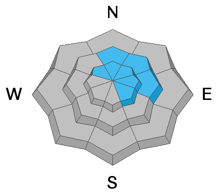
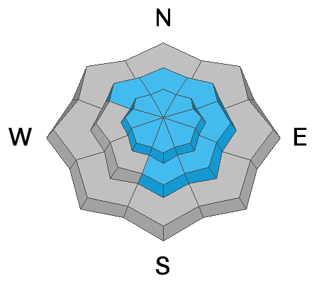
The avalanche danger is a solid MODERATE and tricky avalanche conditions exist. Human triggered avalanches involving wind drifted snow and buried weak layers are possible. Steep, wind drifted slopes right around treeline and above that face N-NE-E are the most likely areas for you to trigger an avalanche up to 18" deep. Wind drifts are recognizable by their smooth, rounded, or rippled appearance. In some areas, a triggered wind slab has the potential to break into a buried persistent weak layer causing a deeper, and more dangerous avalanche. Persistent weak layers have been observed on slopes facing NW-N-S. Backcountry travelers need to have good snow stability analysis skills before considering getting on to steeper terrain.

Low
Moderate
Considerable
High
Extreme
Learn how to read the forecast here
 Special Announcements
Are you looking to improve your avalanche skills? We are offering a Backcountry 101: Introduction to Avalanches class on February 15-16 in Moab. Click here to register. A huge thanks to Moab Gear Trader for sponsoring this course. Please visit them for all your winter backcountry needs.
Road Conditions: The road was plowed on Wednesday. Thank you Grand County!
Grooming report: Our dedicated groomer Matt Hebberd groomed the entire mountain again yesterday and took this awesome photo on the way down. Thanks Matt!
 Weather and Snow
24 Hour Snow 0" Weekly Snow 10" Base Depth in Gold Basin 46" Wind NW 10-15 mph Temp 22F
Weather: It should be a beautiful day in the mountains with mostly sunny skies, light northwesterly winds, and high temps in the upper 20's. Dry conditions continue into Sunday when clouds will begin ti build ahead of a shortwave trough that will bring a chance for light snow Sunday night into Monday. A brief ridge will build on Tuesday before the next short wave on Wednesday when we may see a break in the inversion.
Snowpack: Wednesday's snow has certainly improved things and good riding and turning conditions exist where the wind hasn't gotten to it. However, the combination of recent snow and wind have contributed to a complex snowpack with tricky avalanche conditions. Deep drifts exist alongside wind-scoured areas while a surprising amount of terrain has been left untouched. In some areas, deep drifts are overlying shallow, weaker snow while in others, the underlying snowpack is relatively strong and deep. Spatial variability is the key phrase out there right now. A keen eye for wind loaded slopes, and a penchant for digging into the snow are essential skills to have before venturing into steep terrain.
Reed Kennard was out yesterday and reported good skiing in the trees. He also noted sun crusts developing on exposed southerly aspects. For more info see Dave Garcia's observation from Thursday.
Wind, temperature, humidity on Pre Laurel Peak (11,700')
Storm totals at Gold Basin Study Plot (10,000').
Snotel site near Geyser Pass Trailhead (9600').
NWS weather forecast
 Recent Avalanches
Some natural avalanche activity has occurred as a result of the new snow and winds though it has been isolated and spotty. In my travels yesterday I observed the remnants of a storm snow avalanche that likely ran during the peak of the storm on Wednesday. Details here.
I also observed a relatively small wind slab release from a repeat running path in Tele Gold that also likely ran sometime the night of Wednesday, Jan 21. Details here.
And finally, I observed an avalanche that was triggered during an increase in winds the night of January, 22. I know this to be the case because our party had passed through the area that afternoon and had not seen anything. This was actually a three-part slide that likely shared a connected starting zone. Details here.
All three of these avalanches initiated on N-NE aspects in areas of very steep, rocky terrain. The second two described averaged about 18" in depth and broke into old snow.
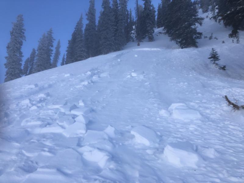
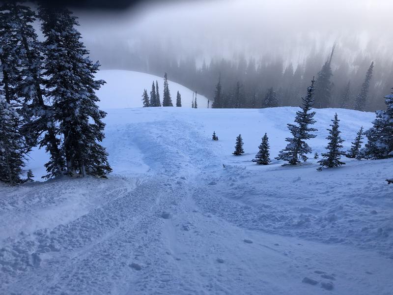
Photos are of the 3 part slide that occurred from an increase in winds the night of January 22.

Avalanche Problem #1
Wind Drifted Snow
Type
Location
Likelihood
Size
Description
Winds during and immediately after Wednesday's storm have created drifts up to 18" deep. Not particularly sensitive to begin with, they are growing increasingly more stubborn with each passing day. Their lack of sensitivity may lure you further downslope before they release, putting you in a much more dangerous situation. Most drifting has occurred right around treeline and above on slopes facing N-NE-E, but shifting wind directions and speeds have deposited snow in isolated areas on virtually all aspects, particularly at upper elevations. In some areas, triggered wind drifts have the potential to break into older, weak snow. Fresh drifts are recognizable by their smooth, rounded, or rippled appearance, and changes in snow depth along ridgelines can indicate areas of wind loading. Continue to avoid steep, wind drifted slopes.
Avalanche Problem #2
Persistent Weak Layer
Type
Location
Likelihood
Size
Description
The snowpack has suddenly become complex. Many areas still have a deep and strong, underlying snowpack, while others have buried persistent weak layers that have come alive with the most recent snow load. Deep wind drifts are overlying loose, weak, buried surface snow on some northerly aspects. In addition, loose, sugary, faceted snow can be found in shallower, rocky areas just below treeline. And finally, I have observed a reactive, persistent weak layer on S-SE facing slopes. Though not unheard of, this is an uncommon concern. Spatial variability is the key phrase right now and when in doubt, steep slopes should be avoided.
General Announcements
My radio interview on KZMU about the history of backcountry skiing in the La Sals, avalanche accidents, and unique snowpack has been saved in perpetuity. You can listen to it here.
Check out the avalanche beacon training park at the Geyser Pass Trailhead and practice your rescue skills!
This forecast is from the U.S. Forest Service, which is solely responsible for its content. This forecast describes general avalanche conditions and local variations always occur.