Forecast for the Moab Area Mountains

Eric Trenbeath
Issued by Eric Trenbeath on
Saturday morning, January 11, 2020
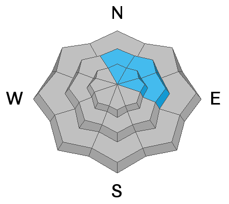
Little change. Though the odds of triggering an avalanche decrease with each passing day, the danger remains MODERATE. Human triggered avalanches involving wind drifted snow are possible on steep slopes right around treeline and above that face N-NE-E. Old, hard wind slabs are most likely to be found downslope from ridge crests, and special attention should be paid to those slopes that have steep convexities or blind break overs. In some areas, a triggered wind slab may step down into a buried weak layer causing a deeper and more dangerous avalanche. Most other terrain has generally LOW danger.
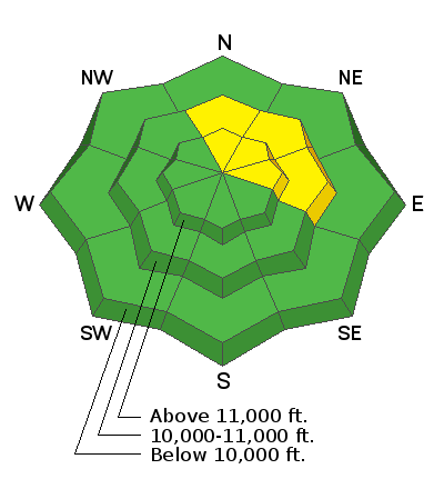
Low
Moderate
Considerable
High
Extreme
Learn how to read the forecast here
Special Announcements
Our Backcountry 101 avalanche class has been scheduled for February 15, 16. The cost is $150. The course starts with a 4-hour classroom session the night of the 15th followed by a day in the field. It's a great way to increase your avalanche awareness and backcountry travel skills. Check back for sign up details.
A new podcst from Drew Hardesty is up - An Avalanche Forecaster, a Meteorologist, and an Economist Walk Into a Bar... check it out here.
Road Conditions: The road is plowed but snow-packed with occasional ice. All-wheel drive with good tires recommended.
Grooming update: Travis groomed Gold Basin through Geyser Pass yesterday.
Weather and Snow
24 Hour Snow 0" Weekly Snow 0" Base Depth in Gold Basin 38" Wind SW 15 mph Temp 15F
Skies cleared off yesterday afternoon making for a sunny and beautiful, if not cold day in the mountains. Northerly winds picked up in the afternoon, averaging 15-20 mph along ridge tops before swinging around to the SW early this morning. Today look for partly sunny skies in the morning with increasing clouds by afternoon as the first system in an active pattern begins to spread over the region. This multi-day orographic storm event will favor the northern and central mountains but it looks like we could get a shot of snow on Monday.
In my travels on Thursday I found a variety of wind-blasted snow surfaces. Everything from wind crust, to hard wind board, and sculpted sastrugi can be found out there right now. You'll have to get creative to find soft snow in sheltered areas. Nate Ament and company did just that and sent in this observation.
Wind, temperature, humidity on Pre Laurel Peak (11,700')
Storm totals at Gold Basin Study Plot (10,000').
Snotel site near Geyser Pass Trailhead (9600').
NWS weather forecast.
Ad
Avalanche Problem #1
Wind Drifted Snow
Type
Location
Likelihood
Size
Description
Old, hard wind slabs that developed over the course of the past week are becoming harder to trigger but they may still be possible. In my travels on Thursday, I found isolated wind slabs along ridge crests that were stubborn to crack and not well connected. Much of the terrain along ridge crests is scoured from shifting wind directions. The greatest danger seemed to be further down-slope where strong, southerly winds have deposited deep drifts on to N-NE-E aspects. Suspect hard surfaces that have a hollow feel underneath, and avoid steep, convex slopes that lure you down beyond the point of no return.
Avalanche Problem #2
Persistent Weak Layer
Type
Location
Likelihood
Size
Description
Weak interfaces continue to be observed in the snowpack but I've not found them to be reactive for some time. Additionally, wind loading over the past week failed to produce any natural avalanches on a buried weak layer. Nevertheless, they do exist and it may still be possible for a triggered wind slab to step down into a buried weak layer.
General Announcements
This forecast is from the U.S. Forest Service, which is solely responsible for its content. This forecast describes general avalanche conditions and local variations always occur.