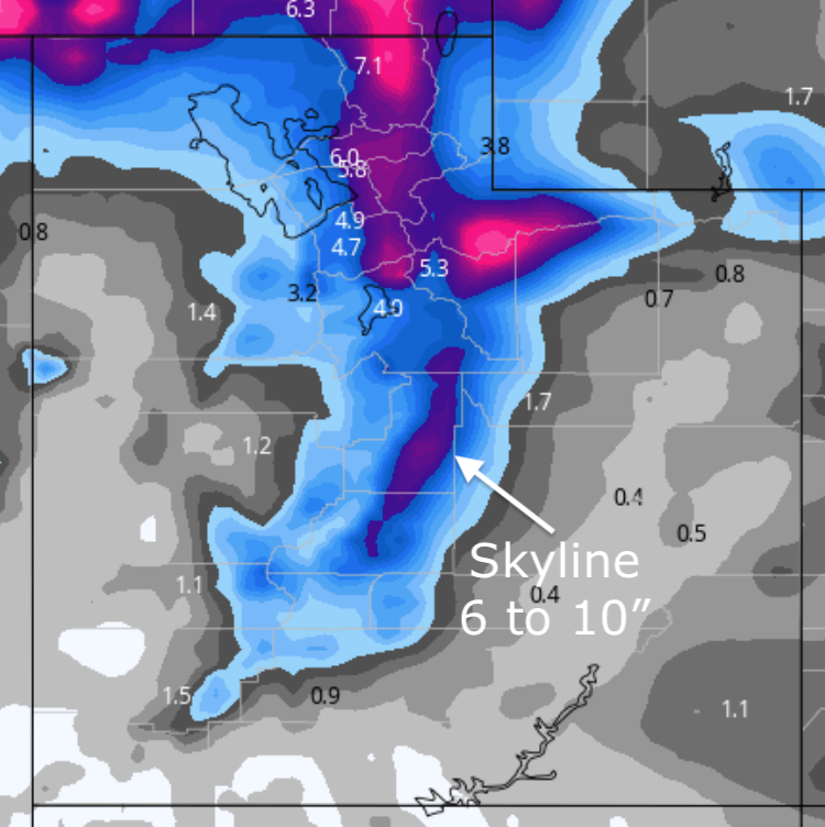
Forecast for the Skyline Area Mountains

Brett Kobernik
Issued by Brett Kobernik on
Sunday morning, December 29, 2019
The avalanche danger is MODERATE on upper elevation steep slopes where recent deposits of wind drifted snow are present. "Pockety" human triggered slides are possible on very steep slopes with fresh wind drifts. Out of the windy terrain the avalanche danger is LOW.
Low
Moderate
Considerable
High
Extreme
Learn how to read the forecast here
Weather and Snow
Current weather:
It's cold! Most mountain locations are in the low single digits this morning. Northwest wind has been in the moderate range. It's probably blowing enough to drift snow along the higher terrain. Light snowfall occurred over the last 24 hours but didn't really add up to anything.

Weather outlook:
We might see a little clearing this morning but the clouds will roll back in later today. High temperatures will be in the low teens. Northwest wind will continue in the moderate speed range. Wind looks like it will be most noticeable along the upper ridges. The next storm is shaping up for late New Year's Day. As of now it looks like it'll bring 6 to 10 inches of snow.
Ad
Avalanche Problem #1
Wind Drifted Snow
Type
Location
Likelihood
Size
Description
Continue to watch out for fresh drifts of wind blown snow. The moderate speed northwest wind is most likely forming some drifts along the upper ridgelines. On steep slopes these may crack out on a person. If you are seeing cracking within the snow, this is a sign that things are sensitive.
Additional Information
This forecast is from the U.S. Forest Service, which is solely responsible for its content. This forecast describes general avalanche conditions and local variations always occur.