


Forecast for the Moab Area Mountains

Issued by Eric Trenbeath on
Sunday morning, December 22, 2019
Sunday morning, December 22, 2019
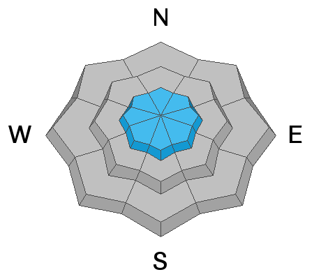
The avalanche danger is generally LOW and mostly stable snow conditions exist. Nevertheless, blowing and drifting snow this past week have created some isolated wind slabs, primarily in upper elevation, wind exposed terrain. These slabs should be pretty welded into place by now, but remain on the lookout for recent drifts, and older, harder wind slabs on the lee sides of ridge crests and terrain features such as sub-ridges or gully walls. Wind slabs may feel hollow underfoot, and cracking in the snow surface is a sign of instability. We're also starting to see some developing layers of weak, sugary snow in the snowpack. Though not currently posing much of a problem, this is something we'll want to keep an eye on when new snow finally comes.

Low
Moderate
Considerable
High
Extreme
Learn how to read the forecast here
 Special Announcements
Road Conditions: The road is snow-packed, slick, and icy in places. All-wheel drive vehicles with good tires are recommended.
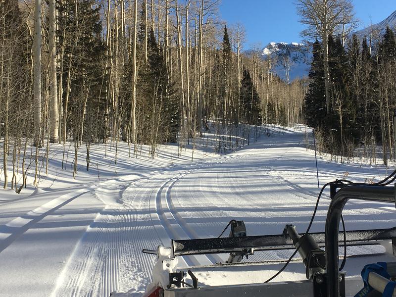
Grooming update: Matt groomed Gold Basin through Geyser Pass on Friday.
 Weather and Snow
24 Hour Snow 0" Weekly Snow 0" Base Depth in Gold Basin 27" Wind S 20 mph Temp 31F
Overcast skies this morning should turn to partly sunny skies as the day progresses. Southerly winds will average 10-20 mph, and high temps at 10,000' will be near freezing. The storm is still on track to bring us a white Christmas but details are still a bit fuzzy. We should see snow start to fall late in the afternoon on Christmas Eve with the greatest intensity coming around midnight. It's not looking to be a huge dump but optimistic projections are in the 6"-10" range.
It's been nearly 3 weeks since our last significant snow and the surface is getting tired and worn. Upper elevation winds have been blowing, drifting, and alternately scouring surfaces all week. Observers are reporting finding soft "recycled" or recrystallized powder in sheltered locations, and the base is still mostly supportable. For more details see this observation from Chris Benson and Matt McEttrick, and this observation from Tim Mathews and Dave Garcia.
Nate Ament was also up running around the peaks on Friday, and he reported snow conditions in the alpine that "run the full spectrum." See his photos below.
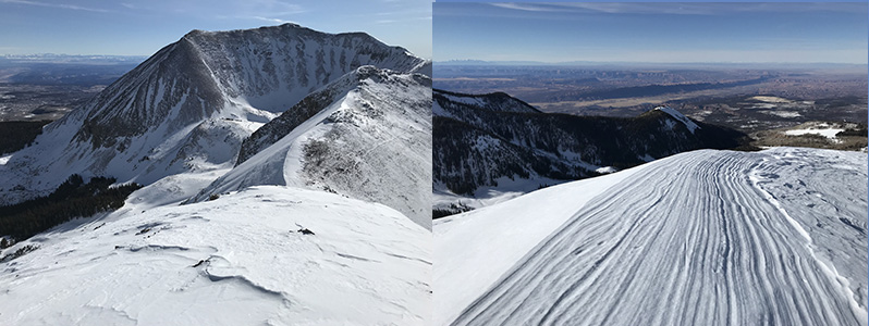
And finally, Cody Marsh sent in this drone footage that illustrates snow conditions in the alpine. Seeing is believing, thanks Cody!
Wind, temperature, humidity on Pre Laurel Peak (11,700')
Storm totals at Gold Basin Study Plot (10,000').
Snotel site near Geyser Pass Trailhead (9600').
NWS weather forecast.

Avalanche Problem #1
Normal Caution
Type
Location
Likelihood
Size
Description
Conditions are mostly stable but LOW danger doesn't mean NO danger. Here are a couple of problems to keep in mind:
Wind Drifted Snow: over the past week shifting winds have blown, drifted, and alternately scoured the snow surface in exposed locations. Look for recent drifts, and older, hard wind slabs on the lee sides of ridge crests and terrain features such as sub-ridges or gully walls. Wind slabs may feel hollow underfoot, and cracking in the snow surface is a sign of instability. In general, you should continue to avoid steep slopes that you suspect have deposits of wind drifted snow.
Persistent Weak Layer: Observers and I have taken note of a deteriorating snowpack over the past week and layers of weak snow are beginning to appear. The video below illustrates my findings last Thursday, and for more details check out all the great observations that have come in this week. These weak layers aren't currently a problem, but as new snow, as well as wind drifted snow, is added to them we'll need to pay attention.
General Announcements
Get one of these cool t-shirts to support the UAC and other avalanche centers across the U.S.
This forecast is from the U.S. Forest Service, which is solely responsible for its content. This forecast describes general avalanche conditions and local variations always occur.