Forecast for the Moab Area Mountains

Eric Trenbeath
Issued by Eric Trenbeath on
Friday morning, December 6, 2019
The avalanche danger is generally LOW to MODERATE. Though increasingly more unlikely, there remains an isolated or MODERATE danger for human triggered avalanches on a buried persistent weak layer on steep slopes facing NW-N-E.
Low
Moderate
Considerable
High
Extreme
Learn how to read the forecast here
Special Announcements
The First Annual Avalanche Awareness Week is December 2-7 We have a week full of fun and educational events planned. Check out the schedule here.
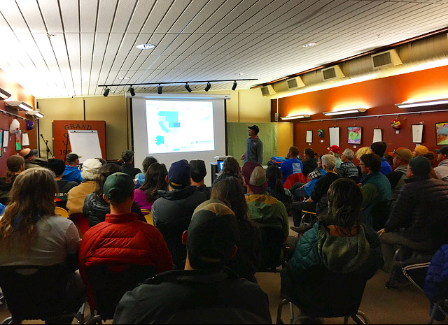
Thanks to everyone who turned out and packed the house for this year's annual Know Before You Go avalanche awareness presentation! It's great to see so many folks interested in learning how to play safely in the mountains!
The first UAC podcast of the season " Early Season Essentials with Program Director Bo Torrey" check it out HERE.
Get one of these cool t-shirts to support the UAC and other avalanche centers across the U.S.
Weather and Snow
Not much to report in the way of weather this morning. Under mostly clear skies winds are light and southwesterly, and 10,000' temps are in the mid-teens. Today will be a beautiful day in the mountains with sunny skies, continued light southwesterly winds, and high temps approaching freezing. Saturday looks to be more of the same. A weak system will move through the area on Sunday favoring points north, and there isn't much else on the horizon.
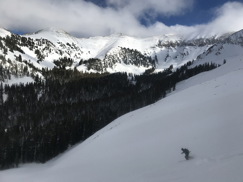
Aron Smith gave me a call this morning and reported excellent riding conditions on a supportable base with up to 8" of new snow above 11,000' from Wednesday night's storm. Total depth in Gold Basin is 37" while up high there is more than 4' of snow on sheltered slopes.
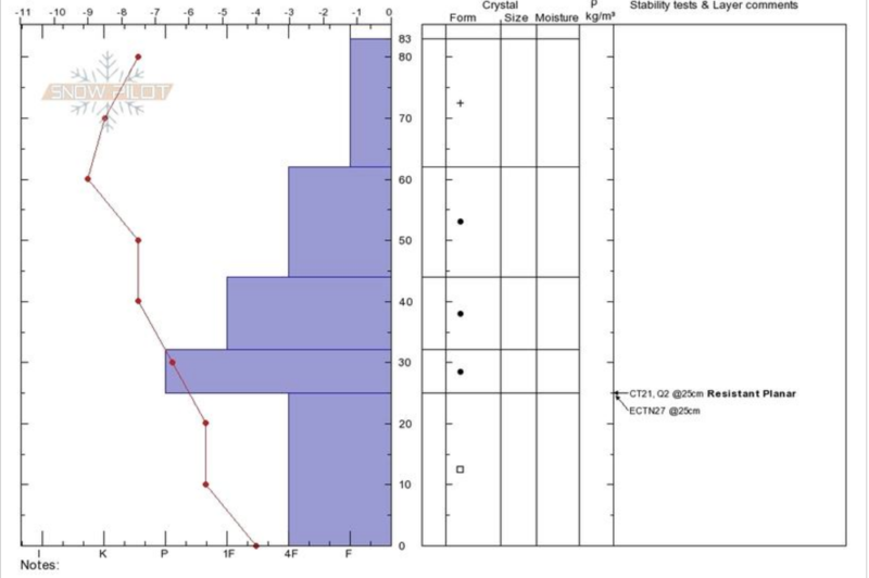
Reed Kennard was up Wednesday sampling the early season snowpack and sent in this observation.
It's looking pretty white up there but the snowpack is still a little thin. Excercise caution in rocky and wooded terrain. Reed Kennard photo.
Wind, temperature, humidity on Pre Laurel Peak (11,700')
Storm totals at Gold Basin Study Plot (10,000').
Snotel site near Geyser Pass Trailhead (9600').
NWS weather forecast.
Recent Avalanches
No recent avalanche activity has been observed since after the Thanksgiving storm.
Ad
Avalanche Problem #1
Persistent Weak Layer
Type
Location
Likelihood
Size
Description
Generally speaking, our snowpack is stacking up about as good as can be hoped for. We had no snow on the ground until Nov 20, when we picked up 6"-12" of dense, heavy snow. That was followed by 25" on the 26th, and then a whopping 33" on the 29th! As a result, we do not have the dreaded loose, sugary, faceted weak layer at the base of the snowpack that we had last season, and that the rest of the state currently has. Nevertheless, some faceting has occurred in the basement. Extended column tests are not producing propagation on this layer, but it is worth paying attention to, especially in areas where a dense, hard slab can be found on top. See this observation from Dave Garcia.
Avalanche Problem #2
Wind Drifted Snow
Type
Location
Likelihood
Size
Description
Today you may find some fresh, shallow wind drifts sensitive to the weight of a skier or rider but they shouldn't be much of an issue. Isolated, unstable areas of wind drifted snow may still exist on steep slopes that face NW-N-E at the highest elevations. Wind drifts are recognizable by their smooth, rounded appearance and cracking is a sign of instability. Old, hard wind slabs often feel hollow like a drum. Avoid steep slopes with areas of wind drifted snow.
General Announcements
This forecast is from the U.S. Forest Service, which is solely responsible for its content. This forecast describes general avalanche conditions and local variations always occur.