Forecast for the Abajos Area Mountains

Issued by Eric Trenbeath on
Thursday morning, February 7, 2019
Thursday morning, February 7, 2019
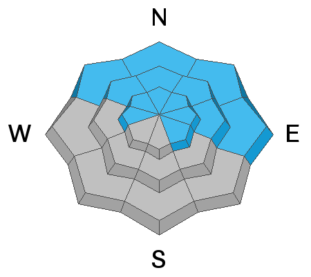
The avalanche danger is CONSIDERABLE today and human triggered avalanches are likely on steep, wind drifted slopes. The greatest danger will be found on slopes facing NW-N-E, where deep drifts are overlying a weak snowpack. Avalanches breaking down into buried persistent weak layers are likely in these areas. NW winds today may also deposit fresh wind drifts on to southerly aspects. Look for recent deposits of wind drifted snow on the lee sides of terrain features like sub ridges and gully walls in the upper elevations. Most mid and low elevation, south facing terrain has a MODERATE danger.
Low
Moderate
Considerable
High
Extreme
Learn how to read the forecast here