Forecast for the Abajos Area Mountains

Issued by Eric Trenbeath on
Wednesday morning, December 26, 2018
Wednesday morning, December 26, 2018
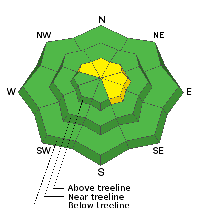
Today there is a MODERATE avalanche danger on steep slopes that have recent deposits of wind drifted snow, primarily in upper elevation terrain that faces NW-N-SE. Look for signs of instability such as cracking in the snow surface, and avoid slopes that have smooth, rounded drifts. There also remains an isolated, MODERATE danger for triggering a dangerous avalanche 1'-3' deep on steep, rocky, north facing terrain that has an underlying weak and sugary snowpack. Most other terrain has generally LOW danger.

Low
Moderate
Considerable
High
Extreme
Learn how to read the forecast here


