


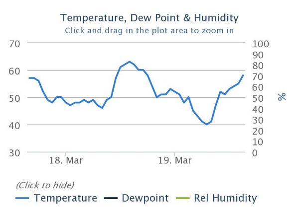
Topped out at 8000' behind Summit Park today. Snow supportable on skis despite an overnight low of 48°F last night at the 7500' Parley's weather station. As you can see in the temperature graph below, Parley's summit hasn't been below freezing in over a week.
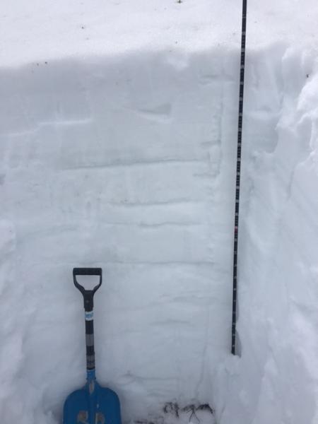
Snow profiles on north facing slopes at both 7500' and 8000' are similar with depths of 105 and 150cm, respectively with snow water equivalent just shy of normal (as per the Parley's snotel site). Each profile showed an isothermal snowpack with various crusts to the ground and only minor pooling noted 25-35cm down to the upper crust. The snow looked as if it was transitioning to a late spring/early summer snowpack. You'll see in my poor photo below of the snow grains. Smaller grains have a lower melting temperature than the larger grains...leading to the larger grains growing at the expense of the smaller ones. (If you've never read Steinbeck's Grapes of Wrath, now's the time). You can also see bonds between rounded grains from weeks gone by. Upper photo from 7500'; lower photos from 8000'.


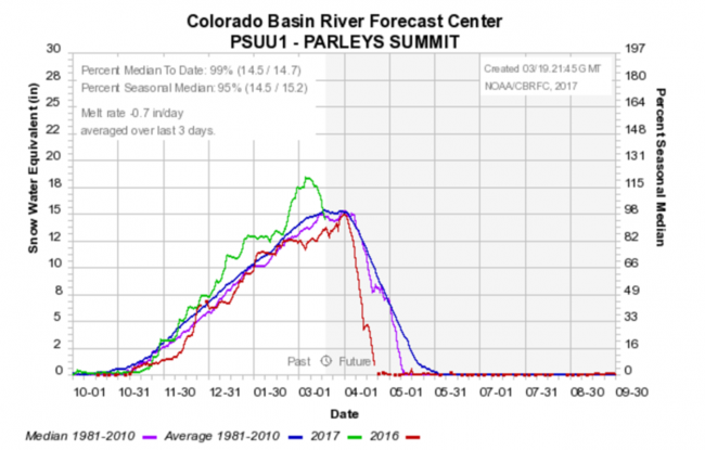
Despite the record heat and superficial - at best - refreezes, I found little to no significant free water in the snowpack. Remember that a little water is ok, too much is not. Take a touch of water between two crystal cards on top of one another and you'll see what I mean. I looked and looked for percolation columns - essentially the vertical plumbing in the snowpack - but could find none. Still, one might look at the loss of Snow Water Equivalent (see the loss of SWE on the green line below as an indicator of free water leaving the pack*) along with observations of the raging creeks waterfalls as other clues.
*Other factors may come into play here as well.