Check out our Holiday Auction - Sign Up for the Utah Snow and Avalanche Workshop (USAW)

Forecast for the Uintas Area Mountains

Andrew Nassetta
Issued by Andrew Nassetta on
Tuesday morning, November 26, 2024
Updated Tuesday, November 26th at 06:00 AM
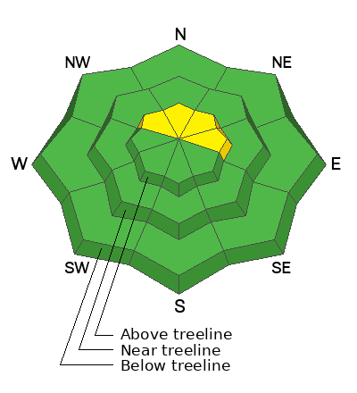
The avalanche danger is currently LOW at all elevations but could rise to MODERATE and human-triggered avalanches may become POSSIBLE as the day wears on. You could trigger small slabs of new and wind-drifted snow, 1-2’ deep, on slopes over 30° in steepness facing NW through E.
Although unlikely and small in size, any slide could be rough due to our shallow snowpack and may break through to old snow layers beneath.
Low
Moderate
Considerable
High
Extreme
Learn how to read the forecast here
Special Announcements
Save the Date -- Saturday, December 7 | 17th Annual Utah Snow and Avalanche Workshop (USAW) | Information and tickets are available here.
Weather and Snow
Nowcast
The storm arrived overnight, delivering 2-3” of medium-density snow across the range. Trailhead temperatures hover just under 30 ℉ at 5:00 AM at 7,500’ and closer to 20℉ at 10,000’, and may feel much colder with wind chill. Moderate winds are blowing from the south-southwest around 25 mph and gusting into the 40’s.
Forecast
This storm may not be a major event, but it's a solid start to the season for the Uintas. Expect winds to shift westward in the early morning hours, with gusts reaching 40 mph, enhancing snowfall intensity. Anticipate consistent snow, wind, and moisture throughout the day, with up to 1' of higher-density snow likely accumulating in the region. Daytime high temperatures will remain steady before dropping into the teens overnight as cold air moves into the area.
Futurecast
While it's disappointing that the storm appears short-lived and may shift south of our area, the southern portions of the range, such as the Wolf Creek and Current Creek zones, are still expected to receive respectable snowfall totals, with just over a foot likely. Snow showers may persist into Wednesday morning before the system moves out of the area.
Snowpack and Travel
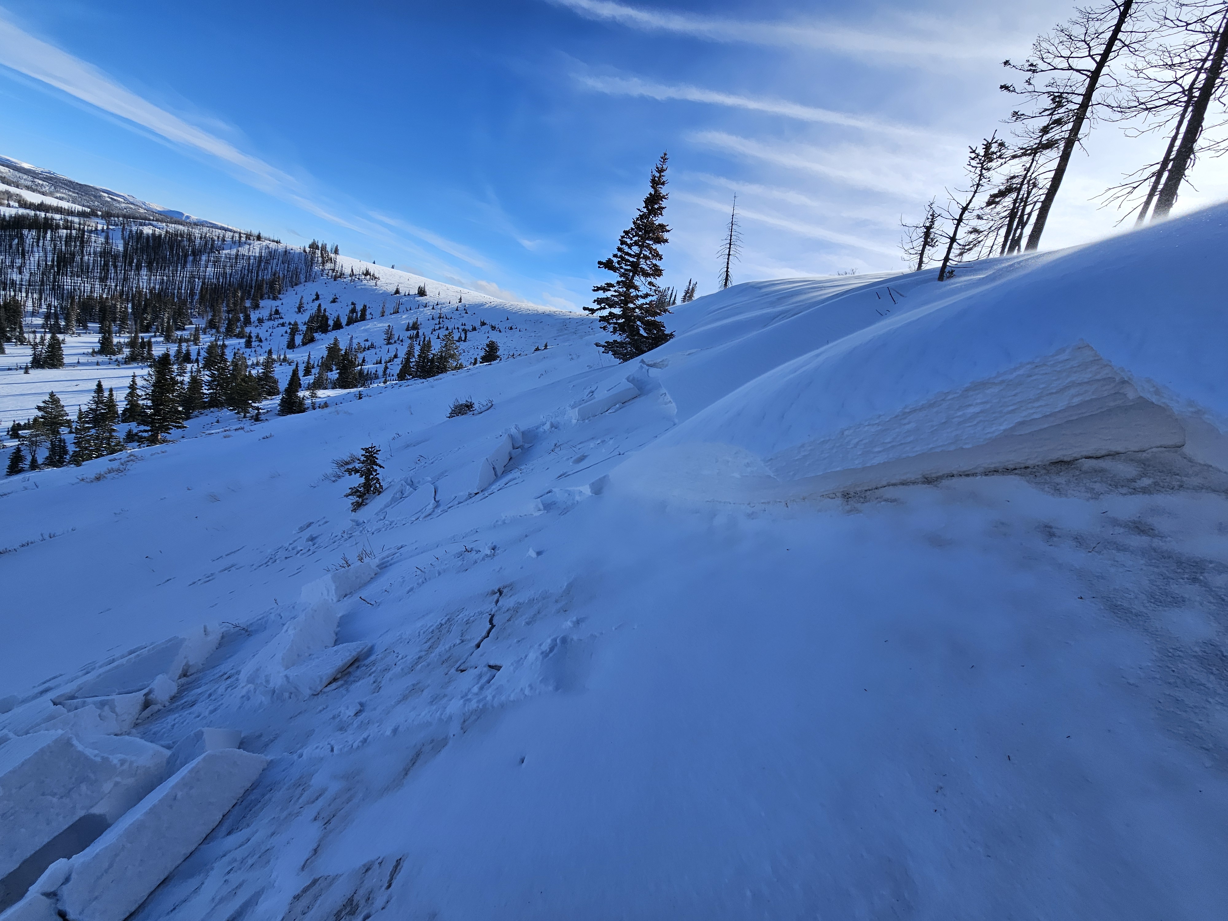
I worked my way around Wolf Creek Pass on Sunday to gather information on snow surfaces, snow depths, and overall structure prior to this active weather pattern. Generally, the snow structure is weak and consists of faceted and decomposing snow. On slopes that see the sun you may find a crust that breaks things up, while at the same time providing support to keep us off the ground for turning and traveling. Ted was on the north half of the range near Mirror Lake yesterday and saw similar structure and noted “The snowpack is still shallow and is mostly sugary, faceted snow that does not have a lot of base to it.”
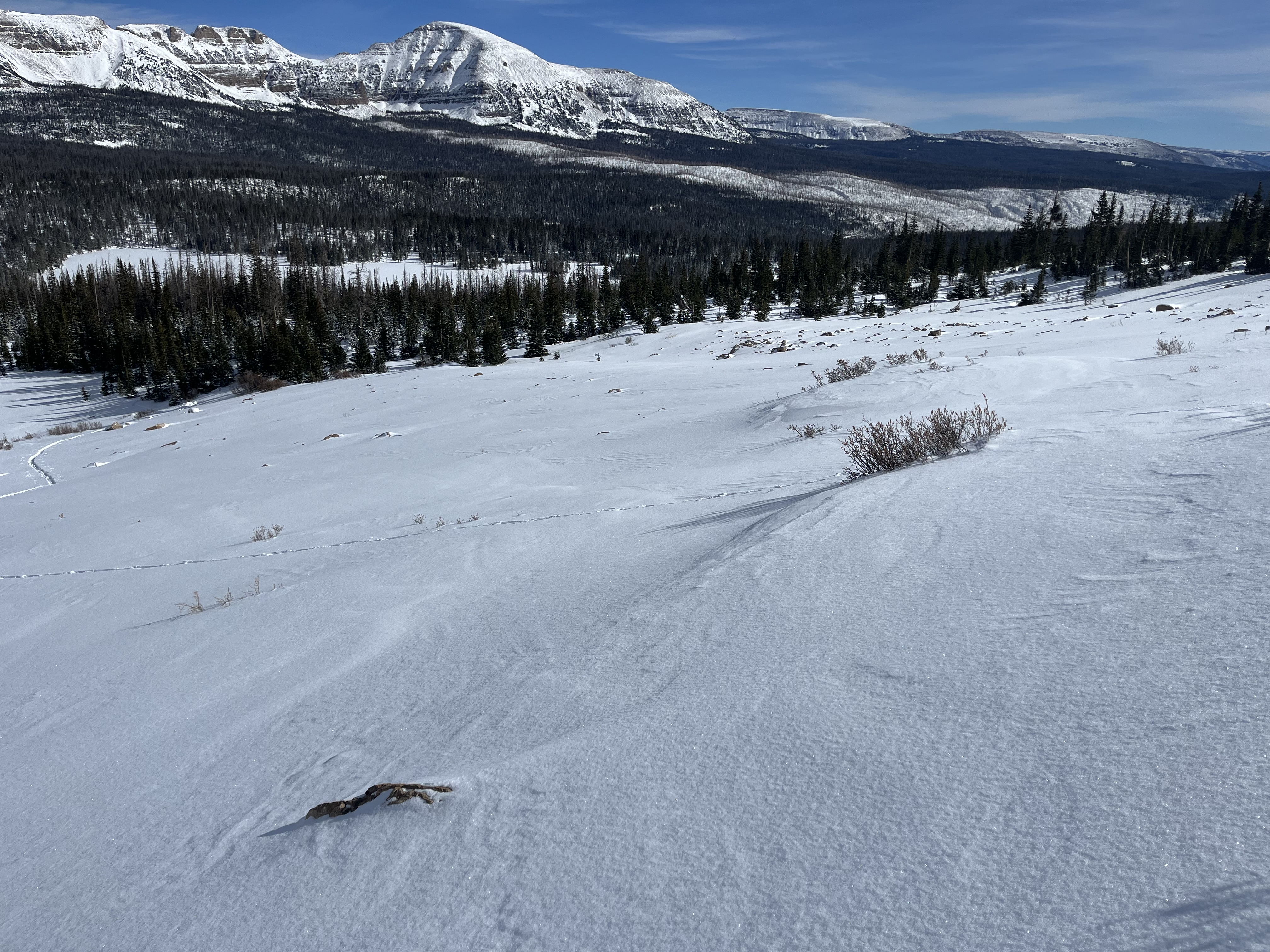
He also mentioned, “The winds have created some stiff wind slabs that would easily break as you traveled over them and these are resting on weak, faceted, old snow.” This affirms what I saw Sunday on my travels in the south half of the range.

Recent Avalanches
Joey was in Wolf Creek yesterday and reported a small wind slab that was remotely triggered from a distance. This avalanche was 1’ deep and 40’ wide, failing on old snow.
Note that hard-slab characteristics could become tricky, allowing us to get further onto the slope before we trigger or kick the legs out from under it.
You can check out all the observations here.
Ad
Avalanche Problem #1
New Snow
Type
Location
Likelihood
Size
Description
Just a few inches of snow piled up overnight, but with heavy periods of precipitation forecasted throughout today, Expect to find shallow slabs of soft, new snow up to 1’ deep by day's end.
In addition, remember before this storm, much of the old snow surface was loose powder and facets. This can allow for a poor bond within the new snow/old snow interface, and I expect dry, loose snow avalanches in steep, sustained terrain.
Avalanche Problem #2
Wind Drifted Snow
Type
Location
Likelihood
Size
Description
Expect strong, gusty winds in upper-elevation terrain near and above treeline today. Be on the lookout for and avoid fresh drifts sensitive to a rider's additional weight. Both new and older drifts may look rounded, like pillows, and feel stiff underfoot. In addition, you may experience shooting cracks out in front of your skis, board, or sled or even collapses or whoomphing sounds—these are red flags!
While I expect most issues to be confined to upper-elevation leeward slopes, don't let your guard down around nuanced terrain features like chutes and gullies that have the potential to cross-load with erratic winds.
Avalanche Problem #3
Persistent Weak Layer
Type
Location
Likelihood
Size
Description
The old saying rings true: “Today’s powder is tomorrow’s weak layer”. The late October and early November snow that we have been riding on has faceted on many aspects at, and above treeline on the north half of the compass. I am closely monitoring the amount of water weight we will put on this weak layer. This weather pattern seems unlikely to bring enough snowfall to trigger widespread activity. However, I do anticipate some avalanches could break into the older, faceted layers near the ground within our shallow snowpack.
The avalanche from yesterday and Joey’s note for “remotely triggered” fit the mold of a persistent weak layer. As we develop a slab on top of the old snow and continue to load this weak set-up, pay attention to avalanche activity, slab development, and stability tests to monitor this problem closely. I am particularly watching heavily wind-loaded areas, as the added weight in these zones might be enough to break into these weaker layers.
Additional Information
The Uinta weather station network was upgraded this summer and all that real-time info is found here. Simply click on the "Western Uinta" tab and then the "Weather Stations" tab to find all your weather needs. You can also learn more by visiting here.
General Announcements
We are always looking for snow and avalanche observations or just general riding conditions.
So... if you see something, say something. You can reach our team directly by contacting Craig at craig@utahavalanchecenter.org, 801-231-2170, or Andy at andy@utahavalanchecenter.org, or 860-460-8142.
Issued on Tuesday, November 26th at 06:00, this forecast expires 24 hours after the date and time issued, but will be updated as conditions change.
This forecast is from the U.S.D.A. Forest Service, which is solely responsible for its content. This forecast describes general avalanche conditions and local variations always occur.