

Forecast for the Uintas Area Mountains

Issued by Craig Gordon on
Tuesday morning, February 4, 2025
Tuesday morning, February 4, 2025
Heads up... while you slept, winds were busy at work and the avy danger ramped up a notch or two-
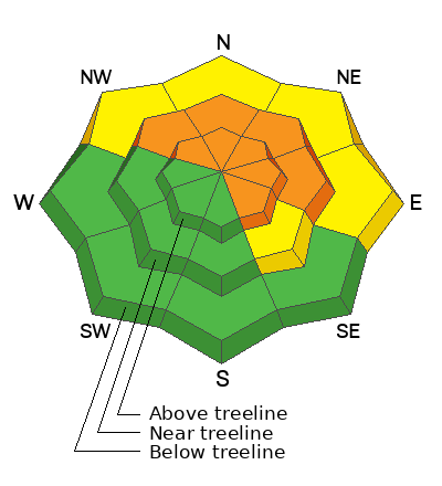
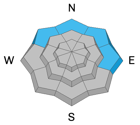
In mid and upper elevation wind drifted terrain you'll find CONSIDERABLE avalanche danger. Human triggered avalanches are LIKELY, especially on steep slopes facing the north half of the compass. Note to self... any slide triggered today has the potential to break deeper and wider than we might expect, delivering a body-bruising slide we might not walk away from.
Lower elevation terrain hasn't seen a decent refreeze in two nights and damp snow issues offer MODERATE avalanche danger. Human triggered wet avalanches are POSSIBLE on sustained, steep, shady slopes. Think about avoiding terrain traps like road cuts and gullies on your approach and exit today.
Low
Moderate
Considerable
High
Extreme
Learn how to read the forecast here
 Special Announcements
Sad news to report from the Monte Cristo area where a snowmobiler was caught, carried, and killed in an avalanche yesterday. We have a team headed to that zone today and will have more details as they are compiled. In the meantime... please know our hearts hurt and our collective energy goes out to friends, family, and everyone involved in this very tragic accident.
 Weather and Snow
Nowcast-
The western Uinta marketing department wants to remind us.... "We know you came for the snow, but we trust you'll stay for the wind... because after all, wind was invented in the western Uinta's." Living up to it's reputation and trademark, southerly winds cranked in the 40's and 50's for the past two days and continue in that spirit this morning. Temperatures hover near freezing along the ridges and are in the 40's at the trailheads. Snow is on the way, so get your chores done today and wait for a refresh... it's in the queue and 24 hours out.
Forecast -
Look for mostly cloudy skies with temperatures climbing into the mid 40's and yes... even low 50's near the trailheads. South and southwest winds remain in the downright obnoxious category, blowing 30-50 mph near the high peaks, but begin tapering off as the day wares on. Overnight lows hover near freezing.
Futurecast-
A weak and fairly mild system slides through Wednesday into early Thursday delivering a couple inches of snow and cooler temperatures. Look for a break in the action on Thursday with a more substantial system slated for late Friday into Saturday.
 Recent Avalanches
Triggered yesterday on a steep, wind drifted slope around Soldier Creek, on the outskirts of Strawberry, please enjoy a great overview and running commentary on a safe way to keep eyes on your partner. The most excellent writeup and more deets found HERE
As always, gain more intel and info via obs, avalanches and trip reports from across the range and beyond, here!

Avalanche Problem #1
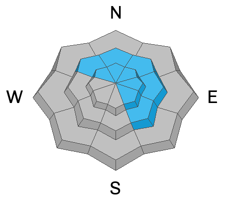
Wind Drifted Snow
Type
Location
Likelihood
Size
Description
Avy-savvy snow-pro, Ted Scroggin was in the Gold Hill zone yesterday and reports... "Some touchy wind slabs today where the near surface faceted snow is preserved under the recent snow and wind. This wind slab broke as I was about 50' away on a little test area I like to visit to see what the winds are doing. I was a bit surprised to find this weak layer still preserved in such a windy location."
Weekend snow coupled with strong winds and warm temperatures continue forming dense wind-drifts in mid and upper elevation, leeward slopes. This trifecta now rests on top of sugary, faceted snow buried a couple feet beneath the snow surface. Here's where it gets tricky... today's drifts are gonna feel quite strong and bomber underneath us, but I wouldn't let my guard down. Strong snow on weaker snow is a mine field and may allow us to get well out onto a slope before breaking above us. Or in the case of Ted's slide yesterday, we might be able to trigger a sizable pocket from a distance.
Avalanche Problem #2
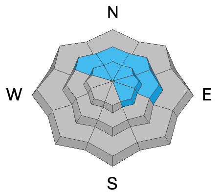
Persistent Weak Layer
Type
Location
Likelihood
Size
Description
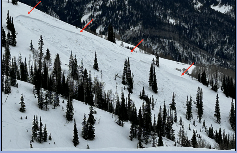
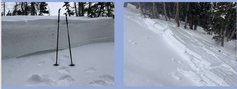
The avalanche in the image above was triggered yesterday on a steep, heavily wind loaded, northeast facing, mid elevation slope. Initiated in the weekend storm snow and then breaking 3'-5' deep and 500' wide on weak, sugary midpack snow, resulting in a very deep, dangerous avalanche.
Two layers of faceted snow, one developed during the mid January cold spell and the other during the mid December drought, are beginning to reach a tipping point and coming back to life. We might've forgotten about 'em, but the snowpack has an amazing memory and yesterday the PWL began showing its cards. I'm not trusting our current snowpack structure, especially in steep rocky terrain or slopes that avalanched earlier this season. Any slide triggered today has the potential to break deeper and wider than we might expect, delivering a body-bruising slide we might not walk away from.
Avalanche Problem #3
Wet Snow
Type
Location
Likelihood
Size
Description
Damp snow... can you believe we're talking about it the first week of February? A couple nights of shallow refreeze should keep us on our toes as we exit low elevation terrain. Be sure to avoid terrain traps like roads cut and gullies where cement-like debris can pile up very deeply.
General Announcements
We are always looking for snow and avalanche observations or just general riding conditions. In the meantime reach out to us with questions, concerns, or if you see anything in your travels! Contact us directly through the info below:
- Craig Gordon | Craig@utahavalanchecenter.org, 801-231-2170, or
- Andrew Nassetta | Andy@utahavalanchecenter.org, or 860-460-8142.
This forecast is from the U.S.D.A. Forest Service, which is solely responsible for its content. This forecast describes general avalanche conditions and local always may occur. This forecast was issued on Tuesday, February 4th at 04:30AM and expires 24 hours after it was issued.