Forecast for the Uintas Area Mountains

Craig Gordon
Issued by Craig Gordon on
Monday morning, December 2, 2024
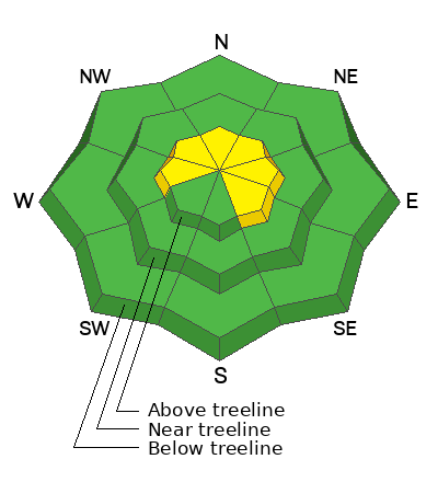
For the moment the snowpack is trending in the right direction and the avy hazard is more predictable, but I'm not letting my guard down or taking my eyes off the prize. Today we'll still find pockets of MODERATE avalanche danger on steep, shady, wind drifted slopes. Though the snowpack is shallow and it doesn't look like there's enough snow to slide, human triggered avalanches are POSSIBLE and could break deeper and wider than you might expect, especially in the wind zone above treeline, and particularly on slopes facing the north half of the compass that held early season snow.
Note to self... any avalanche triggered is gonna reveal a myriad of season ending obstacles like stumps, rocks, and dead-fall.
Low
Moderate
Considerable
High
Extreme
Learn how to read the forecast here
Special Announcements
Save the dates and please join us this week!
- Avalanche Awareness Week kicks off at Sugarhouse Park today, Monday December 2nd from 4:00- 7:00 and there's statewide events throughout the week, Check out the full list of happenings across the state HERE!
-The week wraps up Saturday December 7th from 4:00-7:45 PM at the University of Utah with our 17th annual Utah Snow and Avalanche Workshop. Deets and tickets HERE!
Weather and Snow
Nowcast-
Skies are clear at o'dark thirty and reveal a glittery mosaic of stars overhead. Temperatures remained rather mild overnight, bottoming out in the low to mid 20's and start their day in a similar spirit. North and northeast winds clock in at 10-20 mph near the high peaks. Totals snow depths register in the two foot range and it's low tide, with no shortage of buried treasures barely lurking under a thin facade of snow. Riding and turning conditions are a mixed bag though low angle meadow skipping on shady slopes offers soft, creamy, surface snow.
Forecast-
It'll be another glorious day in the mountains with sunny skies, light northerly winds, and temperatures climbing into the low and mid 30's. Overnight lows dip into the low 20's.
Futurecast-
Pretty quiet on the eastern front through the upcoming week, but there's a hint at a pattern change over the weekend. The jury is still deliberating and we'll keep you posted as things evolve.
Current conditions-
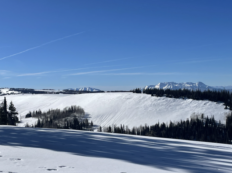
Andy and I were in the Mill Hollow environs yesterday, enjoying the clear, clean air, soft creamy snow, and yes... the beautiful views weren't too shabby either :)
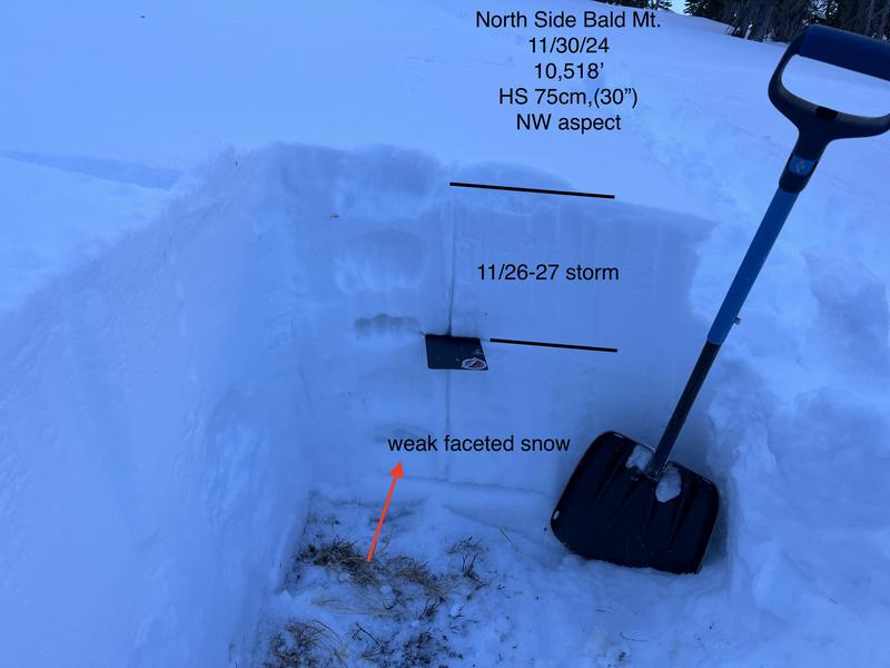
Ted ventured into the cold side of Bald Mountain Saturday and notes... "Nice surface snow that is starting to weaken, there were some crusted conditions on the sunny slopes and firm wind slabby snow in the exposed terrain. Conditions are still thin and it looks better than it is."
Additional obs and trip reports found HERE.
Recent Avalanches
No new avalanche activity since Wednesday, November 27th near Wolf Creek Pass with several remotely triggered avalanches breaking near the ground on our problem child, a persistent weak layer of snow or what we call PWL.
Archived avy activity found HERE.
Ad
Avalanche Problem #1
Persistent Weak Layer
Type
Location
Likelihood
Size
Description
It's been almost a week since our last storm stacked up a respectable amount of snow, water, and wind. The rapid change irritated weak, sugary snow near the ground, making it rather cranky and reactive to our additional weight. In time though, the pack has adjusted somewhat, relaxed a bit, and is becoming comfortable in its own skin. In fact, I suspect there's miles and miles of terrain you can ride safely today. And while I think we're trending the right direction I'm still avoiding upper elevation wind drifted slopes, where all I need to do is find a thin spot in the snowpack, maybe around a bush or rock, collapse the slope, and now I'm staring down the barrel of a moving piece of snow that could ruin my day.
General Announcements
Additional Information
The Uinta weather station network was upgraded this summer and all that real-time info is found here. Simply click on the "Western Uinta" tab and then the "Weather Stations" tab to find all your weather needs.
We are always looking for snow and avalanche observations or just general riding conditions. So... if you see something, say something. You can reach our team directly by contacting Craig at craig@utahavalanchecenter.org, 801-231-2170, or Andrew at andy@utahavalanchecenter.org, or 860-460-8142.
General Information
This forecast is from the U.S.D.A. Forest Service, which is solely responsible for its content. This forecast describes general avalanche conditions and local variations always occur. This forecast was issued on Monday December 2nd at 0400 AM and expires 24 hours after it was issued. We will update the forecast by 07:00 tomorrow. But, in the meantime reach out to us with questions, or if you see anything in your travels.