AVALANCHE WARNING!! Tap for info

Forecast for the Uintas Area Mountains

Craig Gordon
Issued by Craig Gordon on
Thursday morning, December 19, 2024
Paddling out in a sea of green avy danger, I need to remind myself, there are still a few migrating sharks to keep an eye on. In the wind zone at and above treeline you'll find pockets of MODERATE avalanche danger today. While not widespread, human triggered avalanches breaking several feet deep are still POSSIBLE, especially on steep, wind drifted slopes facing the north half of the compass.
Lose some elevation, you lose the wind, you lose the problem and you'll find generally LOW avalanche danger around the dial in mid and lower elevation terrain.
Low
Moderate
Considerable
High
Extreme
Learn how to read the forecast here
Special Announcements
Now is a great time to dial in your safety gear including putting fresh new batteries in your beacons! Local shops across the state will be handing out free Batteries for Beacons now until February 1, 2025. All you need to do is fill out a quick survey and grab the AAA or AA batteries you need to keep your beacon fresh this season. Find participating shops and more info here.
Weather and Snow
Nowcast-
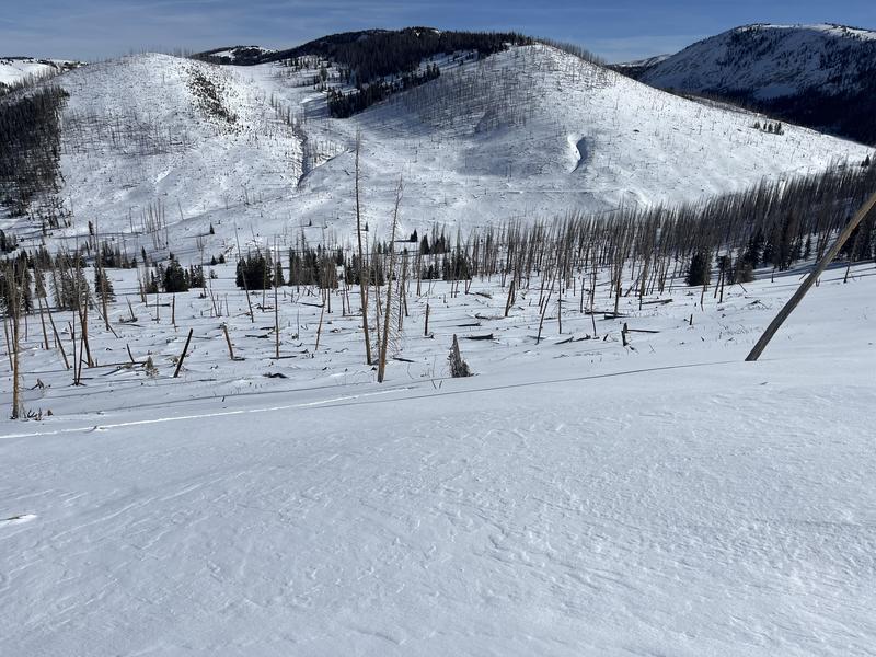
With clear skies overhead, a waning Cold Mood casts beautiful early morning light on our mountains while west and southwest winds hum along in the 20's and 30's near the high peaks. With just two days to go before the days get noticeably longer, it's mild, with overnight low temperatures registering in the mid 20's and a few low lying traiheads finishing up the night shift in the mid teens. It's a mixed bag out there and it's been a slow start to winter with settled snow depths averaging just about 2' across the range. Riding and turning conditions are acceptable, but tread lightly, there's no shortage of buried treasures lurking just below the snow surface.
Forecast-
Look for mostly sunny skies with high temperatures climbing into the low 30's. A storm system bumps to our north and that'll bring gusty, west and southwest winds to the high peaks through the early evening.
Futurecast-
Not much going on in the weather department. We can expect clear skies, warming temperatures, and decreasing winds... rinse and repeat through the weekend. But wait... there's more! Computer models agree with a more active pattern developing between Christmas and the New Year. We'll keep ya posted on this developing story.
Ted was on the east side visiting Mill Creek yesterday and reports... "Early season conditions with only about 20" or so once I got into the Mill Creek drainage. Much of the south facing terrain is very thin to no snow at all."
Recent Avalanches
Trevor spotted this pocket yesterday. Looks like a cornice fall initiated this avalanche on a steep, wind drifted, upper elevation slope, which fits the bill of a handful of slides occurring on Sunday, December 15th.
Read more obs from across the range, here -- Thanks to y'all for the info... please keep those letters and cards coming :)
Ad
Avalanche Problem #1
Wind Drifted Snow
Type
Location
Likelihood
Size
Description
Recent winds have blown from nearly every direction and jerked our shallow snowpack all over the place, delivering uneven drifting patterns and a patchwork of slabs. And although not quite as reactive as the past few days, I suspect if you were looking to trigger an avalanche you could find a pocket or two in the alpine. And remember... today's avalanches may break deeper and wider than you might expect and could easily knock you off your feet and take you for a body bruising ride through rocks, stumps, or deadfall.
Be on the lookout for red flags like cracking in the image above (thanks Weston D) and steer clear of fat, rounded pillows of snow. Consider avoiding drifted areas in the wind zone today and seek out wind sheltered terrain where coverage and riding are a bit more reasonable and the avy hazard is generally low.
Avalanche Problem #2
Persistent Weak Layer
Type
Location
Likelihood
Size
Description
Andy and Trevor stomped around Weber Canyon yesterday and noted... "Although we have a ton of weak snow near the ground and throughout the pack places where this structure exists are the same areas where we have seen our most recent avalanches fail."
Last weeks series of little storms buried a sugary layer of near surface facets (NSF), capping and preserving this very delicate and notoriously tricky weak layer. While more the exception than the rule, once initiated, today's avalanches may initially fail in recent storm snow and then break to fragile layers of snow now buried a couple feet deep, delivering a slide that's bigger than you might've bargained for.
General Announcements
Additional Information
The Uinta weather station network was upgraded this summer and all that real-time info is found here. Simply click on the "Western Uinta" tab and then the "Weather Stations" tab to find all your weather needs.
We are always looking for snow and avalanche observations or just general riding conditions. So... if you see something, say something. You can reach our team directly by contacting: Craig at craig@utahavalanchecenter.org, 801-231-2170, or Andrew at andy@utahavalanchecenter.org, or 860-460-8142.
General Information
This forecast is from the U.S.D.A. Forest Service, which is solely responsible for its content. This forecast describes general avalanche conditions and local variations always occur. This forecast was issued on Thursday, December 19th at 03:30 AM and expires 24 hours after it was issued. We will update the forecast by 0700 AM tomorrow. But, in the meantime reach out to us with questions, or if you see anything in your travels.