Forecast for the Uintas Area Mountains

Issued by Craig Gordon on
Monday morning, November 25, 2019
Monday morning, November 25, 2019
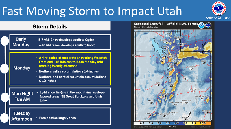
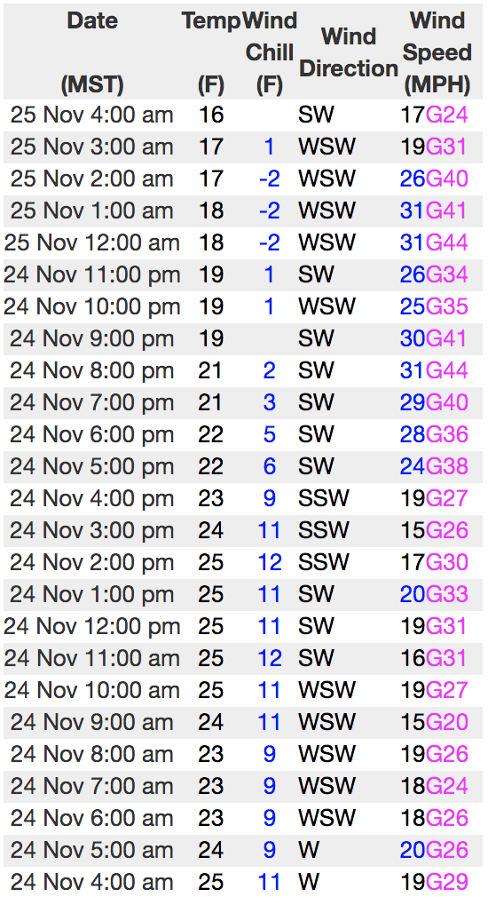
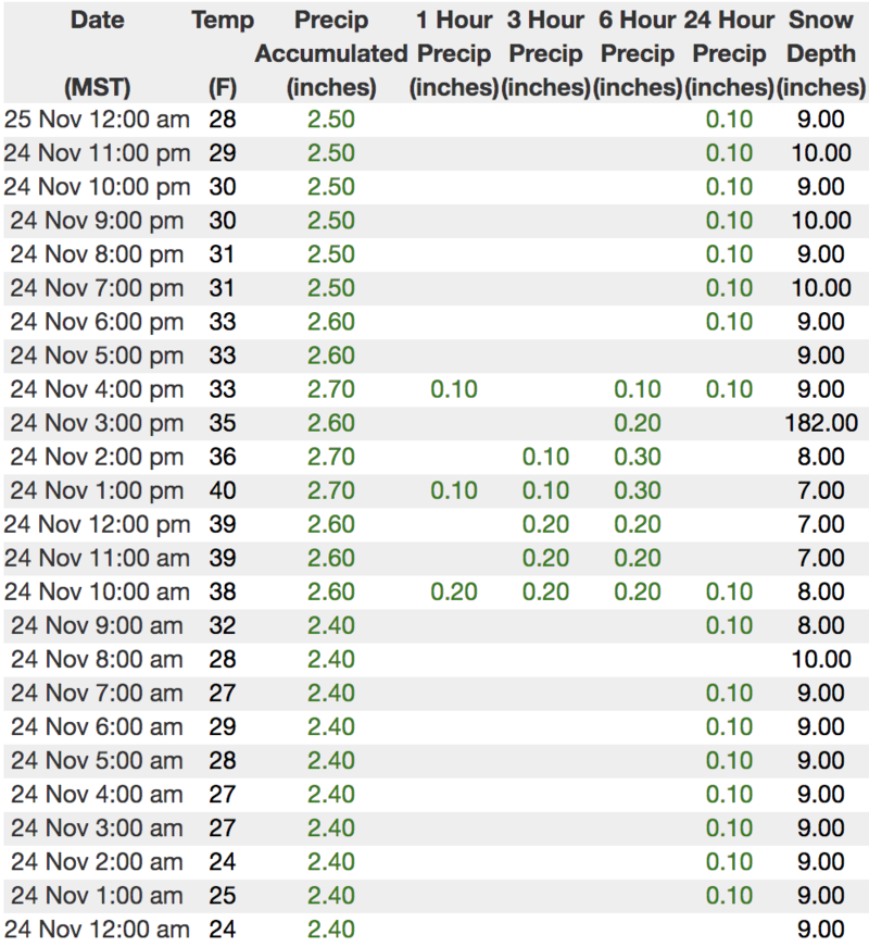
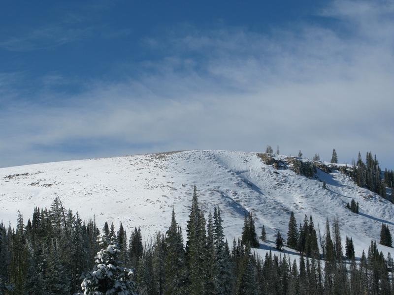
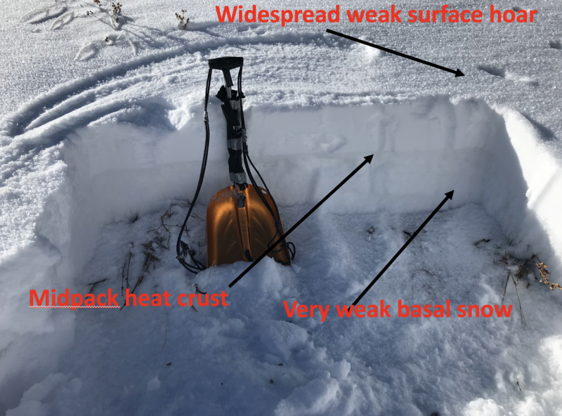
Making up a very small portion of a very large range, in the wind zone, at and above treeline the avalanche danger will rise to MODERATE as todays storm materializes. As new snow stacks up, human triggered avalanches will be possible on steep wind drifted slopes, especially those facing the north half of the compass, and particularly those that harbor weak, pre-existing snow. Any avalanche triggered will reveal a myriad of obstacles and could instantly result in a season ending injury.
And....
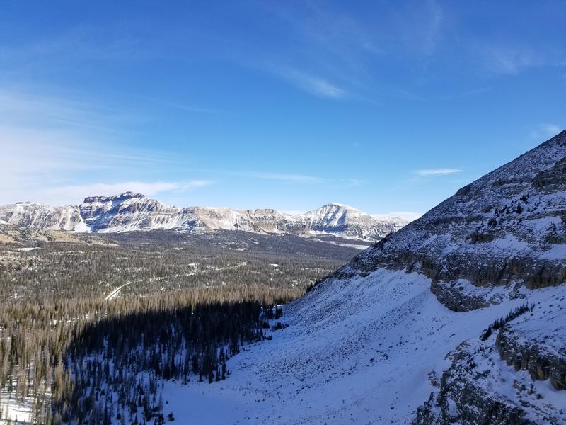
JUST 'CAUSE YOU CAN SEE YOUR RIG PARKED BY THE SIDE OF THE ROAD NEAR BALD MOUNTAIN OR WOLF CREEK PASS DOESN'T NECESSARILY MAKE THE SLOPE YOU CHOOSE TO RIDE MORE SAFE

Low
Moderate
Considerable
High
Extreme
Learn how to read the forecast here