Join us at our 2nd Annual Blizzard Ball

Forecast for the Uintas Area Mountains

Andrew Nassetta
Issued by Andrew Nassetta on
Sunday morning, January 26, 2025
Today's avalanche danger is MODERATE on slopes facing northwest through east at mid and upper elevations for wind-drifted snow. Although UNLIKELY, any slide triggered on the north half of the compass at upper-elevations may fail on weak, sugary, faceted snow, delivering a deeper and wider slide than we might expect.
Out of the wind-zone and in sheltered terrain, LOW avalanche danger exists but riding conditions are hit or miss as snow surfaces are a variable.
Low
Moderate
Considerable
High
Extreme
Learn how to read the forecast here
Special Announcements
  • Urgent battery replacement required for anyone who received batteries from one of our participating "Batteries for Beacons" shops. Please review the "Batteries for Beacons" replacement notice on our blog. Batteries distributed through our "Batteries for Beacons" program this year have shown to be inadequate length.
  • Please join the UAC at Deer Valley on January 30th for the 2nd Annual Blizzard Ball Gala. The night will be full of fun including delicious cuisine, live music, an auction, and presentation by Bruce Tremper. More info found here.
Weather and Snow
Nowcast
Since Friday, we stacked up a whopping 2-5" of snow and .3" of water with the south half of the range in favor. Winds are currently light from southeast with a few gusts near 15 MPH. Temperatures are in the single digits at trailheads and are reading the same up to 11,000'.
Forecast
For today, expect clear skies and cool temps with a high of 20℉. Winds continue from the south between 5-10 MPH with a few gusts, and may have an easterly component at times, but remain tame.
Futurecast
High pressure will persist this week with hopes of another reset for next weekend.
Recent Avalanches
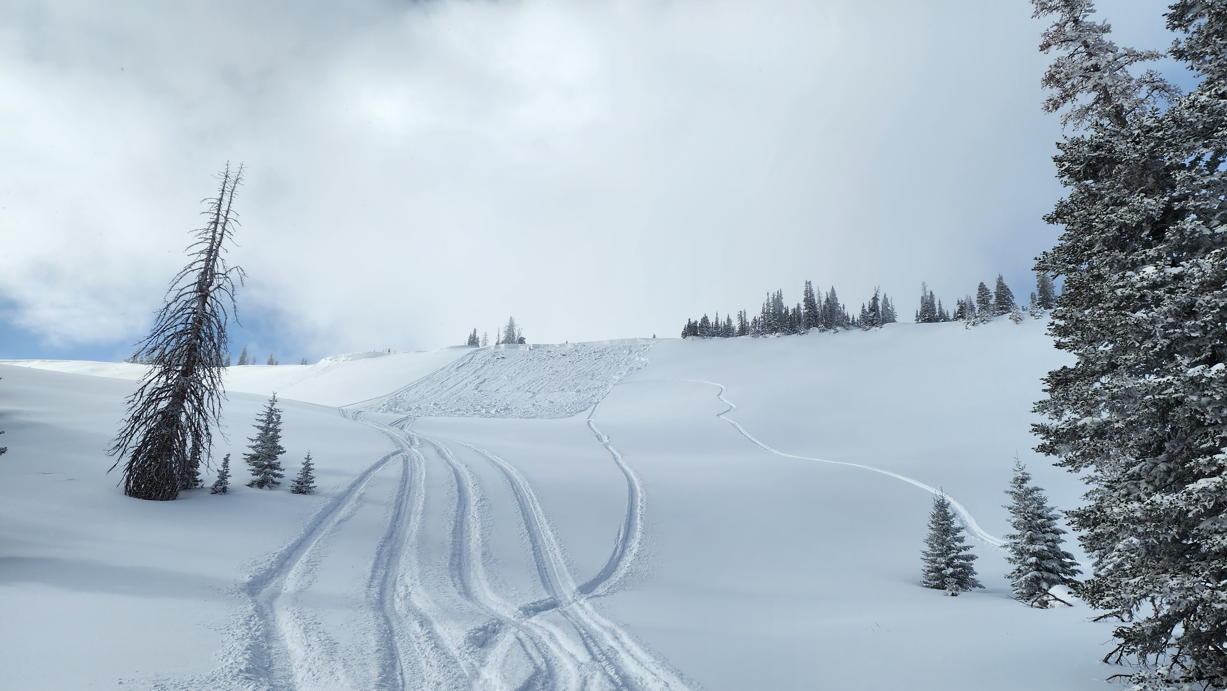
Yesterday, I noted a small chunk of wind-drifted snow during a break in the storm on a steep, heavily wind-drifted slope on the north half of the compass -- Check it out here. You can find trip reports and recent slides from across the range and beyond, here.
A small wind-drift near Wolf Creek Pass that fit the slope mold for the problem -- Upper-elevation, steep, thin, and heavily wind-loaded.
Ad
Avalanche Problem #1
Wind Drifted Snow
Type
Location
Likelihood
Size
Description
Sustained winds have formed hard slabs on steep, mid and upper-elevation slopes on almost all aspects. The challenge here is that recent drifts will feel solid under our skis, board, or sled and allow us to get well out on slope before breaking above or below us. They may also be covered up by a fassade of fresh snow on top and not obvious to the naked eye.
Today's drifts are a mostly manageable and straight-forward with proper terrain choices and travel techniques. Choose clean slope run outs with less severe consequences like cliffs, rocks, or terrain traps and travel mindfully by exposing only one person at a time to the potential hazard. And remember, even a small slide can knock you off your feet and rough you up in consequential terrain.
Avalanche Problem #2
Persistent Weak Layer
Type
Location
Likelihood
Size
Description
It is unlikely for us to trigger a persistent slab avalanche today, but there is still a chance of finding a pocket 1-3' deep into old snow that could break wider than expected. The tricky part is as the likelihood of triggering has gone down significantly over time, the consequences remain severe if we do.
What's my strategy and game plan? I am keeping it straight forward and avoiding steep, rocky, mid and upper elevation terrain on the north half of the compass, especially where the pack is slightly thinner. And remember thin spots are potential trigger points and exist near bushes, rocks, or steep rollovers.
Above is the last reported persistent slab from the range from January 12th, that failed on our persistent weak layer (PWL) that formed during the December drought.
General Announcements
The Uinta weather station network was upgraded this summer and all that real-time info is found here. Simply click on the "Western Uinta" tab and then the "Weather Stations" tab to find all your weather needs.
We are always looking for snow and avalanche observations or just general riding conditions. So... if you see something, say something. You can reach our team directly by contacting: Craig at craig@utahavalanchecenter.org, 801-231-2170, or Andrew at andy@utahavalanchecenter.org, or 860-460-8142.
General Information
This forecast is from the U.S.D.A. Forest Service, which is solely responsible for its content. This forecast describes general avalanche conditions and local variations always occur. This forecast was issued on Sunday, January 26th at 04:00AM and expires 24 hours after it was issued. We will update the forecast by 0700 AM tomorrow. But, in the meantime reach out to us with questions, or if you see anything in your travels.